Here's something you might be interested in.
Ask a Hipster — Advice you didn't know you needed
Big Screen — Movie commentary
Blurt — Music's inside track
Booze News — San Diego spirits
Classical Music — Immortal beauty
Classifieds — Free and easy
Close to Home — What it’s like on the street where you live
Cover Stories — Front-page features
Drinks All Around — Bartenders' drink recipes
Excerpts — Literary and spiritual excerpts
Feast! — Food & drink reviews
Feature Stories — Local news & stories
Fishing Report — What’s getting hooked from ship and shore
From the Archives — Spotlight on the past
Golden Dreams — Talk of the town
The Gonzo Report — Making the musical scene, or at least reporting from it
Letters — Our inbox
Movies@Home — Local movie buffs share favorites
Movie Reviews — Our critics' picks and pans
Musician Interviews — Up close with local artists
Neighborhood News from Stringers — Hyperlocal news
News Ticker — News & politics
Obermeyer — San Diego politics illustrated
Outdoors — Weekly changes in flora and fauna
Overheard in San Diego — Eavesdropping illustrated
Poetry — The old and the new
Reader Travel — Travel section built by travelers
Reading — The hunt for intellectuals
Roam-O-Rama — SoCal's best hiking/biking trails
San Diego Beer — Inside San Diego suds
SD on the QT — Almost factual news
Sheep and Goats — Places of worship
Special Issues — The best of
Street Style — San Diego streets have style
Surf Diego — Real stories from those braving the waves
Theater — On stage in San Diego this week
Tin Fork — Silver spoon alternative
Under the Radar — Matt Potter's undercover work
Unforgettable — Long-ago San Diego
Unreal Estate — San Diego's priciest pads
Your Week — Daily event picks
Lost Roads of San Diego: Truckee Road, Ward Road, Fillmore Avenue
A journey to nowhere, part 3
Looking east from the withered stump if Ward Road
Truckee Road — Pacific Beach, Northeast
Most of the Lost Roads in this series still endure as footpaths, parking lots, or slices of newer highway; but Truckee Road never existed at all, except on paper. Old maps and city directories show that it was supposed to begin near Los Altos Way in Pacific Beach and proceed due east, terminating about a quarter-mile west of todays Interstate 5.
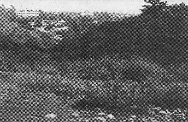
Truckee Road: Looking east from Kate Sessions Memorial Park, with cul-de-sac of Balfour Court in the distance
In the early 1920s, Truckee Road was part of a subdivision plan on the south foot of Mt. Soledad. But San Diego development hit the skids around 1926, and then a depression and a war came.
In the 1940s, a few hundred temporary war-workers’ houses cropped up nearby, along streets that had been paved in the ’20s but never developed. (These hillside prefabs, known as Los Altos Terrace, were pretty classy; from their front stoops you got a panoramic view of downtown, the harbor, and Mission Bay. They were designed by Frank Hope, Jr., who in the 1950s and ’60s would become San Diego’s premier architect of hospitals and office buildings.) After the war, these temporaries were carted off, and private housing took their place. By the late ’50s, most of eastern Pacific Beach had filled in, but the Truckee Road region remained unpaved, ungraded, and unsigned.
In 1961 the Truckee area still looked much as it had in the ’20s- a square mile of steep hills and scrub canyon, most of it city land because no private developers wanted it. But that year the city council voted to turn part of the area into a park, named in honor of a dead Mission Hills florist.

Truckee Rd., as envisioned in 1925
After that, things happened fast in these rocky muirlands. Kate Sessions Memorial Park was open by 1964. Nearby, Soledad Mountain Road was completed, connecting eastern PB with La Jolla. Developers put up pricey houses on two-acre lots, called in the landscapers, and sold the results as “estates on Mt. Soledad in La Jolla.”
By 1970, Truckee Road had vanished from the books. In its place we now find a pair of short cul-de-sacs named for two British MPs of the early 20th Century: Balfour Court and Belloc Court. The juxtaposition of these two streets suggests a developer with a sense of humor. Arthur Balfour is the fellow best remembered for the 1917 Balfour Declaration, in which it was resolved that it would be a good thing to give Palestine to the Jews. Hilaire Belloc is the politician and writer best remembered for his kiddie verse, his travel books, and his belief that it was a lousy thing to give Palestine to the Jews.
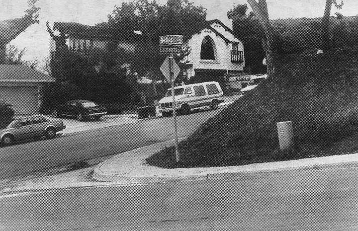
Belloc Court at Edgeworth Road
None of which has anything to do with Mr. Truckee, an early 19th-century Indian guide. Pioneers of the Sierra honored him by naming a river, a lake, a town, and a plateau of meadows after him. Today, the two-fisted mountain town of Truckee, California, is still on the map (north of Lake Tahoe) and so is Truckee River. Truckee Meadows, though, has vanished under the city of Reno, Nevada. And Truckee Lake was long ago renamed Donner Lake, after the ill-fated wagon-train party that camped there in 1846-47.
When Truckee Road was wiped off the San Diego map, that freed up the name. And lo! today there is a tiny Truckee Avenue on the northern rim of Mission Valley, right in the shadow of the 805 freeway.
Ward Road — Normal Heights and Mission Valley
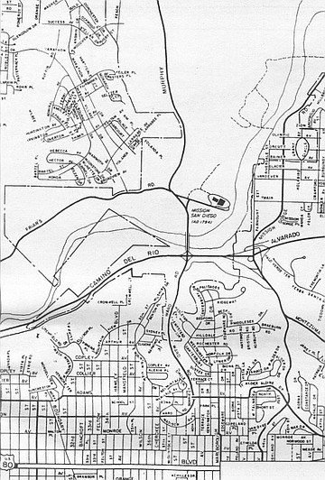
Ward and Murphy Canyon Road
Speaking of the Donner Party: There’s never been a Donner Road in San Diego, but there’ve been lots of Donners. One of the sons of George Donner (died and consumed by the Truckee River in early 1847) sired a son who moved to Texas after the Civil War. Said son begat a son named Joe, who became a carpenter and eventually moved his family to San Diego, where he died in 1944. His widow Myrtle followed in ’66. Only then did the kinfolk go public with the noisome little family secret: yes, they were descended from those Donners.
Joe and Myrtle lived at 3760 Ward Road in Normal Heights. Their house was razed a few years ago to make way for one of those cheap, multiunit apartment buildings that have turned the area into what realtors nicely call a “transitional” or “mixed” neighborhood.
But if the neighborhood’s going, the street’s almost entirely gone. Fifty years ago, Ward Road was one of the city’s key thoroughfares, two miles long and a main route to Mission Valley and the north. Now all that’s left of it is two shabby residential blocks.
Decades ago, if you were downtown and wanted for some strange reason to go to Escondido or Riverside, your most direct route was via Ward Road, which crossed Friars Road, turned into Murphy Canyon Road, and finally joined with Linda Vista Road on Kearny Mesa. From there the Escondido — or Inland — Highway proceeded north.
Today, nearly all of Ward has been supplanted by a stretch of Interstate/State Route 15. The new freeway follows the old Ward Road grade, beneath the Adams Avenue overpass. Recent maps still identify this portion of 15 as Ward Road. (Take out your Thomas Bros, and see.)
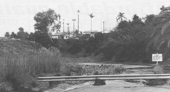
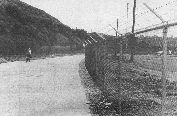
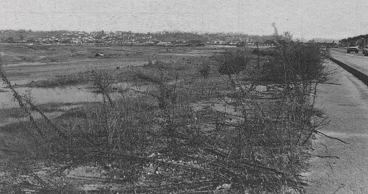
The photograph shows a dead-ended stump of Ward, hard by an I-15 offramp in Normal Heights. Until it was closed off around 1960, this piece of street took you underneath Adams Avenue and into Mission Valley. A sign at the barrier says NO DUMPING, but on a recent day the weed-choked roadside was filled with garbage and a broken-down yellow davenport.
Down near the Mission, off Camino del Rio North, you can find another stump of road bearing the name Ward.
The Wards themselves seem to have been a colorful lot. They included a father-son team of public officials who divided their time between San Diego and Tombstone, Arizona. During one of their extended excursions (c. 1883), the elder Ward got himself named sheriff of Tombstone, with his son as deputy. By 1891 the younger Ward, Will by name, was deputy sheriff in San Diego. A few years later he was styling himself a “rancher” and keeping both a downtown house and a spread northeast of the city.
When the Ward ranch was subdivided in the early 1900s, its driveway was joined to an old Mission Valley wagon trail and called Ward Road. The old driveway proved to be too crooked and narrow for automobile traffic, however. By 1920 the southwest terminus of Ward was moved to a straighter, wider road, originally named Reed Street.
Thus: the block of Ward that conjoins Cherokee Avenue in Normal Heights was originally Reed; and the teensy street that runs from East Mountain View Drive to the road in the photograph is the real Ward driveway, even though maps call it 38th Street.
If this sounds confusing today, think of how it must have been for the Donners.
Murphy Canyon Road — Mission Valley, Kearny Mesa East
Bicycle path near the souther end of old Murphy Canyon Road
Until the teens of this century, Ward Road’s northern extension, Murphy Canyon Road, was little more than a cowpath. Then traffic increased, for a couple of reasons. One was the creation of the Lee Highway, a transcontinental southern route that stretched from Washington, D.C., to San Diego. The Lee route entered the city via El Cajon Boulevard; Ward Road provided a route to Mission Valley and the north.
The second new development was a 12,000-acre army installation, Camp Kearny, on Linda Vista Mesa. There were only two roads from downtown to this army camp, and Ward Road/Murphy Canyon Road was one of them. (The other route was Linda Vista Road, an old wagon trail that took its name from the mesa and would keep it even when the namesake became known as Kearny Mesa.)
Like Ward Road, Murphy Canyon Road has been gradually supplanted by the I-15 freeway. The first phase of building occurred in the early 1960s, when a new four-lane state highway went up a hundred yards east of the old road. For 30 years since, maps have identified this new road as Murphy Canyon Road. The old Murphy Canyon Road remained as a frontage road for business, primarily construction companies.
For the past decade, the “new” Murphy Canyon Road, now widened to ten lanes, has been generally known as I-15. Meanwhile, the old road, with slight reroutings and reconstructions, has blossomed into a business center. Up near the old road’s northern end, you now find industrial parks and mirrored office buildings that house, inter alia, the San Diego Business Journal and radio stations KSDO and KSON.
The southern end of old Murphy Canyon Road used to intersect Friars Road near the Mission. Now it turns into a bicycle path a half-mile north of Friars.
Murphy Canyon, funnily enough, was named for Jack Murphy. Not the 1960s sports columnist who led the fight for a new ballpark, but a pioneer rancher who acquired about a hundred acres of the old San Diego Mission land grant. In the first county census (1860), John Murphy described himself as 26 years old, Irish-born, and a teamster by trade. By the time his widow put the spread up for sale in 1875, it had grown to 260 acres, most of them filled with orange and almond groves.
The two-story, wood-frame Murphy house stood on the west side of the canyon till the 1940s. Nowadays the old homestead is San Diego’s central petroleum-storage depot, a congeries of pipelines and oil tanks that march up the canyon floor behind Jack Murphy Stadium.
A relative, Charles Murphy, was a friend of the Wards of Ward Road. When the Ward father-and-son team moved to the Tombstone sheriff s office in 1883, Charley Murphy became “under sheriff’ of San Diego County. At other times he was city deputy constable, county road-tax collector, and a hose-truck driver for the fire department.
Fillmore Avenue, FIllmore Street — Hillcrest, South Mission Bay
Fillmore and other national streets, on a 1925 Rodney Stokes map
Millard Fillmore, our 13th Chief Executive, was not only a man who appreciated cleanliness (he installed a running-water bathtub in the White House) and respected person property (he signed the Fugitive Slave Act) and understood the need to preserve our Anglo-Saxon heritage (he ran for President on the Know-Nothing ticket in 1856). Fillmore is also distinguished as the only U.S. President to have two San Diego streets named after him.
Neither exists today under the Fillmore name. Brief histories of them both:
1) Fillmore Avenue. This was the original name of the thoroughfare that runs due east from University Avenue at Normal Street. Today it is designated as University Avenue. At the turn of the century, University Avenue (or Boulevard) turned northeast at this juncture — i.e., up Normal Street — then turned east again when it intersected Park Boulevard.
Fillmore Avenue, where it proceeded due east from University
In other words, what’s now called Normal Street and El Cajon Boulevard were formerly known as University Boulevard.
This bit of information helps clear up some puzzling questions. For example, where the name University Avenue comes from. Originally, University Boulevard ran past the state normal school, or teacher’s college, which local boosters hoped would soon blossom into an honest-to-God university. (The state college later moved east, but its main building still stands near the corner of Normal and Park.)
Likewise, this history explains Normal Street and why a neighboring subdivision was called University Heights.
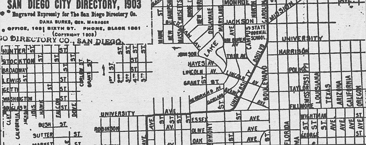
The way things were in 1903
By 1910, Fillmore Avenue in Hillcrest had been renamed University Avenue, and the name Fillmore was up for grabs. City engineers soon assigned it to:
2) A proposed street in the mudflats south of Mission Bay. As the 1925 maps indicates, Fillmore Street ran SW-NE, following the same mid-19th-century street-grid orientation found in Old Town and Point Loma. If it were built today, it would be a causeway leading from Sea World Drive to Fiesta Island.
Fillmore Street remained on city engineering maps till the 1960s, when the city completed the southern portion of Mission Bay Park. In the 1920s, this muddy stretch was envisioned as a residential area, but today its only tenant is Sea World.
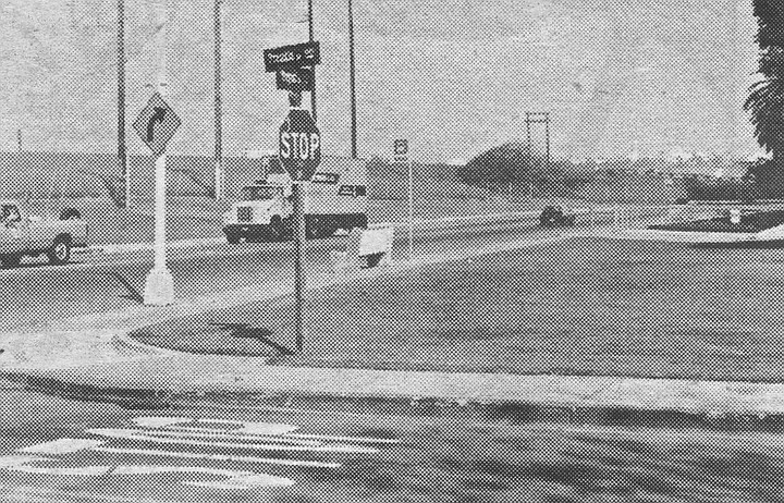
Where Fillmore Street was supposed to be: along Sea World Drive, about a quarter-mile east of Sea World Way
Achilles Drive — East San Diego
In the early 20th Century, the street plan of San Diego/East San Diego moved eastward at the rate of 20 blocks a decade. Occasionally the great moving grid ran into outlying settlements. At that point, some odd little driveway or cowpath would find itself suddenly incorporated into the city plan.
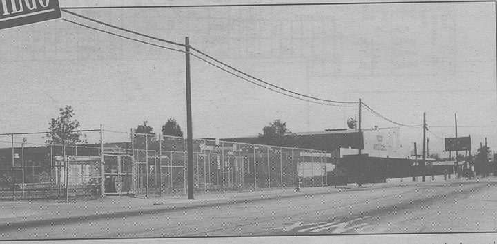
Looking eastward on Orange Avenue by Wilson Middle School. Achilles Drive ran perpendicular off Orange, at left-center in the photograph
Such was the case with Achilles Drive, a tiny street that first appeared in East San Diego around 1910 and stayed on the map until the late ’60s. Now it’s incorporated into the school grounds of Wilson Middle School (formerly Woodrow Wilson Junior High School), on a large block between El Cajon Boulevard and Orange Street.
Early in this century, East San Diego was a separate municipality with its own city hall, schools, Carnegie Library, and street-naming systems. What’s now 37th Street in San Diego was then 3rd Street in East San Diego; the present 38th Street was known variously as 46th Street, Ward Road, and Thomas Avenue.
The main residential area of East S.D. lay between the trolleys of University Avenue and the east-west highway of El Cajon Boulevard. Achilles was created as a cozy two-block drive that lay between the busy boulevards of El Cajon and Orange Avenue. By 1920, one short block of Achilles Drive boasted four houses and a half-dozen garages and other outbuildings.
Achilles Drive on a 1963 Texaco map
During the next few years, San Diego and East San Diego revamped and coordinated their street-naming systems. (Examples: 44th Street in Normal Heights became Cherokee Avenue; 48th Street became 40th Street; Daley Avenue and Rexmore Drive in East San Diego became 39th Street.) In the course of all this, odd little roads like Achilles began to disappear. By 1940, Achilles was a one-block dogleg from Orange to 39th Street. Then, around 1970, the street disappeared altogether as its block was incorporated into the grounds of the neighboring public school.
The name Achilles is a mystery, although it presumably was a family name rather than a reference to the fellow with the heel.
Chestnut Street — Old Town
The short, straight street marked Presidio Drive, intersecting Taylor Street near Morena, is the last remnant of Chestnut Street.
Taylor Street entrance to Presidio Drive, formerly the flag-end of Chestnut Street
A hundred years ago, Chestnut ran in a northwesterly direction from Witherby Street (Mission Hills area) to the Derby Dike by the San Diego River. At least it was supposed to. The two ends of Chestnut were graded and paved by the 1920s, but the middle section, representing the steep grade up the Presidio into Mission Hills, existed only in the mind of the mapmaker.
When Presidio Park and the Serra Museum were created in the late 1920s, the Mission Hills end of Chestnut Street was renamed Presidio Drive.
In those days, Old Town was thick with tourist encampments. The northwest block of Chestnut at Taylor was one of the largest of these, with a strip of tourist cabins and a big lot for trailers.
That northwest end of Chestnut vanished in the 1960s, when an I-8 freeway ramp was built on the site of the old trailer park. All that remained of Chestnut Street was a hundred yards of asphalt leading to the Presidio Drive loop. By 1969, the only private address left on Chestnut Street was an architectural firm (still there, by the way), and no one objected when the city declared that Chestnut Street would thenceforth be known as Presidio Drive.
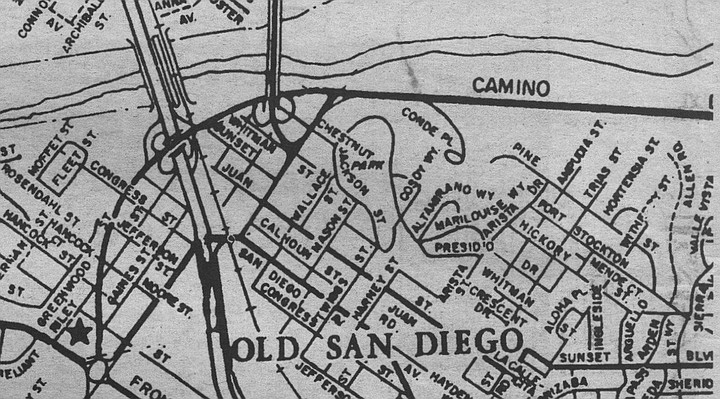
1957 map, showing Chestnut Street when it was two blocks long
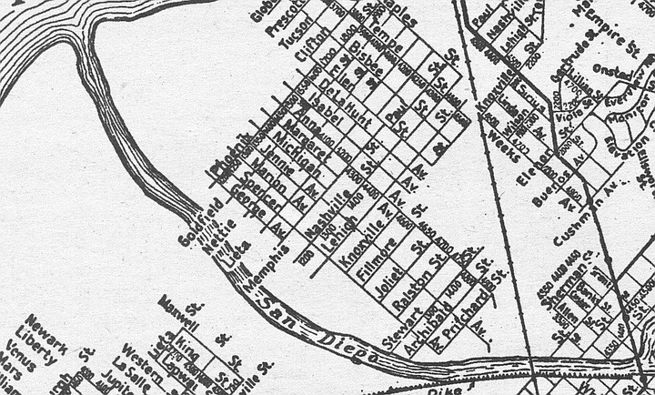
Nashville Street — Sports Arena Boulevard area
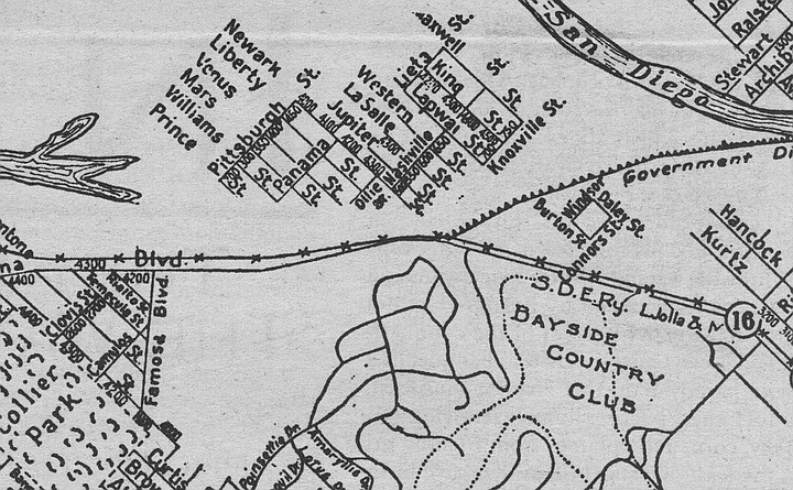
Nashville Street on a 1925 map
A half-century and more ago, Nashville Street was a thriving residential street in the mudflats south of Mission Bay. It began at the Mission Bay Causeway (later known as Midway Drive and now called Sports Arena Boulevard) and headed northeast for about eight blocks. Then it came to the pre-floodway San Diego River, skipped the river, and went on in the same direction for another few blocks.
One block of Nashville Street survives in the Bay Park area of town. The rest of the street has been obliterated by public works: the floodway, Mission Bay Park, and interstates 5 and 8.
In the Sports Arena Boulevard area, Nashville Street lasted till about 1970, when it was turned into an on-ramp for I-8. But its old residential neighborhood has somehow managed to endure. Ollie Street, on the other side of Sports Arena Boulevard, is still there, with its shabby prewar apartment buildings. So are Jupiter Street, LaSalle Street, and Western Street, which used to cross Nashville. Nashville’s sister street, Knoxville Street, is now called Channel Way.
Looking northeast, across Sports Arena Blvd. Freeway ramp occupies the former spot of Nashville Street.
In a letter to the Reader last September, former Nashville Street resident Ralph Willis reminisced that Nashville was the “main drag” in the neighborhood during the 1930s and that locals called their enclave “Dutch Flats.” Earlier, the term “Dutch Flats” referred to the entire isthmus between Mission Bay and the harbor.
Here's something you might be interested in.
Lost Roads of San Diego: Truckee Road, Ward Road, Fillmore Avenue
A journey to nowhere, part 3
Lost Roads of San Diego: Truckee Road, Ward Road, Fillmore Avenue
A journey to nowhere, part 3
Looking east from the withered stump if Ward Road
Truckee Road — Pacific Beach, Northeast
Most of the Lost Roads in this series still endure as footpaths, parking lots, or slices of newer highway; but Truckee Road never existed at all, except on paper. Old maps and city directories show that it was supposed to begin near Los Altos Way in Pacific Beach and proceed due east, terminating about a quarter-mile west of todays Interstate 5.
Truckee Road: Looking east from Kate Sessions Memorial Park, with cul-de-sac of Balfour Court in the distance
In the early 1920s, Truckee Road was part of a subdivision plan on the south foot of Mt. Soledad. But San Diego development hit the skids around 1926, and then a depression and a war came.
In the 1940s, a few hundred temporary war-workers’ houses cropped up nearby, along streets that had been paved in the ’20s but never developed. (These hillside prefabs, known as Los Altos Terrace, were pretty classy; from their front stoops you got a panoramic view of downtown, the harbor, and Mission Bay. They were designed by Frank Hope, Jr., who in the 1950s and ’60s would become San Diego’s premier architect of hospitals and office buildings.) After the war, these temporaries were carted off, and private housing took their place. By the late ’50s, most of eastern Pacific Beach had filled in, but the Truckee Road region remained unpaved, ungraded, and unsigned.
In 1961 the Truckee area still looked much as it had in the ’20s- a square mile of steep hills and scrub canyon, most of it city land because no private developers wanted it. But that year the city council voted to turn part of the area into a park, named in honor of a dead Mission Hills florist.
Truckee Rd., as envisioned in 1925
After that, things happened fast in these rocky muirlands. Kate Sessions Memorial Park was open by 1964. Nearby, Soledad Mountain Road was completed, connecting eastern PB with La Jolla. Developers put up pricey houses on two-acre lots, called in the landscapers, and sold the results as “estates on Mt. Soledad in La Jolla.”
By 1970, Truckee Road had vanished from the books. In its place we now find a pair of short cul-de-sacs named for two British MPs of the early 20th Century: Balfour Court and Belloc Court. The juxtaposition of these two streets suggests a developer with a sense of humor. Arthur Balfour is the fellow best remembered for the 1917 Balfour Declaration, in which it was resolved that it would be a good thing to give Palestine to the Jews. Hilaire Belloc is the politician and writer best remembered for his kiddie verse, his travel books, and his belief that it was a lousy thing to give Palestine to the Jews.
Belloc Court at Edgeworth Road
None of which has anything to do with Mr. Truckee, an early 19th-century Indian guide. Pioneers of the Sierra honored him by naming a river, a lake, a town, and a plateau of meadows after him. Today, the two-fisted mountain town of Truckee, California, is still on the map (north of Lake Tahoe) and so is Truckee River. Truckee Meadows, though, has vanished under the city of Reno, Nevada. And Truckee Lake was long ago renamed Donner Lake, after the ill-fated wagon-train party that camped there in 1846-47.
When Truckee Road was wiped off the San Diego map, that freed up the name. And lo! today there is a tiny Truckee Avenue on the northern rim of Mission Valley, right in the shadow of the 805 freeway.
Ward Road — Normal Heights and Mission Valley
Ward and Murphy Canyon Road
Speaking of the Donner Party: There’s never been a Donner Road in San Diego, but there’ve been lots of Donners. One of the sons of George Donner (died and consumed by the Truckee River in early 1847) sired a son who moved to Texas after the Civil War. Said son begat a son named Joe, who became a carpenter and eventually moved his family to San Diego, where he died in 1944. His widow Myrtle followed in ’66. Only then did the kinfolk go public with the noisome little family secret: yes, they were descended from those Donners.
Joe and Myrtle lived at 3760 Ward Road in Normal Heights. Their house was razed a few years ago to make way for one of those cheap, multiunit apartment buildings that have turned the area into what realtors nicely call a “transitional” or “mixed” neighborhood.
But if the neighborhood’s going, the street’s almost entirely gone. Fifty years ago, Ward Road was one of the city’s key thoroughfares, two miles long and a main route to Mission Valley and the north. Now all that’s left of it is two shabby residential blocks.
Decades ago, if you were downtown and wanted for some strange reason to go to Escondido or Riverside, your most direct route was via Ward Road, which crossed Friars Road, turned into Murphy Canyon Road, and finally joined with Linda Vista Road on Kearny Mesa. From there the Escondido — or Inland — Highway proceeded north.
Today, nearly all of Ward has been supplanted by a stretch of Interstate/State Route 15. The new freeway follows the old Ward Road grade, beneath the Adams Avenue overpass. Recent maps still identify this portion of 15 as Ward Road. (Take out your Thomas Bros, and see.)
The photograph shows a dead-ended stump of Ward, hard by an I-15 offramp in Normal Heights. Until it was closed off around 1960, this piece of street took you underneath Adams Avenue and into Mission Valley. A sign at the barrier says NO DUMPING, but on a recent day the weed-choked roadside was filled with garbage and a broken-down yellow davenport.
Down near the Mission, off Camino del Rio North, you can find another stump of road bearing the name Ward.
The Wards themselves seem to have been a colorful lot. They included a father-son team of public officials who divided their time between San Diego and Tombstone, Arizona. During one of their extended excursions (c. 1883), the elder Ward got himself named sheriff of Tombstone, with his son as deputy. By 1891 the younger Ward, Will by name, was deputy sheriff in San Diego. A few years later he was styling himself a “rancher” and keeping both a downtown house and a spread northeast of the city.
When the Ward ranch was subdivided in the early 1900s, its driveway was joined to an old Mission Valley wagon trail and called Ward Road. The old driveway proved to be too crooked and narrow for automobile traffic, however. By 1920 the southwest terminus of Ward was moved to a straighter, wider road, originally named Reed Street.
Thus: the block of Ward that conjoins Cherokee Avenue in Normal Heights was originally Reed; and the teensy street that runs from East Mountain View Drive to the road in the photograph is the real Ward driveway, even though maps call it 38th Street.
If this sounds confusing today, think of how it must have been for the Donners.
Murphy Canyon Road — Mission Valley, Kearny Mesa East
Bicycle path near the souther end of old Murphy Canyon Road
Until the teens of this century, Ward Road’s northern extension, Murphy Canyon Road, was little more than a cowpath. Then traffic increased, for a couple of reasons. One was the creation of the Lee Highway, a transcontinental southern route that stretched from Washington, D.C., to San Diego. The Lee route entered the city via El Cajon Boulevard; Ward Road provided a route to Mission Valley and the north.
The second new development was a 12,000-acre army installation, Camp Kearny, on Linda Vista Mesa. There were only two roads from downtown to this army camp, and Ward Road/Murphy Canyon Road was one of them. (The other route was Linda Vista Road, an old wagon trail that took its name from the mesa and would keep it even when the namesake became known as Kearny Mesa.)
Like Ward Road, Murphy Canyon Road has been gradually supplanted by the I-15 freeway. The first phase of building occurred in the early 1960s, when a new four-lane state highway went up a hundred yards east of the old road. For 30 years since, maps have identified this new road as Murphy Canyon Road. The old Murphy Canyon Road remained as a frontage road for business, primarily construction companies.
For the past decade, the “new” Murphy Canyon Road, now widened to ten lanes, has been generally known as I-15. Meanwhile, the old road, with slight reroutings and reconstructions, has blossomed into a business center. Up near the old road’s northern end, you now find industrial parks and mirrored office buildings that house, inter alia, the San Diego Business Journal and radio stations KSDO and KSON.
The southern end of old Murphy Canyon Road used to intersect Friars Road near the Mission. Now it turns into a bicycle path a half-mile north of Friars.
Murphy Canyon, funnily enough, was named for Jack Murphy. Not the 1960s sports columnist who led the fight for a new ballpark, but a pioneer rancher who acquired about a hundred acres of the old San Diego Mission land grant. In the first county census (1860), John Murphy described himself as 26 years old, Irish-born, and a teamster by trade. By the time his widow put the spread up for sale in 1875, it had grown to 260 acres, most of them filled with orange and almond groves.
The two-story, wood-frame Murphy house stood on the west side of the canyon till the 1940s. Nowadays the old homestead is San Diego’s central petroleum-storage depot, a congeries of pipelines and oil tanks that march up the canyon floor behind Jack Murphy Stadium.
A relative, Charles Murphy, was a friend of the Wards of Ward Road. When the Ward father-and-son team moved to the Tombstone sheriff s office in 1883, Charley Murphy became “under sheriff’ of San Diego County. At other times he was city deputy constable, county road-tax collector, and a hose-truck driver for the fire department.
Fillmore Avenue, FIllmore Street — Hillcrest, South Mission Bay
Fillmore and other national streets, on a 1925 Rodney Stokes map
Millard Fillmore, our 13th Chief Executive, was not only a man who appreciated cleanliness (he installed a running-water bathtub in the White House) and respected person property (he signed the Fugitive Slave Act) and understood the need to preserve our Anglo-Saxon heritage (he ran for President on the Know-Nothing ticket in 1856). Fillmore is also distinguished as the only U.S. President to have two San Diego streets named after him.
Neither exists today under the Fillmore name. Brief histories of them both:
1) Fillmore Avenue. This was the original name of the thoroughfare that runs due east from University Avenue at Normal Street. Today it is designated as University Avenue. At the turn of the century, University Avenue (or Boulevard) turned northeast at this juncture — i.e., up Normal Street — then turned east again when it intersected Park Boulevard.
Fillmore Avenue, where it proceeded due east from University
In other words, what’s now called Normal Street and El Cajon Boulevard were formerly known as University Boulevard.
This bit of information helps clear up some puzzling questions. For example, where the name University Avenue comes from. Originally, University Boulevard ran past the state normal school, or teacher’s college, which local boosters hoped would soon blossom into an honest-to-God university. (The state college later moved east, but its main building still stands near the corner of Normal and Park.)
Likewise, this history explains Normal Street and why a neighboring subdivision was called University Heights.
The way things were in 1903
By 1910, Fillmore Avenue in Hillcrest had been renamed University Avenue, and the name Fillmore was up for grabs. City engineers soon assigned it to:
2) A proposed street in the mudflats south of Mission Bay. As the 1925 maps indicates, Fillmore Street ran SW-NE, following the same mid-19th-century street-grid orientation found in Old Town and Point Loma. If it were built today, it would be a causeway leading from Sea World Drive to Fiesta Island.
Fillmore Street remained on city engineering maps till the 1960s, when the city completed the southern portion of Mission Bay Park. In the 1920s, this muddy stretch was envisioned as a residential area, but today its only tenant is Sea World.
Where Fillmore Street was supposed to be: along Sea World Drive, about a quarter-mile east of Sea World Way
Achilles Drive — East San Diego
In the early 20th Century, the street plan of San Diego/East San Diego moved eastward at the rate of 20 blocks a decade. Occasionally the great moving grid ran into outlying settlements. At that point, some odd little driveway or cowpath would find itself suddenly incorporated into the city plan.
Looking eastward on Orange Avenue by Wilson Middle School. Achilles Drive ran perpendicular off Orange, at left-center in the photograph
Such was the case with Achilles Drive, a tiny street that first appeared in East San Diego around 1910 and stayed on the map until the late ’60s. Now it’s incorporated into the school grounds of Wilson Middle School (formerly Woodrow Wilson Junior High School), on a large block between El Cajon Boulevard and Orange Street.
Early in this century, East San Diego was a separate municipality with its own city hall, schools, Carnegie Library, and street-naming systems. What’s now 37th Street in San Diego was then 3rd Street in East San Diego; the present 38th Street was known variously as 46th Street, Ward Road, and Thomas Avenue.
The main residential area of East S.D. lay between the trolleys of University Avenue and the east-west highway of El Cajon Boulevard. Achilles was created as a cozy two-block drive that lay between the busy boulevards of El Cajon and Orange Avenue. By 1920, one short block of Achilles Drive boasted four houses and a half-dozen garages and other outbuildings.
Achilles Drive on a 1963 Texaco map
During the next few years, San Diego and East San Diego revamped and coordinated their street-naming systems. (Examples: 44th Street in Normal Heights became Cherokee Avenue; 48th Street became 40th Street; Daley Avenue and Rexmore Drive in East San Diego became 39th Street.) In the course of all this, odd little roads like Achilles began to disappear. By 1940, Achilles was a one-block dogleg from Orange to 39th Street. Then, around 1970, the street disappeared altogether as its block was incorporated into the grounds of the neighboring public school.
The name Achilles is a mystery, although it presumably was a family name rather than a reference to the fellow with the heel.
Chestnut Street — Old Town
The short, straight street marked Presidio Drive, intersecting Taylor Street near Morena, is the last remnant of Chestnut Street.
Taylor Street entrance to Presidio Drive, formerly the flag-end of Chestnut Street
A hundred years ago, Chestnut ran in a northwesterly direction from Witherby Street (Mission Hills area) to the Derby Dike by the San Diego River. At least it was supposed to. The two ends of Chestnut were graded and paved by the 1920s, but the middle section, representing the steep grade up the Presidio into Mission Hills, existed only in the mind of the mapmaker.
When Presidio Park and the Serra Museum were created in the late 1920s, the Mission Hills end of Chestnut Street was renamed Presidio Drive.
In those days, Old Town was thick with tourist encampments. The northwest block of Chestnut at Taylor was one of the largest of these, with a strip of tourist cabins and a big lot for trailers.
That northwest end of Chestnut vanished in the 1960s, when an I-8 freeway ramp was built on the site of the old trailer park. All that remained of Chestnut Street was a hundred yards of asphalt leading to the Presidio Drive loop. By 1969, the only private address left on Chestnut Street was an architectural firm (still there, by the way), and no one objected when the city declared that Chestnut Street would thenceforth be known as Presidio Drive.
1957 map, showing Chestnut Street when it was two blocks long
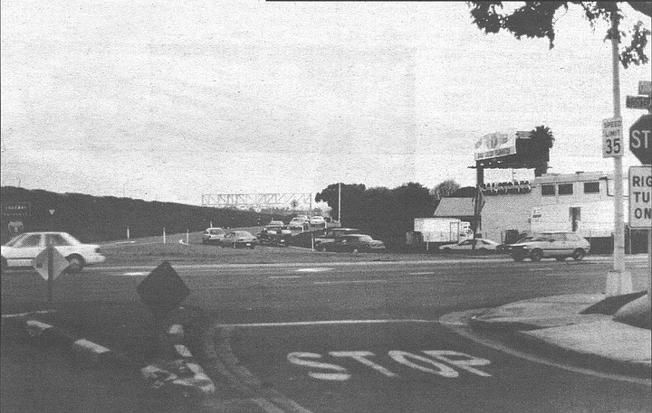
Nashville Street — Sports Arena Boulevard area
Nashville Street on a 1925 map
A half-century and more ago, Nashville Street was a thriving residential street in the mudflats south of Mission Bay. It began at the Mission Bay Causeway (later known as Midway Drive and now called Sports Arena Boulevard) and headed northeast for about eight blocks. Then it came to the pre-floodway San Diego River, skipped the river, and went on in the same direction for another few blocks.
One block of Nashville Street survives in the Bay Park area of town. The rest of the street has been obliterated by public works: the floodway, Mission Bay Park, and interstates 5 and 8.
In the Sports Arena Boulevard area, Nashville Street lasted till about 1970, when it was turned into an on-ramp for I-8. But its old residential neighborhood has somehow managed to endure. Ollie Street, on the other side of Sports Arena Boulevard, is still there, with its shabby prewar apartment buildings. So are Jupiter Street, LaSalle Street, and Western Street, which used to cross Nashville. Nashville’s sister street, Knoxville Street, is now called Channel Way.
Looking northeast, across Sports Arena Blvd. Freeway ramp occupies the former spot of Nashville Street.
In a letter to the Reader last September, former Nashville Street resident Ralph Willis reminisced that Nashville was the “main drag” in the neighborhood during the 1930s and that locals called their enclave “Dutch Flats.” Earlier, the term “Dutch Flats” referred to the entire isthmus between Mission Bay and the harbor.
Comments