Here's something you might be interested in.
Ask a Hipster — Advice you didn't know you needed
Big Screen — Movie commentary
Blurt — Music's inside track
Booze News — San Diego spirits
Classical Music — Immortal beauty
Classifieds — Free and easy
Close to Home — What it’s like on the street where you live
Cover Stories — Front-page features
Drinks All Around — Bartenders' drink recipes
Excerpts — Literary and spiritual excerpts
Feast! — Food & drink reviews
Feature Stories — Local news & stories
Fishing Report — What’s getting hooked from ship and shore
From the Archives — Spotlight on the past
Golden Dreams — Talk of the town
The Gonzo Report — Making the musical scene, or at least reporting from it
Letters — Our inbox
Movies@Home — Local movie buffs share favorites
Movie Reviews — Our critics' picks and pans
Musician Interviews — Up close with local artists
Neighborhood News from Stringers — Hyperlocal news
News Ticker — News & politics
Obermeyer — San Diego politics illustrated
Outdoors — Weekly changes in flora and fauna
Overheard in San Diego — Eavesdropping illustrated
Poetry — The old and the new
Reader Travel — Travel section built by travelers
Reading — The hunt for intellectuals
Roam-O-Rama — SoCal's best hiking/biking trails
San Diego Beer — Inside San Diego suds
SD on the QT — Almost factual news
Sheep and Goats — Places of worship
Special Issues — The best of
Street Style — San Diego streets have style
Surf Diego — Real stories from those braving the waves
Theater — On stage in San Diego this week
Tin Fork — Silver spoon alternative
Under the Radar — Matt Potter's undercover work
Unforgettable — Long-ago San Diego
Unreal Estate — San Diego's priciest pads
Your Week — Daily event picks
The pull-apart basin
Best way to see Canyon Sin Nombre is on foot
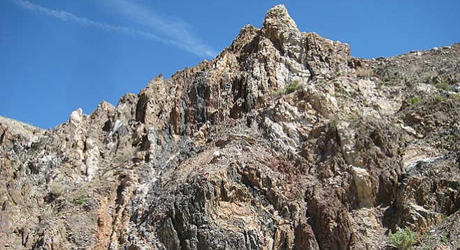
Alverson andesite shows up as a dark, non-linear vein piercing through the northern hillside
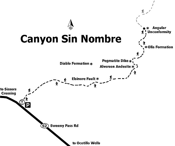
Canyon Sin Nombre is located in the Anza-Borrego Desert State Park, an area known for its driving tectonic forces and awe-inspiring geologic structures. Geologists refer to this region as the Salton Trough, as it is located within an active pull-apart basin. So, get ready to experience some of Anza-Borrego’s most geologically rich areas on your hike into the canyon.
The slight change in elevation and sand are the only hurdles along the way.
The hike starts at the north end of the designated parking area. A sign marked “Canyon Sin Nombre” will be visible, and from there walk east into the canyon on a dirt road. Four-wheel-drive vehicles can navigate the soft sand and uneven terrain, but to truly appreciate Canyon Sin Nombre’s splendor, it is best to hike from the parking area where the dirt road begins.
A noticeable change in sedimentary beds called an angular unconformity appears.
The road is steep when starting out in the soft sand, making this hike moderately difficult. Wearing hiking boots or slip-resistant shoes is helpful, but the slight change in elevation and sand are the only hurdles along the way.
Anticline
The best time to hike into Canyon Sin Nombre is between January and April, when many plants are in bloom. Ocotillos, beaver tail cactus, brittle bush, and fish-hook cactus were just a few of many blooming plants seen in April. Inflated blister beetles were spotted scurrying through the sand quickly from plant to plant, attempting to evade the mid-day sun.
Approximately one mile from the parking lot, the road is at the lowest point of elevation and continues fairly level through a wash where torrential floods have left their mark, helping form the Canyon with No Name.
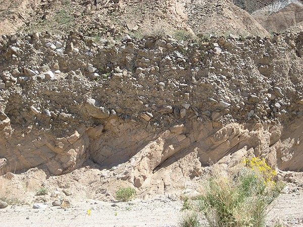
The first wondrous geologic feature is the Elsinore Fault. Fault compression — stress directed toward the center of a rock mass through tectonic activity — can be seen on the northern hillside, as layers are squeezed together making older layers of rock rise above younger layers. It might take a trained eye to notice the offset right away, so make sure to give yourself plenty of time to examine these geologic marvels.
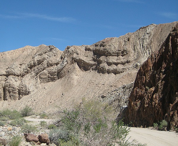
Keep walking through the wash heading northeast. The next feature is impossible to miss and is called the Diablo Formation. This brilliantly reddish hematite-rich mudstone, with its popcorn-like texture, is the result of deposition from the ancestral Colorado River from 2.5 to 4 million years ago and is exposed over much of the Salton Trough region.
A little further into the wash, as it narrows, an olivine rich rock called Alverson andesite can be seen as a dark non-linear vein piercing through the northern hillside. Around the andesite are multitudes of layers, in numerous colors, representing different periods in geologic time. The deeper into the canyon you go, the more dramatic and beautiful it becomes.
The first left turn through the meandering wash goes right through an eroded pegmatite dike — an intrusion of large granitic minerals. On both sides of the hill, easily noticed is a wide, light-colored vein of large quartz crystals, black tourmaline, and flaky muscovite mica. This pegmatite that was once molten rock intruded into the already existing rock layers, cooling very slowly deep underground, giving the minerals present plenty of time to form. For the next quarter-mile, the canyon walls are decorated with pegmatite dikes, one after another. This striking feature can even be seen on Google Earth.
Not far from the myriad intrusions, the wash starts to meander due east and the canyon walls start to fall away, opening up the canyon. On the right side of the wash, and now directly in front of you, is beautiful sandstone called the Olla Formation, also between 2.5 and 4 million years old. The Olla Formation becomes the dominant feature, as its beautiful features make it hard to miss. Soft sediment deposited in uneven layers from local ancestral streams, gives the formation a wavy and folded appearance. This soft-sediment deformation is breathtaking, but it is not the last stop! There is one more feature to see before turning back, right around the bend.
On the right, a noticeable change in sedimentary beds called an angular unconformity appears. This specific unconformity shows two drastically different types of sedimentary bedding, with one layer of large slabs tilting upward from below, and the other, a rocky conglomerate laying on top, completely parallel to the ground.
This is the turnaround point. Make sure not to collect any artifacts, rocks, or plant life on your walk. In addition, take plenty of pictures, as these features will change over the years, although probably not in our lifetime.
Directions from downtown San Diego: Approximately 100 miles (Ocotillo). Allow 1 hour and 40 minutes driving time. From I-8E, take exit 89 and turn left (north) onto Imperial Hwy/S2 toward Ocotillo. Drive 13 miles and park on right side of the road at Canyon Sin Nombre turnout and park.
Hiking length: 3 miles out and back.
Difficulty: Moderate difficulty, with 100’ elevation gain and loss. No facilities. Dogs and mountain bikes are not allowed on trail.
Here's something you might be interested in.
The pull-apart basin
Best way to see Canyon Sin Nombre is on foot
The pull-apart basin
Best way to see Canyon Sin Nombre is on foot
Alverson andesite shows up as a dark, non-linear vein piercing through the northern hillside
Canyon Sin Nombre is located in the Anza-Borrego Desert State Park, an area known for its driving tectonic forces and awe-inspiring geologic structures. Geologists refer to this region as the Salton Trough, as it is located within an active pull-apart basin. So, get ready to experience some of Anza-Borrego’s most geologically rich areas on your hike into the canyon.
The slight change in elevation and sand are the only hurdles along the way.
The hike starts at the north end of the designated parking area. A sign marked “Canyon Sin Nombre” will be visible, and from there walk east into the canyon on a dirt road. Four-wheel-drive vehicles can navigate the soft sand and uneven terrain, but to truly appreciate Canyon Sin Nombre’s splendor, it is best to hike from the parking area where the dirt road begins.
A noticeable change in sedimentary beds called an angular unconformity appears.
The road is steep when starting out in the soft sand, making this hike moderately difficult. Wearing hiking boots or slip-resistant shoes is helpful, but the slight change in elevation and sand are the only hurdles along the way.
Anticline
The best time to hike into Canyon Sin Nombre is between January and April, when many plants are in bloom. Ocotillos, beaver tail cactus, brittle bush, and fish-hook cactus were just a few of many blooming plants seen in April. Inflated blister beetles were spotted scurrying through the sand quickly from plant to plant, attempting to evade the mid-day sun.
Approximately one mile from the parking lot, the road is at the lowest point of elevation and continues fairly level through a wash where torrential floods have left their mark, helping form the Canyon with No Name.
The first wondrous geologic feature is the Elsinore Fault. Fault compression — stress directed toward the center of a rock mass through tectonic activity — can be seen on the northern hillside, as layers are squeezed together making older layers of rock rise above younger layers. It might take a trained eye to notice the offset right away, so make sure to give yourself plenty of time to examine these geologic marvels.
Keep walking through the wash heading northeast. The next feature is impossible to miss and is called the Diablo Formation. This brilliantly reddish hematite-rich mudstone, with its popcorn-like texture, is the result of deposition from the ancestral Colorado River from 2.5 to 4 million years ago and is exposed over much of the Salton Trough region.
A little further into the wash, as it narrows, an olivine rich rock called Alverson andesite can be seen as a dark non-linear vein piercing through the northern hillside. Around the andesite are multitudes of layers, in numerous colors, representing different periods in geologic time. The deeper into the canyon you go, the more dramatic and beautiful it becomes.
The first left turn through the meandering wash goes right through an eroded pegmatite dike — an intrusion of large granitic minerals. On both sides of the hill, easily noticed is a wide, light-colored vein of large quartz crystals, black tourmaline, and flaky muscovite mica. This pegmatite that was once molten rock intruded into the already existing rock layers, cooling very slowly deep underground, giving the minerals present plenty of time to form. For the next quarter-mile, the canyon walls are decorated with pegmatite dikes, one after another. This striking feature can even be seen on Google Earth.
Not far from the myriad intrusions, the wash starts to meander due east and the canyon walls start to fall away, opening up the canyon. On the right side of the wash, and now directly in front of you, is beautiful sandstone called the Olla Formation, also between 2.5 and 4 million years old. The Olla Formation becomes the dominant feature, as its beautiful features make it hard to miss. Soft sediment deposited in uneven layers from local ancestral streams, gives the formation a wavy and folded appearance. This soft-sediment deformation is breathtaking, but it is not the last stop! There is one more feature to see before turning back, right around the bend.
On the right, a noticeable change in sedimentary beds called an angular unconformity appears. This specific unconformity shows two drastically different types of sedimentary bedding, with one layer of large slabs tilting upward from below, and the other, a rocky conglomerate laying on top, completely parallel to the ground.
This is the turnaround point. Make sure not to collect any artifacts, rocks, or plant life on your walk. In addition, take plenty of pictures, as these features will change over the years, although probably not in our lifetime.
Directions from downtown San Diego: Approximately 100 miles (Ocotillo). Allow 1 hour and 40 minutes driving time. From I-8E, take exit 89 and turn left (north) onto Imperial Hwy/S2 toward Ocotillo. Drive 13 miles and park on right side of the road at Canyon Sin Nombre turnout and park.
Hiking length: 3 miles out and back.
Difficulty: Moderate difficulty, with 100’ elevation gain and loss. No facilities. Dogs and mountain bikes are not allowed on trail.
Comments