
Here's something you might be interested in.
Ask a Hipster — Advice you didn't know you needed
Big Screen — Movie commentary
Blurt — Music's inside track
Booze News — San Diego spirits
Classical Music — Immortal beauty
Classifieds — Free and easy
Cover Stories — Front-page features
Drinks All Around — Bartenders' drink recipes
Excerpts — Literary and spiritual excerpts
Feast! — Food & drink reviews
Feature Stories — Local news & stories
Fishing Report — What’s getting hooked from ship and shore
From the Archives — Spotlight on the past
Golden Dreams — Talk of the town
The Gonzo Report — Making the musical scene, or at least reporting from it
Letters — Our inbox
Movies@Home — Local movie buffs share favorites
Movie Reviews — Our critics' picks and pans
Musician Interviews — Up close with local artists
Neighborhood News from Stringers — Hyperlocal news
News Ticker — News & politics
Obermeyer — San Diego politics illustrated
Outdoors — Weekly changes in flora and fauna
Overheard in San Diego — Eavesdropping illustrated
Poetry — The old and the new
Reader Travel — Travel section built by travelers
Reading — The hunt for intellectuals
Roam-O-Rama — SoCal's best hiking/biking trails
San Diego Beer — Inside San Diego suds
SD on the QT — Almost factual news
Sheep and Goats — Places of worship
Special Issues — The best of
Street Style — San Diego streets have style
Surf Diego — Real stories from those braving the waves
Theater — On stage in San Diego this week
Tin Fork — Silver spoon alternative
Under the Radar — Matt Potter's undercover work
Unforgettable — Long-ago San Diego
Unreal Estate — San Diego's priciest pads
Your Week — Daily event picks
Dangerous bike spots: Friars Road, Nimitz Blvd, University Ave., Pershing Dr., Genesee, Pacific Hwy at Barnett Ave.
Safer routes: SD River Trail, West Point Loma, Robinson, Governor
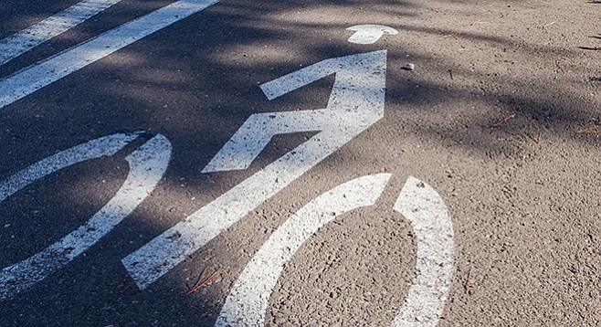
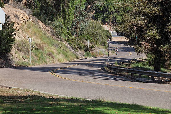
Regents Road bike lane
Bicyclists who ride the streets of San Diego daily are used to the constant hazards a bike ride can present. Texting motorists, freeway on-ramps, cracked pavement — veteran cyclists have grown accustomed to these challenges. But imagine a young couple who are looking for safe passage from one neighborhood to another. They are not daily commuters looking for the speediest route; they want a nice, terror-free ride on a Sunday afternoon.
With this couple in mind, we have identified five spots that have been deemed particularly nerve-racking, tricky, or dangerous. We will present alternative routes so the riders can reach their preferred destinations minus the fear many of these spots can induce. In most scenarios the alterantive rides will be longer, but remember, these are the bicycling equivalent of “Sunday drivers.” Even though they are trying to get from Point A to Point B, the main idea is to have a pleasant ride — and to get there alive.
These locations were submitted as responses to the Reader’s July 14 Facebook “Question of the Day,” which asked, “What do you think is the most dangerous bicycling spot within San Diego city limits?” And you, the noble cyclists of San Diego, responded in force. We thank you for your input there and have used some of your responses.
The collision data we have included was sourced from the Transportation Injury Mapping System (“TIMS”). It’s from a five-year query on “bicycle collisions” from January 1, 2007, to January 1, 2012. The map generated and utilized to pinpoint collision locations for this story accounts for 85.5 percent of all incidents. The data for 2013 and 2014 was still incomplete as of this story’s publication.
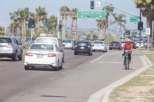
Friars Road from Morena Blvd. to Qualcomm Way
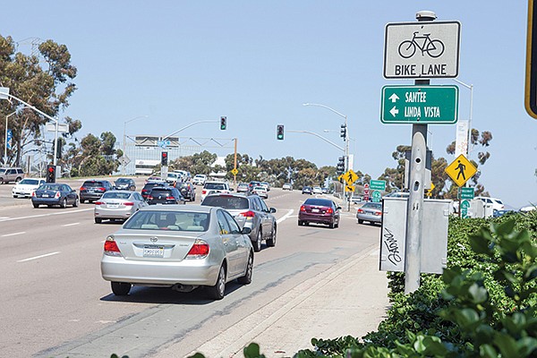
Why does Friars Road even have a bike lane?
Imagine our lovely young couple rents an apartment off of Friars Road just west of Fashion Valley. They want to take a ride on their new bikes down to the Bed Bath and Beyond in Mission Valley to check out some curtains they can’t live without. According to our Facebook correspondents, here’s what they may be up against:
“Nearly all of Friars Road is a fully designated and recommended bike route on the official bike map,” complains one respondent. “Gotta love the freeway-style on-ramps, riding between merging lanes with cars doing 50 mph or more on both sides of you! Never again!”
“Agree with the folks who say Friars from 163 past the 15. Holy smokes. Why does that even have a bike lane? Never again.”
“Friars Road/Ulric St. Try to take a left to get on Ulric St. Friars Rd. in general. Speed limit is 45 and 55. Not cool riding there with cars flying by.”
If you are riding on Friars Road heading near Fashion Valley, you may be improperly lulled into thinking the designated bike lanes make it a safe option for cyclists. Just wait until you reach Ulric Street and the insane traffic that can build on the bridge that crosses over State Route 163. Add to that mix the freeway on-ramps and you have one heck of an opportunity to sharpen your skills at weaving in between multiple lanes of fast moving traffic, whether you want to or not. Between 2007 and 2012, there were 15 collisions listed on this stretch of Friars Road. Not the best route for timid or inexperienced cyclists.
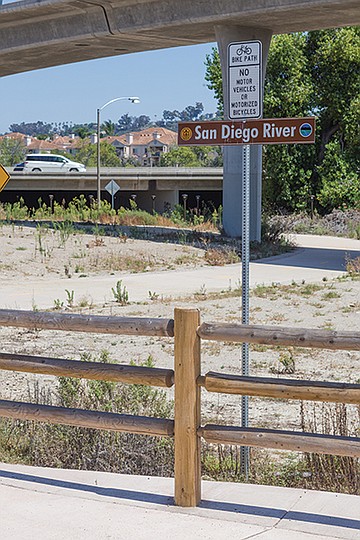
The San Diego River Trail
Alternate Route
Instead of beelining it to Mission Center Road on Friars (a straight shot on the map) a better option for our young couple is to take Friars to Fashion Valley Road and then hop on the San Diego River Trail heading east.
The San Diego River Trail now connects all the way from Ocean Beach to I-805 without interruption. It is a great option for navigating Mission Valley on a bike.
Nimitz Boulevard-Sunset Cliffs-West end of Interstate 8
“The Sunset Cliffs, Nimitz, end of 8 freeway cluster is pretty bad. Going Southbound is okay but going Northbound is incredibly dangerous.”
Our couple was determined to be closer to the beach, so they rented an apartment just to the east of Nimitz on West Point Loma Boulevard. They are trying to make it over to South Mission Beach to toss around a Frisbee and tear up some waves on their boogie-boards. Here’s what they may face:
“The Sunset Cliffs, Nimitz, end of 8 freeway cluster is pretty bad. Going Southbound is okay but going Northbound is incredibly dangerous. The cycling lane ends...and everybody is trying to get onto the 8, and it’s impossible for a cyclist to actually change lanes to continue straight to cross the bridge over the river. Almost saw a cyclist get hit from behind there the other day actually because someone pulled out to change a lane (and didn’t signal of course) and the BMW behind him got upset, pulled to the right of the vehicle (onto the shoulder of the road) and passed from the right, nearly hitting the cyclist.” — Facebook user, 7/14/15
This spot was also mentioned by Hannah Williams from the San Diego Bike Coalition as a particularly tricky juncture. Nimitz and Sunset Cliffs are both major thoroughfares, while vehicles traveling north out of Ocean Beach and onto I-8 are bound to be moving at a rapid clip. It can be an overwhelming area for any cyclist, but, similar to many spots like this, it has seen very few collisions over the five-year period from 2007 to 2012. Only two were recorded during the timespan — one in 2009 and one in 2010.
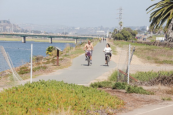
The San Diego River Pathway near Robb Field
Alternate Route
Instead of riding through the trickier passage mentioned here, our beachy couple should take West Point Loma toward Ocean Beach and take a right on Bacon Street, which will take them into Robb Field. At the north end of the park, they will be able to pick up the San Diego River Pathway and head inland. After 100 yards, signs to Mission Beach will direct them onto the Sunset Cliffs bridge over the river, on which they will ride in a lane separated from traffic by concrete barriers. On the north side, they can veer off onto lightly traveled Quivira Way, which will bring them to West Mission Bay Boulevard. A tricky but short ride over the bridge and a left at Gleason and they can pick up the bike path south to the jetty and to South Mission Beach.
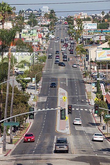
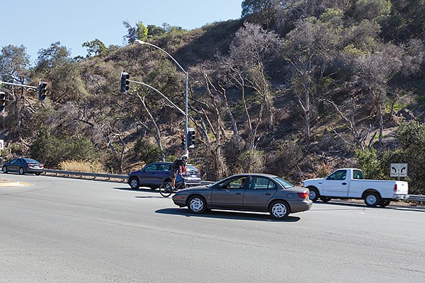
University Avenue — a busy portion of the city.
University Avenue from Hillcrest to North Park
This is a busy portion of the city, so our young couple — who grew out of the beach phase and into their Uptown phase — may be a bit out of luck in finding a completely stress-free route from their new apartment in the heart of Hillcrest to lunch with friends at Junz Teriyaki & BBQ on University and 30th.
Between 2007 and 2012, there were a whopping 67 collisions recorded in this passage; 13 were on the short stretch between Park Boulevard and Mississippi Street, with the largest number, 6, occurring at Alabama Street. This portion of University is a popular route for both cyclists and drivers because it connects Hillcrest all the way to City Heights. It is a direct route but a gamble on a bike. A number of major intersections (Sixth, Park, Texas, 30th) have to be navigated, and the squeeze between bikes and automobiles —parked and moving — can turn from annoying to injurious in a moment.
Video:
Mike Tyson whooping up on Sammy Scaff

Even the most feeble Toyota Yaris or Car2Go is sure to kick your butt in a collision. Heck, even a librarian on a moped is bound to knock you around like Mike Tyson. And that’s not even mentioning all the random doors flying open from the cars parallel-parked along the way.
Video:
Getting tossed in front of traffic
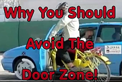
Serge Issakov, a boardmember with the San Diego Bicycling Club, said many bicyclists feel safe riding next to parked cars in what is known as the “door zone,” but added, “But that’s dangerous not only because someone might suddenly open a door causing you to crash into it, or, worse, toss you in front of traffic, but a bicyclist riding next to parked cars is also obscured to crossing traffic and is particularly vulnerable to oncoming traffic turning left in front of him, perhaps into a mid-block driveway, or someone pulling out of such a driveway who ‘noses’ out into the door zone right in the cyclist’s path. Most bicyclists don’t think about those risks, until it’s too late.”
Jim Baross, president of the California Association of Bicycling Organizations and a bicycling instructor for the League of American Bicyclists and the American Bicycling Education Association, added, “Always beware of parked cars with people in them, either as seen through the windows or by evidence of recent movement, backup lights, or just parked in a high-turnover location [short parking times]. Leave a door’s width clearance from parked cars if at all possible.”
Morley Field Drive is a safer, more scenic alternative to University Avenue.
Alternate Route
Back to our couple. They should try Sixth Avenue to Robinson Street (heading east), then head south on Richmond Street followed by a left onto Upas Street. Turn right onto Park Boulevard, and then make a quick left onto Morley Field Drive and chug it back up the hill to Upas. Then make a left onto Mississippi Street and then a quick right onto Myrtle Avenue all the way to 29th and then head back north to University. After they get off Morley Field Drive, there are no recorded collisions for the remaining portion of this route (Myrtle through 29th) from 2007 to 2012. Their ride will be close to double the time, but much safer and scenic.
Pershing Drive between Redwood Street and the Interstate 5 on-ramps
“Going down Pershing into downtown where the freeway ramps for the 5 are on the right side and you have
to cross your heart and haul ass before a car nails you.”
Our fickle couple has once again moved. They have fallen in love with the cheeseburgers at Mexico Lindo restaurant and now rent a granny flat one block away from Morley Field on Louisiana Street just to be closer to it. Both are considering furthering their education at City College, and decide to ride their bikes downtown and check out the campus. Then they read these comments on Facebook:
“Going down Pershing into downtown where the freeway ramps for the 5 are on the right side and you have to cross your heart and haul ass before a car nails you.”
“Pershing headed into town where you have to cross the 5 North entrance ramp (bad enough) and immediately after that, the 5 South entrance ramp (worse, as it is around a semi blind corner). It is still signed indicating that cyclists should dismount and cross on foot. That’s not right...that sign should be removed and both ramps should be green-laned to warn drivers that bikes are crossing the ramp.”
“I lived near there for a couple of years recently and it always blew my mind seeing people riding down Pershing with no helmet. It was like one-third of them.”
Perhaps the best advice for descending the Pershing hill as you head toward downtown is to make sure your brakes are reliable. The street is all downhill from Upas on, and you can get going at a fine clip in no time. Automobiles fly by as well. This is not a good spot for a cyclist unaccustomed to fast-moving traffic. Surprisingly, though, the scariest portion of this route (the merging of the 5 on-ramps with Pershing) accounted for no reported collisions between 2007 and 2012. Three collisions were recorded at the intersection of Pershing and Florida Drives. The aforementioned “semi-blind corner” refers to an on-ramp on the right-hand side for I-5 south, which is just past the on-ramp for I-5 north. Another tricky element is that motorists may be temporarily blinded if they skip the on-ramps and proceed under the bridge heading downtown. It is dark during daylight hours, and drivers’ eyes need a second to adjust when entering and emerging. A cyclist or a pedestrian can go undetected underneath this overpass pretty easily. Add to that the fact that the final merge onto B Street isn’t always a ride in the park either. It’s pretty obvious why this isn’t the most popular cycling location in San Diego.
Baross notes some intersections and roadways that are known to be scary to ride on may have zero or few crashes because few people will ride there. “An instance of this could be Fairmount Avenue between Aldine and I-8,” he said. “The intersections along Fairmount with Montezuma and under I-8 are designed for fast-as-possible motor-vehicle throughput. On-ramps and off-ramps that can be driven at high speed make bicycling (never mind trying to walk) there difficult.”
The stretch of Park Boulevard running through Balboa Park had only five collisions reported from 2007 to 2012.
Alternate Route
Our couple’s considered taking Florida Street, but they checked out the data and saw that Florida had even more occurrences of collisions on their route than Pershing did. So they decided to suck it up and take Upas to Morley Field Drive, all the way back up the hill to Park Boulevard. Park has only five collisions reported from 2007 to 2012 between Morley Field Drive and the northern edge of City College at Russ Boulevard. Four of the incidents were south of I-5, while the other lone incident was at the intersection of Morley Field Drive. On paper, Park is a surprisingly safe route, especially next to the zoo and Balboa Park.
Genesee Avenue heading south at the State Route 52 on-ramps
If you’re going to be one of the brave souls who choose to ride along Genesee Avenue, please stay on the right side of the roadway!
Our upwardly mobile young couple is once again on the move. They have landed better jobs after getting degrees at City College and have purchased a house in UTC just east of Genesee on Governor Drive. There is a special weeklong engagement of Transformers: Revenge of the Fallen at the Reading Cinemas on Clairemont Drive, and these two are determined to ride down and catch a matinee screening.
One must tip one’s hat to the brave souls who choose to ride along Genesee between UTC and Clairemont frequently. The long descent from Governor Drive to the intersection with the State Route 52 west on-ramp must be particularly harrowing. A bike lane hugs the shoulder of the hill until the first entrance for the 52 west appears (with no stop sign or traffic light) followed shortly thereafter by a second entrance for 52 west (for traffic making a left from the northbound lanes — once again, no stop sign or traffic light) followed shortly by the clover-leaf off-ramp from 52 west feeding back onto Genesee Avenue south (once again, no stop sign or traffic light). During a busy rush hour, cyclists must cross these three junctions with no help besides their best judgment. Sounds like a bloodbath in the making, but between the years of 2007 and 2012, there were only two collisions recorded at the intersection of 52 and Genesee. Still, the whole route from Governor to Clairemont Mesa has ten reported collisions in that time.
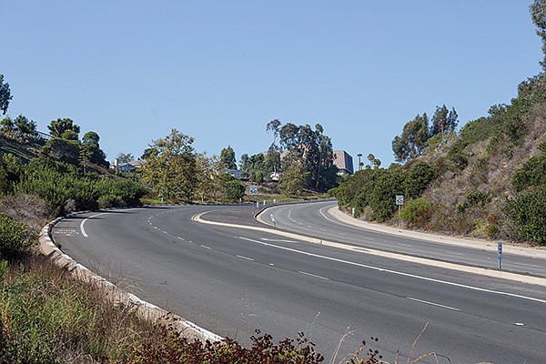
Regents is a lower-volume alternative to Genesee.
Alternate Route
Our couple is terrified of cycling down Genesee south. Instead they will take Governor west to Regents Road and take Regents south to Clairemont Mesa Boulevard. They will then make a left onto Pocahontas Avenue, followed by a right onto Lakehurst Drive, which spits them out at the strip mall with the theater. There were only four collisions on this entire route between 2007 and 2012. Care is still required on this route, as Regents has its own issues with freeway ramps. But it’s a lower-volume thoroughfare than Genesee.
The casual cyclist
One last thought regarding casual cyclists, courtesy of Baross: “Interesting term ‘casual cyclists.’ I’m reminded that we used to call slow, timid drivers ‘Sunday drivers.’ Use of a bicycle on public roads is available to everyone, a basic right of travel. But, just as with driving a motor vehicle, there are laws, skills, and best practices that can make bicycling safer and a more effective travel mode. Entering some of San Diego’s urban traffic situations should not be done casually. Yes, it is a good idea to avoid traffic situations that you are unprepared to handle. The San Diego Regional Bike Map helps some by highlighting the location of bikeways and suggested routes.”
(Dis)Honorable mentions
Pacific Highway at Barnett Avenue: “A white-knuckled drift-over if I’ve ever seen one,” is how one Facebook user described it. A notorious, well-despised spot among many cyclists which somehow had zero reported collisions between 2007 and 2012.
Texas Street at Interstate 8 on-ramps: See Pershing Drive between Redwood Street and I-5 on-ramps. Steep hill descent followed be freeway on-ramps, all in heavy traffic.
Broadway downtown between Harbor Drive and Park Boulevard: 11 collisions reported between 2007 and 2012. Lots of cars and buses, lots of bikes, lots of pedestrians, lots of intersections, tight spacing, plenty of opportunities for collisions. One bright spot is that some stretches of Broadway have no street parking.
Entering Morena Boulevard from Taylor Street: A tricky section of a ride that can connect Old Town to northern destinations along Interstate 5. Interesting side-note: even though three collisions were reported at the intersection of Taylor and Morena between 2007 and 2012, the long stretch of Morena between Asher Street and Garnet Avenue only had two reported collisions in the same time period. Judging by collision stats, Morena Boulevard is a safe route.
Washington Street heading west at 163 on-ramp: Two lanes of traffic exiting from Washington onto the 163 north and south here. This juncture gets very busy, and riders have to figure out how to cross over two lanes of cars trying to get on the 163, while they are attempting to continue toward Hillcrest on Washington. Seems almost miraculous that only one collision was reported here between 2007 and 2012. People may be avoiding this route.
Safety First
Bicycling instructor Jim Baross recommended these five tips that can be found in Lemon Grove resident John Forester’s book Effective Cycling.
- Ride on the right side of the roadway, never on the left and never on the sidewalk.
- When you reach a more important or larger road than the one you are on, yield to crossing traffic. Here, yielding means looking to each side and waiting until it’s your turn or no traffic is coming.
- When you intend to change lanes or to move laterally on the roadway, yield to traffic in the new lane or line of travel. Here, yielding means looking forward and backward until you see that no traffic is coming.
- When approaching an intersection, position yourself with respect to your destination direction—on the right nearer the curb if you want to turn right, on the left near the centerline if you want to turn left, and between those positions if you want to go straight.
- Between intersections, position yourself according to your speed relative to other traffic; slower traffic is nearer the curb and faster traffic is nearer the centerline.
Here's something you might be interested in.
Dangerous bike spots: Friars Road, Nimitz Blvd, University Ave., Pershing Dr., Genesee, Pacific Hwy at Barnett Ave.
Safer routes: SD River Trail, West Point Loma, Robinson, Governor
Dangerous bike spots: Friars Road, Nimitz Blvd, University Ave., Pershing Dr., Genesee, Pacific Hwy at Barnett Ave.
Safer routes: SD River Trail, West Point Loma, Robinson, Governor
Regents Road bike lane
Bicyclists who ride the streets of San Diego daily are used to the constant hazards a bike ride can present. Texting motorists, freeway on-ramps, cracked pavement — veteran cyclists have grown accustomed to these challenges. But imagine a young couple who are looking for safe passage from one neighborhood to another. They are not daily commuters looking for the speediest route; they want a nice, terror-free ride on a Sunday afternoon.
With this couple in mind, we have identified five spots that have been deemed particularly nerve-racking, tricky, or dangerous. We will present alternative routes so the riders can reach their preferred destinations minus the fear many of these spots can induce. In most scenarios the alterantive rides will be longer, but remember, these are the bicycling equivalent of “Sunday drivers.” Even though they are trying to get from Point A to Point B, the main idea is to have a pleasant ride — and to get there alive.
These locations were submitted as responses to the Reader’s July 14 Facebook “Question of the Day,” which asked, “What do you think is the most dangerous bicycling spot within San Diego city limits?” And you, the noble cyclists of San Diego, responded in force. We thank you for your input there and have used some of your responses.
The collision data we have included was sourced from the Transportation Injury Mapping System (“TIMS”). It’s from a five-year query on “bicycle collisions” from January 1, 2007, to January 1, 2012. The map generated and utilized to pinpoint collision locations for this story accounts for 85.5 percent of all incidents. The data for 2013 and 2014 was still incomplete as of this story’s publication.
Friars Road from Morena Blvd. to Qualcomm Way
Why does Friars Road even have a bike lane?
Imagine our lovely young couple rents an apartment off of Friars Road just west of Fashion Valley. They want to take a ride on their new bikes down to the Bed Bath and Beyond in Mission Valley to check out some curtains they can’t live without. According to our Facebook correspondents, here’s what they may be up against:
“Nearly all of Friars Road is a fully designated and recommended bike route on the official bike map,” complains one respondent. “Gotta love the freeway-style on-ramps, riding between merging lanes with cars doing 50 mph or more on both sides of you! Never again!”
“Agree with the folks who say Friars from 163 past the 15. Holy smokes. Why does that even have a bike lane? Never again.”
“Friars Road/Ulric St. Try to take a left to get on Ulric St. Friars Rd. in general. Speed limit is 45 and 55. Not cool riding there with cars flying by.”
If you are riding on Friars Road heading near Fashion Valley, you may be improperly lulled into thinking the designated bike lanes make it a safe option for cyclists. Just wait until you reach Ulric Street and the insane traffic that can build on the bridge that crosses over State Route 163. Add to that mix the freeway on-ramps and you have one heck of an opportunity to sharpen your skills at weaving in between multiple lanes of fast moving traffic, whether you want to or not. Between 2007 and 2012, there were 15 collisions listed on this stretch of Friars Road. Not the best route for timid or inexperienced cyclists.
The San Diego River Trail
Alternate Route
Instead of beelining it to Mission Center Road on Friars (a straight shot on the map) a better option for our young couple is to take Friars to Fashion Valley Road and then hop on the San Diego River Trail heading east.
The San Diego River Trail now connects all the way from Ocean Beach to I-805 without interruption. It is a great option for navigating Mission Valley on a bike.
Nimitz Boulevard-Sunset Cliffs-West end of Interstate 8
“The Sunset Cliffs, Nimitz, end of 8 freeway cluster is pretty bad. Going Southbound is okay but going Northbound is incredibly dangerous.”
Our couple was determined to be closer to the beach, so they rented an apartment just to the east of Nimitz on West Point Loma Boulevard. They are trying to make it over to South Mission Beach to toss around a Frisbee and tear up some waves on their boogie-boards. Here’s what they may face:
“The Sunset Cliffs, Nimitz, end of 8 freeway cluster is pretty bad. Going Southbound is okay but going Northbound is incredibly dangerous. The cycling lane ends...and everybody is trying to get onto the 8, and it’s impossible for a cyclist to actually change lanes to continue straight to cross the bridge over the river. Almost saw a cyclist get hit from behind there the other day actually because someone pulled out to change a lane (and didn’t signal of course) and the BMW behind him got upset, pulled to the right of the vehicle (onto the shoulder of the road) and passed from the right, nearly hitting the cyclist.” — Facebook user, 7/14/15
This spot was also mentioned by Hannah Williams from the San Diego Bike Coalition as a particularly tricky juncture. Nimitz and Sunset Cliffs are both major thoroughfares, while vehicles traveling north out of Ocean Beach and onto I-8 are bound to be moving at a rapid clip. It can be an overwhelming area for any cyclist, but, similar to many spots like this, it has seen very few collisions over the five-year period from 2007 to 2012. Only two were recorded during the timespan — one in 2009 and one in 2010.
The San Diego River Pathway near Robb Field
Alternate Route
Instead of riding through the trickier passage mentioned here, our beachy couple should take West Point Loma toward Ocean Beach and take a right on Bacon Street, which will take them into Robb Field. At the north end of the park, they will be able to pick up the San Diego River Pathway and head inland. After 100 yards, signs to Mission Beach will direct them onto the Sunset Cliffs bridge over the river, on which they will ride in a lane separated from traffic by concrete barriers. On the north side, they can veer off onto lightly traveled Quivira Way, which will bring them to West Mission Bay Boulevard. A tricky but short ride over the bridge and a left at Gleason and they can pick up the bike path south to the jetty and to South Mission Beach.
University Avenue — a busy portion of the city.
University Avenue from Hillcrest to North Park
This is a busy portion of the city, so our young couple — who grew out of the beach phase and into their Uptown phase — may be a bit out of luck in finding a completely stress-free route from their new apartment in the heart of Hillcrest to lunch with friends at Junz Teriyaki & BBQ on University and 30th.
Between 2007 and 2012, there were a whopping 67 collisions recorded in this passage; 13 were on the short stretch between Park Boulevard and Mississippi Street, with the largest number, 6, occurring at Alabama Street. This portion of University is a popular route for both cyclists and drivers because it connects Hillcrest all the way to City Heights. It is a direct route but a gamble on a bike. A number of major intersections (Sixth, Park, Texas, 30th) have to be navigated, and the squeeze between bikes and automobiles —parked and moving — can turn from annoying to injurious in a moment.
Video:
Mike Tyson whooping up on Sammy Scaff
Even the most feeble Toyota Yaris or Car2Go is sure to kick your butt in a collision. Heck, even a librarian on a moped is bound to knock you around like Mike Tyson. And that’s not even mentioning all the random doors flying open from the cars parallel-parked along the way.
Video:
Getting tossed in front of traffic
Serge Issakov, a boardmember with the San Diego Bicycling Club, said many bicyclists feel safe riding next to parked cars in what is known as the “door zone,” but added, “But that’s dangerous not only because someone might suddenly open a door causing you to crash into it, or, worse, toss you in front of traffic, but a bicyclist riding next to parked cars is also obscured to crossing traffic and is particularly vulnerable to oncoming traffic turning left in front of him, perhaps into a mid-block driveway, or someone pulling out of such a driveway who ‘noses’ out into the door zone right in the cyclist’s path. Most bicyclists don’t think about those risks, until it’s too late.”
Jim Baross, president of the California Association of Bicycling Organizations and a bicycling instructor for the League of American Bicyclists and the American Bicycling Education Association, added, “Always beware of parked cars with people in them, either as seen through the windows or by evidence of recent movement, backup lights, or just parked in a high-turnover location [short parking times]. Leave a door’s width clearance from parked cars if at all possible.”
Morley Field Drive is a safer, more scenic alternative to University Avenue.
Alternate Route
Back to our couple. They should try Sixth Avenue to Robinson Street (heading east), then head south on Richmond Street followed by a left onto Upas Street. Turn right onto Park Boulevard, and then make a quick left onto Morley Field Drive and chug it back up the hill to Upas. Then make a left onto Mississippi Street and then a quick right onto Myrtle Avenue all the way to 29th and then head back north to University. After they get off Morley Field Drive, there are no recorded collisions for the remaining portion of this route (Myrtle through 29th) from 2007 to 2012. Their ride will be close to double the time, but much safer and scenic.
Pershing Drive between Redwood Street and the Interstate 5 on-ramps
“Going down Pershing into downtown where the freeway ramps for the 5 are on the right side and you have
to cross your heart and haul ass before a car nails you.”
Our fickle couple has once again moved. They have fallen in love with the cheeseburgers at Mexico Lindo restaurant and now rent a granny flat one block away from Morley Field on Louisiana Street just to be closer to it. Both are considering furthering their education at City College, and decide to ride their bikes downtown and check out the campus. Then they read these comments on Facebook:
“Going down Pershing into downtown where the freeway ramps for the 5 are on the right side and you have to cross your heart and haul ass before a car nails you.”
“Pershing headed into town where you have to cross the 5 North entrance ramp (bad enough) and immediately after that, the 5 South entrance ramp (worse, as it is around a semi blind corner). It is still signed indicating that cyclists should dismount and cross on foot. That’s not right...that sign should be removed and both ramps should be green-laned to warn drivers that bikes are crossing the ramp.”
“I lived near there for a couple of years recently and it always blew my mind seeing people riding down Pershing with no helmet. It was like one-third of them.”
Perhaps the best advice for descending the Pershing hill as you head toward downtown is to make sure your brakes are reliable. The street is all downhill from Upas on, and you can get going at a fine clip in no time. Automobiles fly by as well. This is not a good spot for a cyclist unaccustomed to fast-moving traffic. Surprisingly, though, the scariest portion of this route (the merging of the 5 on-ramps with Pershing) accounted for no reported collisions between 2007 and 2012. Three collisions were recorded at the intersection of Pershing and Florida Drives. The aforementioned “semi-blind corner” refers to an on-ramp on the right-hand side for I-5 south, which is just past the on-ramp for I-5 north. Another tricky element is that motorists may be temporarily blinded if they skip the on-ramps and proceed under the bridge heading downtown. It is dark during daylight hours, and drivers’ eyes need a second to adjust when entering and emerging. A cyclist or a pedestrian can go undetected underneath this overpass pretty easily. Add to that the fact that the final merge onto B Street isn’t always a ride in the park either. It’s pretty obvious why this isn’t the most popular cycling location in San Diego.
Baross notes some intersections and roadways that are known to be scary to ride on may have zero or few crashes because few people will ride there. “An instance of this could be Fairmount Avenue between Aldine and I-8,” he said. “The intersections along Fairmount with Montezuma and under I-8 are designed for fast-as-possible motor-vehicle throughput. On-ramps and off-ramps that can be driven at high speed make bicycling (never mind trying to walk) there difficult.”
The stretch of Park Boulevard running through Balboa Park had only five collisions reported from 2007 to 2012.
Alternate Route
Our couple’s considered taking Florida Street, but they checked out the data and saw that Florida had even more occurrences of collisions on their route than Pershing did. So they decided to suck it up and take Upas to Morley Field Drive, all the way back up the hill to Park Boulevard. Park has only five collisions reported from 2007 to 2012 between Morley Field Drive and the northern edge of City College at Russ Boulevard. Four of the incidents were south of I-5, while the other lone incident was at the intersection of Morley Field Drive. On paper, Park is a surprisingly safe route, especially next to the zoo and Balboa Park.
Genesee Avenue heading south at the State Route 52 on-ramps
If you’re going to be one of the brave souls who choose to ride along Genesee Avenue, please stay on the right side of the roadway!
Our upwardly mobile young couple is once again on the move. They have landed better jobs after getting degrees at City College and have purchased a house in UTC just east of Genesee on Governor Drive. There is a special weeklong engagement of Transformers: Revenge of the Fallen at the Reading Cinemas on Clairemont Drive, and these two are determined to ride down and catch a matinee screening.
One must tip one’s hat to the brave souls who choose to ride along Genesee between UTC and Clairemont frequently. The long descent from Governor Drive to the intersection with the State Route 52 west on-ramp must be particularly harrowing. A bike lane hugs the shoulder of the hill until the first entrance for the 52 west appears (with no stop sign or traffic light) followed shortly thereafter by a second entrance for 52 west (for traffic making a left from the northbound lanes — once again, no stop sign or traffic light) followed shortly by the clover-leaf off-ramp from 52 west feeding back onto Genesee Avenue south (once again, no stop sign or traffic light). During a busy rush hour, cyclists must cross these three junctions with no help besides their best judgment. Sounds like a bloodbath in the making, but between the years of 2007 and 2012, there were only two collisions recorded at the intersection of 52 and Genesee. Still, the whole route from Governor to Clairemont Mesa has ten reported collisions in that time.
Regents is a lower-volume alternative to Genesee.
Alternate Route
Our couple is terrified of cycling down Genesee south. Instead they will take Governor west to Regents Road and take Regents south to Clairemont Mesa Boulevard. They will then make a left onto Pocahontas Avenue, followed by a right onto Lakehurst Drive, which spits them out at the strip mall with the theater. There were only four collisions on this entire route between 2007 and 2012. Care is still required on this route, as Regents has its own issues with freeway ramps. But it’s a lower-volume thoroughfare than Genesee.
The casual cyclist
One last thought regarding casual cyclists, courtesy of Baross: “Interesting term ‘casual cyclists.’ I’m reminded that we used to call slow, timid drivers ‘Sunday drivers.’ Use of a bicycle on public roads is available to everyone, a basic right of travel. But, just as with driving a motor vehicle, there are laws, skills, and best practices that can make bicycling safer and a more effective travel mode. Entering some of San Diego’s urban traffic situations should not be done casually. Yes, it is a good idea to avoid traffic situations that you are unprepared to handle. The San Diego Regional Bike Map helps some by highlighting the location of bikeways and suggested routes.”
(Dis)Honorable mentions
Pacific Highway at Barnett Avenue: “A white-knuckled drift-over if I’ve ever seen one,” is how one Facebook user described it. A notorious, well-despised spot among many cyclists which somehow had zero reported collisions between 2007 and 2012.
Texas Street at Interstate 8 on-ramps: See Pershing Drive between Redwood Street and I-5 on-ramps. Steep hill descent followed be freeway on-ramps, all in heavy traffic.
Broadway downtown between Harbor Drive and Park Boulevard: 11 collisions reported between 2007 and 2012. Lots of cars and buses, lots of bikes, lots of pedestrians, lots of intersections, tight spacing, plenty of opportunities for collisions. One bright spot is that some stretches of Broadway have no street parking.
Entering Morena Boulevard from Taylor Street: A tricky section of a ride that can connect Old Town to northern destinations along Interstate 5. Interesting side-note: even though three collisions were reported at the intersection of Taylor and Morena between 2007 and 2012, the long stretch of Morena between Asher Street and Garnet Avenue only had two reported collisions in the same time period. Judging by collision stats, Morena Boulevard is a safe route.
Washington Street heading west at 163 on-ramp: Two lanes of traffic exiting from Washington onto the 163 north and south here. This juncture gets very busy, and riders have to figure out how to cross over two lanes of cars trying to get on the 163, while they are attempting to continue toward Hillcrest on Washington. Seems almost miraculous that only one collision was reported here between 2007 and 2012. People may be avoiding this route.
Safety First
Bicycling instructor Jim Baross recommended these five tips that can be found in Lemon Grove resident John Forester’s book Effective Cycling.
- Ride on the right side of the roadway, never on the left and never on the sidewalk.
- When you reach a more important or larger road than the one you are on, yield to crossing traffic. Here, yielding means looking to each side and waiting until it’s your turn or no traffic is coming.
- When you intend to change lanes or to move laterally on the roadway, yield to traffic in the new lane or line of travel. Here, yielding means looking forward and backward until you see that no traffic is coming.
- When approaching an intersection, position yourself with respect to your destination direction—on the right nearer the curb if you want to turn right, on the left near the centerline if you want to turn left, and between those positions if you want to go straight.
- Between intersections, position yourself according to your speed relative to other traffic; slower traffic is nearer the curb and faster traffic is nearer the centerline.