Here's something you might be interested in.
Ask a Hipster — Advice you didn't know you needed
Big Screen — Movie commentary
Blurt — Music's inside track
Booze News — San Diego spirits
Classical Music — Immortal beauty
Classifieds — Free and easy
Cover Stories — Front-page features
Drinks All Around — Bartenders' drink recipes
Excerpts — Literary and spiritual excerpts
Feast! — Food & drink reviews
Feature Stories — Local news & stories
Fishing Report — What’s getting hooked from ship and shore
From the Archives — Spotlight on the past
Golden Dreams — Talk of the town
The Gonzo Report — Making the musical scene, or at least reporting from it
Letters — Our inbox
Movies@Home — Local movie buffs share favorites
Movie Reviews — Our critics' picks and pans
Musician Interviews — Up close with local artists
Neighborhood News from Stringers — Hyperlocal news
News Ticker — News & politics
Obermeyer — San Diego politics illustrated
Outdoors — Weekly changes in flora and fauna
Overheard in San Diego — Eavesdropping illustrated
Poetry — The old and the new
Reader Travel — Travel section built by travelers
Reading — The hunt for intellectuals
Roam-O-Rama — SoCal's best hiking/biking trails
San Diego Beer — Inside San Diego suds
SD on the QT — Almost factual news
Sheep and Goats — Places of worship
Special Issues — The best of
Street Style — San Diego streets have style
Surf Diego — Real stories from those braving the waves
Theater — On stage in San Diego this week
Tin Fork — Silver spoon alternative
Under the Radar — Matt Potter's undercover work
Unforgettable — Long-ago San Diego
Unreal Estate — San Diego's priciest pads
Your Week — Daily event picks
How Do You Like Our Moonscape?
San Felipe Valley awaits the deluge
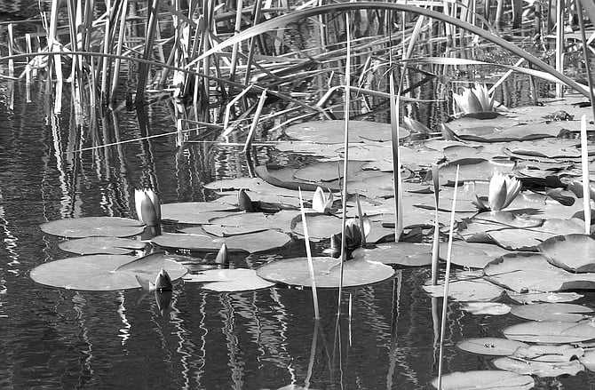
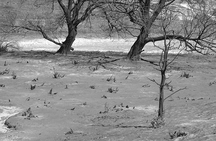
The Keenans’ pond. Helicopters flew back and forth, dipping 500-gallon buckets into it at two-minute intervals.
As we drove through the San Felipe Valley, Ann and Tom Keenan pointed out a lone house ringed with greenery on the blackened hillside. A small circle, saved. It's one of several hundred homes that the Pines fire didn't touch. "The firefighters told me that if they have enough time they can save every structure," said Ann. "That's assuming people don't have trash all around their property. But some people keep tons of trash and they haven't cleared their brush, so those places are really hard to defend."
Tom and Ann Keenan own 700 acres and a one-room stone cabin off San Felipe Road.
The Keenans, who own 700 acres and a one-room stone cabin off San Felipe Road, have acquired new terminology since the second-worst fire in county history burned more than 61,000 acres, including theirs. "Defensible" is one of those terms. "Indefensible" is another, which Ann used as we passed a burned-down building in Ranchita. (Whether it had been a home or another kind of structure was impossible to tell.) Three charred cars were parked alongside it.
The techniques of the firefighters, who used bulldozers to create miles of firebreaks disrupted the landscape, and the current fear is a Biblical reverse: not fire next time but floods.
Water from the Keenans' property helped save scores of defensible houses during the fire. The firefighters used the Keenans' pond to fight the flames. Helicopters flew back and forth, dipping 500-gallon buckets into it at two-minute intervals. Ann was told by "a guy named John," a navigator out of El Cajon's Gillespie Field, that he and his small crew alone took 200,000 gallons from the pond during the fire and have been back many times since, using the water to douse hot spots. At ten feet deep, the pond usually contains two million gallons, Tom estimates. The depth had dropped to six feet by the time officials finally declared the fire to be contained. That was on August 13, two weeks and two days after a helicopter on another sort of mission had started the blaze in the first place.
Old Indian cemetery near the Keenans’ cabin. "A firefighter named Grand was glad to pay a visit to his relatives while he was here."
My visit was on the last day of September; by then, the area no longer looked disastrous. Tom noted that obliterated highway signs, like one for Teofulio Summit, had been replaced. Ann sounded apologetic when she said, "Since some leaves have fallen, it doesn't look that bad. The hills are less black." But the crisis continues. The techniques of the firefighters, who used bulldozers to create miles of firebreaks 100 to 500 feet wide, disrupted the landscape, and the current fear is a Biblical reverse: not fire next time but floods.
"All the mystery of the property is gone. It used to be that you really didn't know how the separate pieces hooked up. Now it's just wide open."
"This is one of the main watersheds in the county," said Ann. "The San Felipe Creek runs through it. And when the rain falls, the water's going to come pouring down from the hills and wreak havoc. When the wind blows, the dirt just swirls, because there's nothing to hold it down. You can just imagine the Dust Bowl."
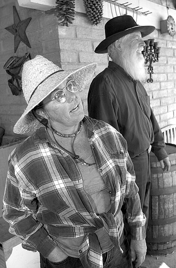
Sally Snipes and Clint Powell. "When we were evacuated, the only things I took were my computer and my piles of weather records."
We reached the ranch's gate at 10:00 in the morning. It was the same hour at which they had arrived seven weeks earlier, as the fire moved toward their property. Their main residence is in La Mesa, and they had heard on the radio that San Felipe Road was about to be closed. "Tom and I called the sheriff," said Ann, "and asked if we could come out. He said we could have one hour. When we got here, we saw 30 bulldozers and hundreds of firefighters. They were trying to keep the fire away from the sheriff's substation next door, where there's a big fuel tank. The fire was slow-moving, but you could see it coming."
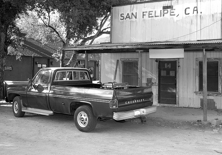
Closed San Felipe general store
They used the hour to bring their RV and tractor to a firebreak zone.
As we drove in, I saw that the substation looked pristine, like the saved house on the hillside. "There was not a bit of damage done to the sheriff's place," said Ann. "Look! Every blade of grass is green. It's like nothing ever happened."
You could say the same about the Keenans' cabin, but not for the rest of the property.
I had been here before, last December, on a birding expedition with the Keenans, who were volunteers for the recently completed San Diego County Bird Atlas Project. Nearly everything looked different on this second visit. Where before the place had resembled an image of old California, with narrow paths leading into groves of ancient trees, blackberries, persimmons, pomegranates, and wild grapes, now huge areas were cleared, as if for a giant parking lot or a development. "We think it looks like Otay Lakes," said Tom, referring to development going on there. "I thanked one of the fire crew for putting in the new roads. He told me, 'Hell, we put in a freeway.' "
Ann said, "All the mystery of the property is gone. It used to be that you really didn't know how the separate pieces hooked up. Now it's just wide open."
We parked beside the cabin, and the Keenans got out. But they wanted me to wait a moment. "We'll have a little walk-around for rattlesnakes," said Ann. "We've seen two big, fat ones since the fire."
"It's interesting about the snakes," said Tom. "The firefighters told us there were a lot of them, even in their camps. They saw them on the road, too. It was unusual, especially since the pavement was so hot."
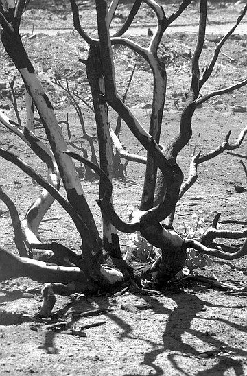
No rattlers were in evidence, so we walked up the hill toward the pond, following a bulldozer's trail. The road was soft; spots off the trail were even softer. They felt like talcum powder. In some areas there were ten-foot pools of gray-white ash, where giant oaks once stood. Tom said, "People talk about oaks being tough, but I think sycamores are tougher." Some oaks were two-toned: only half-burned. The Keenans had trouble naming another tree that was in the same condition. Lemonadeberry? Laurel sumac? "It's hard to identify trees without their leaves," said Ann, displeased with herself. "In a way, it's like having a brand-new piece of property."
On the ridge above us, the bulldozers' trails looked like ski runs. The driver must have been perpendicular to the ground as he reached the top. "They coursed over the hills," said Ann. "They're cowboys, those bulldozer guys. They're told to do a job and do it."
The Keenans have learned other facts about firefighters. "There's a whole subculture," said Ann. "They come from across the country. Many are Native American. They bring their music and arts. They have big camps together. They buy and sell and trade different articles. They wear the T-shirts that are sold as souvenirs at every fire. It's like a reunion."
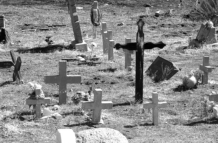
An old Indian cemetery is situated near the Keenans' cabin. Twice a year, on Memorial Day and All Souls' Day, members of the Santa Ysabel band of the Kumeyaay tribe visit their dead and decorate the graves. The cemetery isn't large, perhaps 500 square feet, and is enclosed by a wrought-iron fence. "They saved the cemetery, too," said Tom, "because it's a historical site." Recurring names on the headstones are Maxcy, Hyde, and Grand. "A firefighter named Grand was glad to pay a visit to his relatives while he was here."
The pond came into view long before we reached it; it looked like an oasis, outlined in velvety green. White blooming lily pads floated in it. Firefighters had felled the willows and cottonwoods on one side to give the helicopters room to swing in and dip their buckets.
"Usually quail are so secretive," said Ann, "it's hard to see them. But now there's no cover for them, so you see great groups of them drinking. How did they ever survive?"
As we stood at the pond's edge, we admired the scene of tranquility. But my eye was drawn to a strange sight nearby — a dozen upright plants that looked like large pineapples. "Agaves," said Tom. "When we saw the first ones, we thought they were pineapples too. 'Where did they come from?' They looked like they had been placed there by somebody." The Keenans have since learned from Philip Unitt, collection manager for the San Diego Natural History Museum, that agaves are traditionally good survivors of massive fires like this one, becoming prominent when everything else around them has burned away.
Unitt came out to the Keenans' ranch two weeks after the fire. He wanted to see how San Felipe's birds had fared. He and the Keenans identified 36 species. On the phone Unitt told me that some "small, weak-flying birds," like bushtits and wrentits, were populating burned areas. He suspects they survived the fire elsewhere, in less intensely burned areas. He noted the oak trees that were leafless but still alive, along with some big-cone Douglas firs that were burned at the base but not at the crown.
Ann, Tom, and I watched a Nashville warbler perched on a low bush. A stubby green-and-yellow migrant, on its way to Central America, it let us get within three feet. "It's probably shocked," said Ann. "It doesn't know what to do. The last time it came through, the landscape looked very different."
Starting in December, after the winter birds have arrived, Unitt wants to deploy volunteers like the Keenans to resurvey some fire areas for the Bird Atlas. But he needs funds to do the analysis correctly. He's trying to find a source as well as someone with ample experience in fire ecology to give input on the study design -- "or at least point out other studies that can be adapted as a model."
As we left the pond and headed downhill, I became aware of the sound of running water. I realized I had been hearing it all along. "All the streams are running much faster than they ever did before," said Ann. "We have more water on our property now than we ever have, because so many trees, which used to soak it up, are dead. So you can only imagine what it's going to do when it rains." Most of the surrounding land is federal property, and the government will make arrangements for flood control in those areas. In addition, the California Fish and Game Commission just bought 5000 acres. "So all these public places will get fixed. But there's nobody to help us."
"Us" includes the Keenans' neighbors — Clint Powell and Sally Snipes. "They're going to be inundated, so they're getting sand bags ready," said Ann.
New Mexican sunflowers, five feet tall, lined the roadway to the Powell-Snipes ranch house that sits low in the valley on 69 acres. It's almost certainly one of the houses that the Keenans' pond water helped save.
"How do you like our moonscape?" Snipes asked, gesturing to areas leveled by bulldozers. She had just returned from a hike. Her route: a bulldozer's trail. "It's funny what you ask for. I have tried to climb that ridge eight different times in the six years since we've lived here. I would get half or a quarter of the way up, and the brush always stopped me, until now."
Chickens clucked in the henhouse. "The SPCA took them during the fire," said Powell. "They were off their egg-laying for a few days, but they got back to it."
At our feet, two kittens tumbled. Born the day after the fire, they were named Smokey and Cinder.
But Snipes and Powell were not so carefree. "There's a massive soil movement coming our way," said Powell, a naturalist. "Ten days ago, a road crew came out to drain the road because of mud, and that was after only 15/100 of an inch of rain."
He showed me the rain notation on a page of his Sierra Club engagement calendar. He has been tracking local weather conditions since 1974, he said. "When we were evacuated, the only things I took were my computer and my piles of weather records."
Snipes is an artist as well as a gardener. Known as the "Daffodil Lady," she's the one who started planting daffodils in Julian 12 years ago, to honor her late father. She estimates there to be three to four million of them today.
She turned off a garden sprinkler. "We're trying to resuscitate," she said. "Last week, the well blew up. Actually, not the whole well — just the pump in the engine. That's probably because we've overused it since the fire."
It's ironic that, as a gardener, she hopes now not to see thunderclouds overhead.
"Sally was told by a National Guard officer not to sleep for three to ten years during heavy rains," said Powell. "I would like to have that officer's name."
And after three to ten years, what then?
"Hopefully, there will have been some revegetation," said Snipes.
But that won't happen, or at least not quickly, unless there's rain, and therefore, it's really --
"Catch-22."
Snipes went into the house and returned with a report generated by the National Resources Conservation Service, part of the United States Department of Agriculture. The report is the Burned Area Emergency Stabilization & Rehabilitation Plan -- or BAER report, for short (pronounced "Bayer," like the aspirin). "These are the [government's] suggestions for what should happen to help us," she said, handing me the report. "We're not just being fanatical females out here. You know? This is a legitimate, legal government document. Anybody who asks me what I'm talking about, I give them a copy, because it shows I'm not making this up."
I skimmed the pages. They were stocked with disconcerting terms like "mudflows" and "rolling rocks." It mentioned "floatable debris" -- "downed trees, picnic tables, machinery, and abandoned vehicles." I started to imagine those three burned vehicles in Ranchita, floating.
One recommendation was the installation of sirens -- in lieu of rainy-night vigils, I presumed. The sirens would "provide direct warning to local residents in the event of an anticipated flood event."
The report gave costs of the recommended items. The sirens were $5000 each.
The computerized "rain station" (i.e., rain gauges) to which the sirens would be attached were $3500 each. The software was separate: $5000 per system.
"The early warning system," the report went on, "will potentially save lives by providing communities downstream of burned areas with greater lead time than would otherwise be available for evacuation in the event of an extreme flood event."
The report also recommended the installation of K-rails (also known as Jersey barriers). These would channel the flood waters away from various buildings at risk. The Powell home was among those listed. Total cost for 75 K-rails: $26,250.
The advice was free; the report didn't say who was supposed to pay to implement it. Snipes hoped the government would. "I have spent the last month on the phone," she said, "with Dianne Jacob's office, Bill Horn's, Assemblyman [Dennis] Hollingsworth's. Everybody says, 'It's not my department. We don't have funds. Talk to somebody else. We're not responsible.' Everybody's doing this." She made a buck-passing motion. "I'm not supposed to sleep for the next three to ten years? That's not casual! Even in Ranchita, it won't be so bad. We're in a valley. And as far as Julian knows, the fire's over. Yes, wonderful Julian, where we lived for 30 years, is in denial. It didn't happen to them." Nor will a flood, if it comes? "No. They're uphill."
Somebody wondered aloud if it would ever rain again. Powell cited statistics. "After years of drought, there were floods in 1916," he said. "They had 36 inches of rain that winter. Things had gotten so bad before that, San Diego hired a rainmaker, Charles Mallory Hatfield. But he did such a good job that the whole town of Banner was washed out."
"Or was it just coincidence?" said Snipes. "Hatfield built towers 30 feet high, put platforms on top of those, then burned or exploded something up there. They almost tarred and feathered him. They ran him out of town, and they never did pay him. It was too much, too fast."
We drove along the Banner Grade, past more scenes of aftermath. At a bend, we stopped and looked into a gully, at a house and pool in gray ruins. On many hillsides, we saw red fire retardant on rocks. "That's going to be there for a long, long time," said Ann. At what's called the Banner store (officially, the Banner Recreation Ranch), Tom went in for a soda; when he emerged, he said, "The man lost his apple crop. Entire crop." He didn't want to speak to a reporter. We all fell mostly silent then. As the hillsides slowly got greener, Ann said, "We're out of it now."
When I got home, I read the report by the National Resources Conservation Service more carefully. It mentioned property owned by other neighbors of the Keenans. Michael and Susan Pinto own 566 acres along a tributary of the San Felipe Creek. The Keenans had taken me there, but the Pintos hadn't been home. They have another residence in Laguna Beach. The report mentioned the two structures we had seen on the Pintos' property, an elegant stone main house and a clapboard guest house. Their housekeeper, Sandy Garner, had shown us how close the fire had come to these structures and told how she had been advised by the firefighters to strip the curtains from the windows. "Because the fire gets so hot, windows burst; then the flames want the oxygen. So they suck the curtains and things out of the house. That's when the inside of the house gets going." Garner had made those emergency preparations five days before the fire arrived. At the moment, she said, yes, she had heard talk of floods, and preparations for them were apparently being made by the Pintos. "I only hear bits and pieces." She was aware that the property was a flood zone. "You can see where it all funnels down." She gestured toward crevices in the hills above the property. "This is the main wash right here." It ended in a pond by the stone house. About half the size of the Keenans' pond, it, too, had been used by the firefighters, its depth lowered by several feet. "They had never been able to find the bottom before, free-diving, and now they can," said Garner of her employers.
I called Michael Pinto in Laguna Beach to ask him about his reaction to the report. Was he hopeful that the government would pay for its recommendations? "To me, hope has nothing to do with it," he said. "You have to go ahead and protect your property, then send your bills to the appropriate people, who will or will not pay them. The National Guard is number one, which probably won't [pay]. And it would be just like the government to say, 'Oh, if you'd only waited for us, then we could have paid for it, but you've already done it, so it's too late.' But we can't wait.
"The team came in — the hydrologist, geologist, and so on — and they said, 'Here's where the flow of water is going to go. This is where it's going to hit your house.' So their recommendation was hay bales or those concrete dividers you see on freeways. But the trouble with them is, they're not very elegant, and they're difficult to work with, because they're big, heavy concrete things. A good friend of mine has been through three floods in Laguna Canyon, and I'm following his advice. Instead of using K-rails, we'll use I-beams for the water to 'glance off' and go back into its channel. We're putting in a series of those along both sides of the streambed. When I showed it to Jason, he liked it so much, he said he was going to share it with others."
"Jason" is Jason Jackson, district conservationist for the Natural Resources Conservation Service. It's his name that's on the report. I called Jackson at his office in Escondido. "The federal people take care of their land," he said. "But federal land doesn't have anything to do with my agency, even though it's federal too. We work only with private land and private land owners, providing natural-resource services. A lot of people from farming communities know us as a soil-conservation service. We're the ones that do all the wind breaks in the Midwest and the fancy strip cropping that you see pictures of, with all the different strips, going with the contour of the land. We've been around since 1935 doing this type of work."
Jackson emphasized that most of what his agency does is give technical support. It comes in the form of suggestions, like those in the report, tailored to each particular property. "The Powells need some Cat work," said Jackson. That's "Cat" as in Caterpillar -- yes, bulldozers once again. "This would remove materials that have accumulated over the years. They could push the materials up on the bank."
I noted that the report states the cost of bulldozer crews to be thousands of dollars a day.
"A lot of the time, cost is one thing; permits is another," said Jackson ominously.
As he explained it, the Powells would need permits for the work that the report recommends.
Who issues the permits? "Different agencies, and that's a bureaucratic nightmare. Permits from Fish and Game, Corps of Engineers, the county -- although the county can exempt itself."
I asked next about the Pinto property. "I've been out there several times. Mr. Pinto is going do things on his own. He is installing things that are a little more progressive."
He doesn't need permits? "No, because he's staying outside the stream channel. Anytime you get into the stream channel, then you're getting into lots of agencies. And even though it's an emergency, you still need to go through them and get permits -- or waivers."
And if you can't afford to do the work yourself? "There is a program from our agency, if you have a local sponsor. The sponsor provides a 25 percent match [in funding] and also has other duties, like getting the permits."
Who is a potential sponsor? "The sponsor could be any special district. It could be a community services district, if there is one. In this case, there isn't. Basically, for that area, you're probably looking at the county to be the sponsor."
I told Jackson I called the same county supervisors that Snipes has called and gotten no further than she has. Bill Horn's website named policy advisor Trudy Thomas as the contact for the Pines fire. But Thomas would not be quoted for publication about Jackson's report. Dianne Jacob's office said only Jacob herself could be quoted on the subject, but she was not available to speak about it.
I asked Jackson what he thought the chances were that a sponsor would come forward. "Probably remote, but I'm not sure. We've had disasters before and nobody has come forward, so..." He didn't complete the sentence. "We've been to most of the properties and made our suggestions. That's all I can do.
"But, you know, those lands burn every so often. In this case, the fire was accidentally started, but it would have burned eventually. This type of habitat burns on a cyclical basis. It's nature's way of replenishing itself. It's that fire-flood cycle that just happens. It's only when we build homes next to the drainages that we start running into problems."
Not exactly. Fires are fewer and larger these days than in the past, according to the United States Forest Service. The number of acres burned per fire has also increased. It's due to human activity of various sorts.
Nor did nature intend to add bulldozers to the fire-flood mix. Tom Keenan showed me the difference between ground that has been burned and rained upon again and again over the years -- it has a hard crust -- and ground that bulldozers have turned to dust.
Finally, as Ann Keenan said, nobody really can predict where the stream channels will go next. They may find entirely new routes downhill, and they won't bother seeking permits.
The Pines fire is fraught with ironies, starting with the fire's cause. But the final irony would come if what the firefighters saved -- like that lone house I saw on the hillside -- floods then carried away.
A week or so after my visit, I called Snipes to ask if they'd had any rain out there yet. "We've had a little tiny bit of...moisture, I'd call it. But otherwise, mostly only low clouds."
Here's something you might be interested in.
How Do You Like Our Moonscape?
San Felipe Valley awaits the deluge
How Do You Like Our Moonscape?
San Felipe Valley awaits the deluge
The Keenans’ pond. Helicopters flew back and forth, dipping 500-gallon buckets into it at two-minute intervals.
As we drove through the San Felipe Valley, Ann and Tom Keenan pointed out a lone house ringed with greenery on the blackened hillside. A small circle, saved. It's one of several hundred homes that the Pines fire didn't touch. "The firefighters told me that if they have enough time they can save every structure," said Ann. "That's assuming people don't have trash all around their property. But some people keep tons of trash and they haven't cleared their brush, so those places are really hard to defend."
Tom and Ann Keenan own 700 acres and a one-room stone cabin off San Felipe Road.
The Keenans, who own 700 acres and a one-room stone cabin off San Felipe Road, have acquired new terminology since the second-worst fire in county history burned more than 61,000 acres, including theirs. "Defensible" is one of those terms. "Indefensible" is another, which Ann used as we passed a burned-down building in Ranchita. (Whether it had been a home or another kind of structure was impossible to tell.) Three charred cars were parked alongside it.
The techniques of the firefighters, who used bulldozers to create miles of firebreaks disrupted the landscape, and the current fear is a Biblical reverse: not fire next time but floods.
Water from the Keenans' property helped save scores of defensible houses during the fire. The firefighters used the Keenans' pond to fight the flames. Helicopters flew back and forth, dipping 500-gallon buckets into it at two-minute intervals. Ann was told by "a guy named John," a navigator out of El Cajon's Gillespie Field, that he and his small crew alone took 200,000 gallons from the pond during the fire and have been back many times since, using the water to douse hot spots. At ten feet deep, the pond usually contains two million gallons, Tom estimates. The depth had dropped to six feet by the time officials finally declared the fire to be contained. That was on August 13, two weeks and two days after a helicopter on another sort of mission had started the blaze in the first place.
Old Indian cemetery near the Keenans’ cabin. "A firefighter named Grand was glad to pay a visit to his relatives while he was here."
My visit was on the last day of September; by then, the area no longer looked disastrous. Tom noted that obliterated highway signs, like one for Teofulio Summit, had been replaced. Ann sounded apologetic when she said, "Since some leaves have fallen, it doesn't look that bad. The hills are less black." But the crisis continues. The techniques of the firefighters, who used bulldozers to create miles of firebreaks 100 to 500 feet wide, disrupted the landscape, and the current fear is a Biblical reverse: not fire next time but floods.
"All the mystery of the property is gone. It used to be that you really didn't know how the separate pieces hooked up. Now it's just wide open."
"This is one of the main watersheds in the county," said Ann. "The San Felipe Creek runs through it. And when the rain falls, the water's going to come pouring down from the hills and wreak havoc. When the wind blows, the dirt just swirls, because there's nothing to hold it down. You can just imagine the Dust Bowl."
Sally Snipes and Clint Powell. "When we were evacuated, the only things I took were my computer and my piles of weather records."
We reached the ranch's gate at 10:00 in the morning. It was the same hour at which they had arrived seven weeks earlier, as the fire moved toward their property. Their main residence is in La Mesa, and they had heard on the radio that San Felipe Road was about to be closed. "Tom and I called the sheriff," said Ann, "and asked if we could come out. He said we could have one hour. When we got here, we saw 30 bulldozers and hundreds of firefighters. They were trying to keep the fire away from the sheriff's substation next door, where there's a big fuel tank. The fire was slow-moving, but you could see it coming."
Closed San Felipe general store
They used the hour to bring their RV and tractor to a firebreak zone.
As we drove in, I saw that the substation looked pristine, like the saved house on the hillside. "There was not a bit of damage done to the sheriff's place," said Ann. "Look! Every blade of grass is green. It's like nothing ever happened."
You could say the same about the Keenans' cabin, but not for the rest of the property.
I had been here before, last December, on a birding expedition with the Keenans, who were volunteers for the recently completed San Diego County Bird Atlas Project. Nearly everything looked different on this second visit. Where before the place had resembled an image of old California, with narrow paths leading into groves of ancient trees, blackberries, persimmons, pomegranates, and wild grapes, now huge areas were cleared, as if for a giant parking lot or a development. "We think it looks like Otay Lakes," said Tom, referring to development going on there. "I thanked one of the fire crew for putting in the new roads. He told me, 'Hell, we put in a freeway.' "
Ann said, "All the mystery of the property is gone. It used to be that you really didn't know how the separate pieces hooked up. Now it's just wide open."
We parked beside the cabin, and the Keenans got out. But they wanted me to wait a moment. "We'll have a little walk-around for rattlesnakes," said Ann. "We've seen two big, fat ones since the fire."
"It's interesting about the snakes," said Tom. "The firefighters told us there were a lot of them, even in their camps. They saw them on the road, too. It was unusual, especially since the pavement was so hot."
No rattlers were in evidence, so we walked up the hill toward the pond, following a bulldozer's trail. The road was soft; spots off the trail were even softer. They felt like talcum powder. In some areas there were ten-foot pools of gray-white ash, where giant oaks once stood. Tom said, "People talk about oaks being tough, but I think sycamores are tougher." Some oaks were two-toned: only half-burned. The Keenans had trouble naming another tree that was in the same condition. Lemonadeberry? Laurel sumac? "It's hard to identify trees without their leaves," said Ann, displeased with herself. "In a way, it's like having a brand-new piece of property."
On the ridge above us, the bulldozers' trails looked like ski runs. The driver must have been perpendicular to the ground as he reached the top. "They coursed over the hills," said Ann. "They're cowboys, those bulldozer guys. They're told to do a job and do it."
The Keenans have learned other facts about firefighters. "There's a whole subculture," said Ann. "They come from across the country. Many are Native American. They bring their music and arts. They have big camps together. They buy and sell and trade different articles. They wear the T-shirts that are sold as souvenirs at every fire. It's like a reunion."
An old Indian cemetery is situated near the Keenans' cabin. Twice a year, on Memorial Day and All Souls' Day, members of the Santa Ysabel band of the Kumeyaay tribe visit their dead and decorate the graves. The cemetery isn't large, perhaps 500 square feet, and is enclosed by a wrought-iron fence. "They saved the cemetery, too," said Tom, "because it's a historical site." Recurring names on the headstones are Maxcy, Hyde, and Grand. "A firefighter named Grand was glad to pay a visit to his relatives while he was here."
The pond came into view long before we reached it; it looked like an oasis, outlined in velvety green. White blooming lily pads floated in it. Firefighters had felled the willows and cottonwoods on one side to give the helicopters room to swing in and dip their buckets.
"Usually quail are so secretive," said Ann, "it's hard to see them. But now there's no cover for them, so you see great groups of them drinking. How did they ever survive?"
As we stood at the pond's edge, we admired the scene of tranquility. But my eye was drawn to a strange sight nearby — a dozen upright plants that looked like large pineapples. "Agaves," said Tom. "When we saw the first ones, we thought they were pineapples too. 'Where did they come from?' They looked like they had been placed there by somebody." The Keenans have since learned from Philip Unitt, collection manager for the San Diego Natural History Museum, that agaves are traditionally good survivors of massive fires like this one, becoming prominent when everything else around them has burned away.
Unitt came out to the Keenans' ranch two weeks after the fire. He wanted to see how San Felipe's birds had fared. He and the Keenans identified 36 species. On the phone Unitt told me that some "small, weak-flying birds," like bushtits and wrentits, were populating burned areas. He suspects they survived the fire elsewhere, in less intensely burned areas. He noted the oak trees that were leafless but still alive, along with some big-cone Douglas firs that were burned at the base but not at the crown.
Ann, Tom, and I watched a Nashville warbler perched on a low bush. A stubby green-and-yellow migrant, on its way to Central America, it let us get within three feet. "It's probably shocked," said Ann. "It doesn't know what to do. The last time it came through, the landscape looked very different."
Starting in December, after the winter birds have arrived, Unitt wants to deploy volunteers like the Keenans to resurvey some fire areas for the Bird Atlas. But he needs funds to do the analysis correctly. He's trying to find a source as well as someone with ample experience in fire ecology to give input on the study design -- "or at least point out other studies that can be adapted as a model."
As we left the pond and headed downhill, I became aware of the sound of running water. I realized I had been hearing it all along. "All the streams are running much faster than they ever did before," said Ann. "We have more water on our property now than we ever have, because so many trees, which used to soak it up, are dead. So you can only imagine what it's going to do when it rains." Most of the surrounding land is federal property, and the government will make arrangements for flood control in those areas. In addition, the California Fish and Game Commission just bought 5000 acres. "So all these public places will get fixed. But there's nobody to help us."
"Us" includes the Keenans' neighbors — Clint Powell and Sally Snipes. "They're going to be inundated, so they're getting sand bags ready," said Ann.
New Mexican sunflowers, five feet tall, lined the roadway to the Powell-Snipes ranch house that sits low in the valley on 69 acres. It's almost certainly one of the houses that the Keenans' pond water helped save.
"How do you like our moonscape?" Snipes asked, gesturing to areas leveled by bulldozers. She had just returned from a hike. Her route: a bulldozer's trail. "It's funny what you ask for. I have tried to climb that ridge eight different times in the six years since we've lived here. I would get half or a quarter of the way up, and the brush always stopped me, until now."
Chickens clucked in the henhouse. "The SPCA took them during the fire," said Powell. "They were off their egg-laying for a few days, but they got back to it."
At our feet, two kittens tumbled. Born the day after the fire, they were named Smokey and Cinder.
But Snipes and Powell were not so carefree. "There's a massive soil movement coming our way," said Powell, a naturalist. "Ten days ago, a road crew came out to drain the road because of mud, and that was after only 15/100 of an inch of rain."
He showed me the rain notation on a page of his Sierra Club engagement calendar. He has been tracking local weather conditions since 1974, he said. "When we were evacuated, the only things I took were my computer and my piles of weather records."
Snipes is an artist as well as a gardener. Known as the "Daffodil Lady," she's the one who started planting daffodils in Julian 12 years ago, to honor her late father. She estimates there to be three to four million of them today.
She turned off a garden sprinkler. "We're trying to resuscitate," she said. "Last week, the well blew up. Actually, not the whole well — just the pump in the engine. That's probably because we've overused it since the fire."
It's ironic that, as a gardener, she hopes now not to see thunderclouds overhead.
"Sally was told by a National Guard officer not to sleep for three to ten years during heavy rains," said Powell. "I would like to have that officer's name."
And after three to ten years, what then?
"Hopefully, there will have been some revegetation," said Snipes.
But that won't happen, or at least not quickly, unless there's rain, and therefore, it's really --
"Catch-22."
Snipes went into the house and returned with a report generated by the National Resources Conservation Service, part of the United States Department of Agriculture. The report is the Burned Area Emergency Stabilization & Rehabilitation Plan -- or BAER report, for short (pronounced "Bayer," like the aspirin). "These are the [government's] suggestions for what should happen to help us," she said, handing me the report. "We're not just being fanatical females out here. You know? This is a legitimate, legal government document. Anybody who asks me what I'm talking about, I give them a copy, because it shows I'm not making this up."
I skimmed the pages. They were stocked with disconcerting terms like "mudflows" and "rolling rocks." It mentioned "floatable debris" -- "downed trees, picnic tables, machinery, and abandoned vehicles." I started to imagine those three burned vehicles in Ranchita, floating.
One recommendation was the installation of sirens -- in lieu of rainy-night vigils, I presumed. The sirens would "provide direct warning to local residents in the event of an anticipated flood event."
The report gave costs of the recommended items. The sirens were $5000 each.
The computerized "rain station" (i.e., rain gauges) to which the sirens would be attached were $3500 each. The software was separate: $5000 per system.
"The early warning system," the report went on, "will potentially save lives by providing communities downstream of burned areas with greater lead time than would otherwise be available for evacuation in the event of an extreme flood event."
The report also recommended the installation of K-rails (also known as Jersey barriers). These would channel the flood waters away from various buildings at risk. The Powell home was among those listed. Total cost for 75 K-rails: $26,250.
The advice was free; the report didn't say who was supposed to pay to implement it. Snipes hoped the government would. "I have spent the last month on the phone," she said, "with Dianne Jacob's office, Bill Horn's, Assemblyman [Dennis] Hollingsworth's. Everybody says, 'It's not my department. We don't have funds. Talk to somebody else. We're not responsible.' Everybody's doing this." She made a buck-passing motion. "I'm not supposed to sleep for the next three to ten years? That's not casual! Even in Ranchita, it won't be so bad. We're in a valley. And as far as Julian knows, the fire's over. Yes, wonderful Julian, where we lived for 30 years, is in denial. It didn't happen to them." Nor will a flood, if it comes? "No. They're uphill."
Somebody wondered aloud if it would ever rain again. Powell cited statistics. "After years of drought, there were floods in 1916," he said. "They had 36 inches of rain that winter. Things had gotten so bad before that, San Diego hired a rainmaker, Charles Mallory Hatfield. But he did such a good job that the whole town of Banner was washed out."
"Or was it just coincidence?" said Snipes. "Hatfield built towers 30 feet high, put platforms on top of those, then burned or exploded something up there. They almost tarred and feathered him. They ran him out of town, and they never did pay him. It was too much, too fast."
We drove along the Banner Grade, past more scenes of aftermath. At a bend, we stopped and looked into a gully, at a house and pool in gray ruins. On many hillsides, we saw red fire retardant on rocks. "That's going to be there for a long, long time," said Ann. At what's called the Banner store (officially, the Banner Recreation Ranch), Tom went in for a soda; when he emerged, he said, "The man lost his apple crop. Entire crop." He didn't want to speak to a reporter. We all fell mostly silent then. As the hillsides slowly got greener, Ann said, "We're out of it now."
When I got home, I read the report by the National Resources Conservation Service more carefully. It mentioned property owned by other neighbors of the Keenans. Michael and Susan Pinto own 566 acres along a tributary of the San Felipe Creek. The Keenans had taken me there, but the Pintos hadn't been home. They have another residence in Laguna Beach. The report mentioned the two structures we had seen on the Pintos' property, an elegant stone main house and a clapboard guest house. Their housekeeper, Sandy Garner, had shown us how close the fire had come to these structures and told how she had been advised by the firefighters to strip the curtains from the windows. "Because the fire gets so hot, windows burst; then the flames want the oxygen. So they suck the curtains and things out of the house. That's when the inside of the house gets going." Garner had made those emergency preparations five days before the fire arrived. At the moment, she said, yes, she had heard talk of floods, and preparations for them were apparently being made by the Pintos. "I only hear bits and pieces." She was aware that the property was a flood zone. "You can see where it all funnels down." She gestured toward crevices in the hills above the property. "This is the main wash right here." It ended in a pond by the stone house. About half the size of the Keenans' pond, it, too, had been used by the firefighters, its depth lowered by several feet. "They had never been able to find the bottom before, free-diving, and now they can," said Garner of her employers.
I called Michael Pinto in Laguna Beach to ask him about his reaction to the report. Was he hopeful that the government would pay for its recommendations? "To me, hope has nothing to do with it," he said. "You have to go ahead and protect your property, then send your bills to the appropriate people, who will or will not pay them. The National Guard is number one, which probably won't [pay]. And it would be just like the government to say, 'Oh, if you'd only waited for us, then we could have paid for it, but you've already done it, so it's too late.' But we can't wait.
"The team came in — the hydrologist, geologist, and so on — and they said, 'Here's where the flow of water is going to go. This is where it's going to hit your house.' So their recommendation was hay bales or those concrete dividers you see on freeways. But the trouble with them is, they're not very elegant, and they're difficult to work with, because they're big, heavy concrete things. A good friend of mine has been through three floods in Laguna Canyon, and I'm following his advice. Instead of using K-rails, we'll use I-beams for the water to 'glance off' and go back into its channel. We're putting in a series of those along both sides of the streambed. When I showed it to Jason, he liked it so much, he said he was going to share it with others."
"Jason" is Jason Jackson, district conservationist for the Natural Resources Conservation Service. It's his name that's on the report. I called Jackson at his office in Escondido. "The federal people take care of their land," he said. "But federal land doesn't have anything to do with my agency, even though it's federal too. We work only with private land and private land owners, providing natural-resource services. A lot of people from farming communities know us as a soil-conservation service. We're the ones that do all the wind breaks in the Midwest and the fancy strip cropping that you see pictures of, with all the different strips, going with the contour of the land. We've been around since 1935 doing this type of work."
Jackson emphasized that most of what his agency does is give technical support. It comes in the form of suggestions, like those in the report, tailored to each particular property. "The Powells need some Cat work," said Jackson. That's "Cat" as in Caterpillar -- yes, bulldozers once again. "This would remove materials that have accumulated over the years. They could push the materials up on the bank."
I noted that the report states the cost of bulldozer crews to be thousands of dollars a day.
"A lot of the time, cost is one thing; permits is another," said Jackson ominously.
As he explained it, the Powells would need permits for the work that the report recommends.
Who issues the permits? "Different agencies, and that's a bureaucratic nightmare. Permits from Fish and Game, Corps of Engineers, the county -- although the county can exempt itself."
I asked next about the Pinto property. "I've been out there several times. Mr. Pinto is going do things on his own. He is installing things that are a little more progressive."
He doesn't need permits? "No, because he's staying outside the stream channel. Anytime you get into the stream channel, then you're getting into lots of agencies. And even though it's an emergency, you still need to go through them and get permits -- or waivers."
And if you can't afford to do the work yourself? "There is a program from our agency, if you have a local sponsor. The sponsor provides a 25 percent match [in funding] and also has other duties, like getting the permits."
Who is a potential sponsor? "The sponsor could be any special district. It could be a community services district, if there is one. In this case, there isn't. Basically, for that area, you're probably looking at the county to be the sponsor."
I told Jackson I called the same county supervisors that Snipes has called and gotten no further than she has. Bill Horn's website named policy advisor Trudy Thomas as the contact for the Pines fire. But Thomas would not be quoted for publication about Jackson's report. Dianne Jacob's office said only Jacob herself could be quoted on the subject, but she was not available to speak about it.
I asked Jackson what he thought the chances were that a sponsor would come forward. "Probably remote, but I'm not sure. We've had disasters before and nobody has come forward, so..." He didn't complete the sentence. "We've been to most of the properties and made our suggestions. That's all I can do.
"But, you know, those lands burn every so often. In this case, the fire was accidentally started, but it would have burned eventually. This type of habitat burns on a cyclical basis. It's nature's way of replenishing itself. It's that fire-flood cycle that just happens. It's only when we build homes next to the drainages that we start running into problems."
Not exactly. Fires are fewer and larger these days than in the past, according to the United States Forest Service. The number of acres burned per fire has also increased. It's due to human activity of various sorts.
Nor did nature intend to add bulldozers to the fire-flood mix. Tom Keenan showed me the difference between ground that has been burned and rained upon again and again over the years -- it has a hard crust -- and ground that bulldozers have turned to dust.
Finally, as Ann Keenan said, nobody really can predict where the stream channels will go next. They may find entirely new routes downhill, and they won't bother seeking permits.
The Pines fire is fraught with ironies, starting with the fire's cause. But the final irony would come if what the firefighters saved -- like that lone house I saw on the hillside -- floods then carried away.
A week or so after my visit, I called Snipes to ask if they'd had any rain out there yet. "We've had a little tiny bit of...moisture, I'd call it. But otherwise, mostly only low clouds."
Comments