Here's something you might be interested in.
Ask a Hipster — Advice you didn't know you needed
Big Screen — Movie commentary
Blurt — Music's inside track
Booze News — San Diego spirits
Classical Music — Immortal beauty
Classifieds — Free and easy
Cover Stories — Front-page features
Drinks All Around — Bartenders' drink recipes
Excerpts — Literary and spiritual excerpts
Feast! — Food & drink reviews
Feature Stories — Local news & stories
Fishing Report — What’s getting hooked from ship and shore
From the Archives — Spotlight on the past
Golden Dreams — Talk of the town
The Gonzo Report — Making the musical scene, or at least reporting from it
Letters — Our inbox
Movies@Home — Local movie buffs share favorites
Movie Reviews — Our critics' picks and pans
Musician Interviews — Up close with local artists
Neighborhood News from Stringers — Hyperlocal news
News Ticker — News & politics
Obermeyer — San Diego politics illustrated
Outdoors — Weekly changes in flora and fauna
Overheard in San Diego — Eavesdropping illustrated
Poetry — The old and the new
Reader Travel — Travel section built by travelers
Reading — The hunt for intellectuals
Roam-O-Rama — SoCal's best hiking/biking trails
San Diego Beer — Inside San Diego suds
SD on the QT — Almost factual news
Sheep and Goats — Places of worship
Special Issues — The best of
Street Style — San Diego streets have style
Surf Diego — Real stories from those braving the waves
Theater — On stage in San Diego this week
Tin Fork — Silver spoon alternative
Under the Radar — Matt Potter's undercover work
Unforgettable — Long-ago San Diego
Unreal Estate — San Diego's priciest pads
Your Week — Daily event picks
How border with Mexico was set
A league south of the southern tip of San Diego Bay
We didn’t actually settle the last border dispute until 1967.
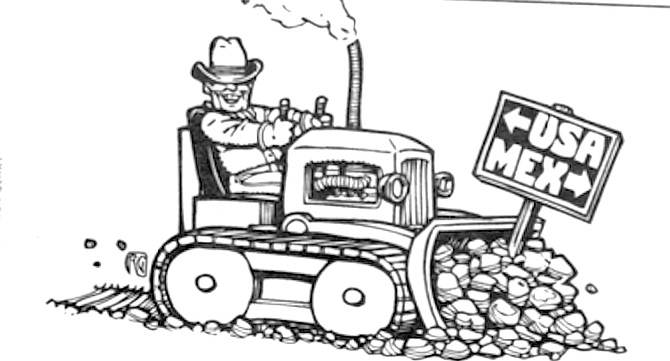
Dear M.A.: Is it true that the original boundary between the U.S. and Mexico was seven miles north of the present one, and the U.S. “took” the rest? A friend who grew up in Tijuana said their history class teaches this. — Just Wondering, downtown
Were we supposed to have done this in one instant land grab, or did we get up before sunrise every morning and secretly nudge the line a few inches south until everybody in Chula Vista and Brownsville woke up one day and suddenly realized they were Americans? I’m sure history looks different from the other side of the line, but probably not that different. Parts of the border have been juggled around, but not the whole thing.
The 1848 Treaty of Guadalupe Hidalgo loosely described the original international boundary, but we didn’t actually settle the last border dispute until 1967, so we’ve had plenty of time to argue the details. The western boundary point was to have been a league south of the southern tip of San Diego Bay. We argued about whether that meant at high tide or at low tide and about how long a league is, but that dispute didn’t constitute a 7-mile difference. Later, when surveyors moving west were scheduled to meet surveyors measuring east from San Diego, they missed one another by about 2000 feet. The resolution favored the U.S., which picked up a wedge of land about 180 miles long and a third of a mile wide at its widest point. Don’t think that would qualify as a 7-mile land grab either.
The original treaty included maps that formed the basis for all surveying work. In an especially nice example of bureaucratic bungling, the U.S. and Mexico received different maps, and both of them were wrong. Nobody realized this until they went looking for El Paso and the nearby Rio Grande, which were important landmarks described in the treaty. But the north-south difference between the maps and reality was about 42 miles, not 7. Mexico won that round, at least temporarily. But U.S. railroad and military interests coveted more land to the south and weren’t pleased. So the U.S. used specious logic, veiled threats, and the lure of cash to convince President Santa Ana to relinquish the disputed land near El Paso, a strip of southern New Mexico, and the southern quarter of Arizona. We got the land, then stiffed them for about a third of the pu rchase price. (In high school history tests, that maneuver’s known as the Gadsden Purchase.) I’m sure the Mexican classroom take on this is very different from ours, but it involved a whole lot more than 7 miles.
Perhaps the oddest of the border oddities occurred in the early 1970s. A retired U.S. military officer claimed a tiny island in the mouth of the Rio Grande that had been created the year before by a river course change during a hurricane. He declared it the Sovereign Cherokee Nation Tejas, changed his name from Herbert Williams to Bear Who Walks Softly, requested diplomatic immunity, and claimed that one major asset in the country’s treasury was a plaster life mask of Marlon Brando, worth $1.5 million. Today, the founder’s dead, his associates are accused of insurance fraud, and Mexico still owns the land.
Here's something you might be interested in.
How border with Mexico was set
A league south of the southern tip of San Diego Bay
How border with Mexico was set
A league south of the southern tip of San Diego Bay
We didn’t actually settle the last border dispute until 1967.
Dear M.A.: Is it true that the original boundary between the U.S. and Mexico was seven miles north of the present one, and the U.S. “took” the rest? A friend who grew up in Tijuana said their history class teaches this. — Just Wondering, downtown
Were we supposed to have done this in one instant land grab, or did we get up before sunrise every morning and secretly nudge the line a few inches south until everybody in Chula Vista and Brownsville woke up one day and suddenly realized they were Americans? I’m sure history looks different from the other side of the line, but probably not that different. Parts of the border have been juggled around, but not the whole thing.
The 1848 Treaty of Guadalupe Hidalgo loosely described the original international boundary, but we didn’t actually settle the last border dispute until 1967, so we’ve had plenty of time to argue the details. The western boundary point was to have been a league south of the southern tip of San Diego Bay. We argued about whether that meant at high tide or at low tide and about how long a league is, but that dispute didn’t constitute a 7-mile difference. Later, when surveyors moving west were scheduled to meet surveyors measuring east from San Diego, they missed one another by about 2000 feet. The resolution favored the U.S., which picked up a wedge of land about 180 miles long and a third of a mile wide at its widest point. Don’t think that would qualify as a 7-mile land grab either.
The original treaty included maps that formed the basis for all surveying work. In an especially nice example of bureaucratic bungling, the U.S. and Mexico received different maps, and both of them were wrong. Nobody realized this until they went looking for El Paso and the nearby Rio Grande, which were important landmarks described in the treaty. But the north-south difference between the maps and reality was about 42 miles, not 7. Mexico won that round, at least temporarily. But U.S. railroad and military interests coveted more land to the south and weren’t pleased. So the U.S. used specious logic, veiled threats, and the lure of cash to convince President Santa Ana to relinquish the disputed land near El Paso, a strip of southern New Mexico, and the southern quarter of Arizona. We got the land, then stiffed them for about a third of the pu rchase price. (In high school history tests, that maneuver’s known as the Gadsden Purchase.) I’m sure the Mexican classroom take on this is very different from ours, but it involved a whole lot more than 7 miles.
Perhaps the oddest of the border oddities occurred in the early 1970s. A retired U.S. military officer claimed a tiny island in the mouth of the Rio Grande that had been created the year before by a river course change during a hurricane. He declared it the Sovereign Cherokee Nation Tejas, changed his name from Herbert Williams to Bear Who Walks Softly, requested diplomatic immunity, and claimed that one major asset in the country’s treasury was a plaster life mask of Marlon Brando, worth $1.5 million. Today, the founder’s dead, his associates are accused of insurance fraud, and Mexico still owns the land.
Comments