Sponsored
Sponsored
Poway has 55 miles of trails and other options that are not designated as trails but still are enjoyable to walk or jog. The walk described here ends either through or close to Old Poway Park, which includes the Poway-Midland Railroad that offers rides aboard vintage and antique railroad equipment. Saturday mornings there is a farmers’ market that is always a good place to stop for a cool drink.
Park along Adrian Street, then walk east past Eastern Street where the road starts. This is the only noticeable elevation gain on this walk. Continue past the pavement to dirt where there is a level section before descending to Tierra Bonita Road. Turn left (north) along this rural stretch intermittently shaded by sycamore and other landscape trees.
Across the street to the right is Dearborn Memorial Park, founded in 1885 by the first doctor in the area, Dr. Louis Hilleary, and named after the first person buried there. Soon, to the left are bleacher seats where the Poway Rodeo is held every September. Walk past the Poway Valley Riders Association sign and past Rattlesnake Creek where the chain-link fence ends. Turn left (west), walk past four posts, and continue on a wide dirt path lined by trees.
The path has shade trees on both sides with Rattlesnake Creek to the left, noticeable only due to the cattails growing at the lowest point. Cattails grow in muddy soil or in up to a foot in water and have deep roots. Then due to the slight elevation gain, willow, Hooker’s evening primrose, and two nonnative poisonous plants — castor bean with its dark green palmate leaves and cockleburs with multiple spiny seeds that spread by attaching to moving surfaces — are visible. The dark orange to brown stems seen here are curly dock flowers at the end of the season.
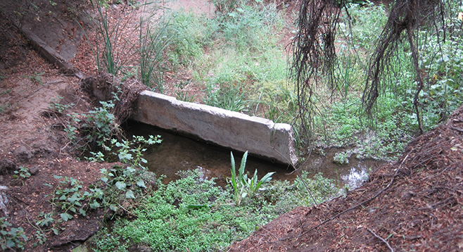
At the same level as the path are mission prickly pear and cholla cactus, buckwheat, narrowleaf willow, and horehound. Once the path veers southward, the area is not as groomed. Three narrow dams of undetermined age have cracks with the water easier to see in spots where watercress and duckweed are on the surface in shaded areas. Marsh fleabane can be easy to spot with its magenta-to-pink flower among the green plants. There are also a number of unique trees not seen in other areas of the county, along with familiar poison oak. In the winter of 2017, during the unusual high rainfall and high winds, a number of trees uprooted and toppled over into the creek.
The trail exits onto Midland Road. At this point there are two options. The first is to cross at Norwalk and walk south on Midland Road to Audrey Park, which is accessed by crossing on a bridge over the cement drainage of Rattlesnake Creek. Once at the park, take the path to the left (south) around the baseball field to the parking lot and walk down the center to cross Aubrey Street before walking through Old Poway Park. The second option is to turn left (south) on Midland Road, then turn down Adrian Street to return to your parked vehicle.
Distance from downtown San Diego: 24 miles (Poway). Allow 30 minutes driving time. From SR-163 north, merge onto I-15 north, then take Exit 19, Ted Williams Parkway, keeping in the right two lanes. Turn right (east) at the signal. Continue on Ted Williams Parkway for 2.5 miles, then go right onto Twin Peaks Road for 1.5 miles. Then turn right (south) onto Midland Road for a short distance. Turn left (east) onto Adrian Street and park along the road.
Hiking length: Approximately 1.85-mile loop.
Difficulty: Easy with less than 100 feet of elevation gain/loss. Open sunrise to sunset.