Sponsored
Sponsored
The Broken Hill Trail is the longest and one of the most scenic trails at Torrey Pines State Natural Reserve, winding through a thicket of chaparral until the trail opens up to reveal spectacular ocean views and then dropping down a steep canyon to Flat Rock and the beach below. The South Fork and North Fork routes are heavily used by power-walkers and joggers, alone or in groups. Strollers and botanizers should be prepared to stand aside for these cordial but brisk trail-users.
Before beginning the hike, stop at the visitor center to see exhibits on the natural and cultural history of the area and to pick up a brochure about the reserve and common plants found here. To reach the trailhead, walk south for 10–15 minutes on a segment of the original coast highway now restricted to hikers and bicyclists. The route is a national historic landmark first paved in 1915. Its successor is the North Torrey Pines Road, a section of US-101 built in 1933. Further to the east roars Interstate 5, constructed in the mid-1960s to speed the world to San Diego.
Look for the Broken Hill North Fork Trail sign. Initially flat, the light-colored, sandy path is easy to follow as it winds through densely packed manzanita, scrub oak, sage, coast spice bush, and yerba santa. Sun-lit openings in the chaparral make room for seasonal wildflowers. Those areas are also strewn with marble-sized concretions, remnants of the rust-colored Lindavista Formation that caps the light-colored Torrey sandstone at Broken Hill. When the trail forks, go right if Flat Rock is the objective, and head down to the beach. If a shorter loop is desired, then go left to the Broken Hill Overlook.
The descent to the beach passes along a ridge with Fern Canyon to the north. Signs on the south side of the trail warn of unstable cliffs, so stay on the posted route. The trail gradually becomes less sandy and increasingly rutted where hikers have worn down the trailbed, exposing cobbles and roots. There are stairs in some spots, so take care and stop at times to enjoy the area.
The shorter trail to the Broken Hill Overlook highlights the erosion-shaped geology of the reserve and its rare Torrey pines. While the softer Torrey sandstone has eroded around Broken Hill, a segment still capped by the harder Lindavista Formation stands tall. From the overlook, gaze south across La Jolla Bay or look east to take in the emerald fairways of Torrey Pines Municipal Golf Course juxtaposed with the muted greens of the reserve’s native chaparral.
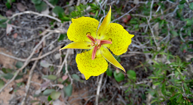
In some areas along the North Fork and South Fork trails, footbridges and boardwalks have been built across areas where water drains in the rainy season. Smell an odor? It could be a small California native called prickly skunk flower. Elsewhere in the reserve, hikers may catch a whiff of fragrance that could be bottled as perfume — another native known as Cleveland sage. Both have a home in the chaparral.
Walking east back along the Broken Hill Trail, turn right at the junction to return via the South Fork Trail, but first turn right again on the spur trail to Broken Hill Overlook for some spectacular views of Torrey pines clinging to the eroded landscape. Return to the South Fork Trail and follow it back to the old coast highway and the visitor center.
Distance from downtown San Diego: 22 miles. Allow about 35 minutes driving time (Del Mar). From I-5 N, exit on Carmel Valley Rd. and turn left (west). From Carmel Valley Rd., turn left (south) on So. Camino del Mar, which becomes N. Torrey Pines Rd. as you cross into La Jolla. Drive 0.7 mile to the park entrance to pay a day-use fee. The visitor center parking area is about 1.5 miles up the Torrey Pines Park Rd. Free parking, if available, is by the beach on N. Torrey Pines Rd.
Hiking Length: 1 to 3 miles, depending on route. Broken Hill Trail has two starting points, South Fork Trail and North Fork Trail. Round trip to the beach and Flat Rock via the South Fork is 2.6 miles; the north fork is 2.4 miles. Some hikers opt to return to the mesa from Flat Rock by using the Beach and Razor Point trails, for a 3-mile loop. Depending on the tide, hikers may also walk north on the beach for 0.75 mile to the reserve’s entrance. For a shorter hike that stays on the mesa, a walk to the Broken Hill Overlook from the South Fork trailhead is a 1-mile out-and-back.
Difficulty: Moderate to Flat Rock because of its descent to the beach and the return climb. Elevation gain/loss 800 feet. Easy to Broken Hill Overlook with little change in elevation. Trails are well maintained and signed. Facilities and water are available near the trailhead. Water is allowed in the reserve, but neither food, dogs, nor bikes are permitted. Open 7:15 a.m. to sunset.