Sponsored
Sponsored
The Sweetwater River is the main artery of the Sweetwater watershed. Its headwaters are in the Cuyamaca Mountains, flowing into Sweetwater Reservoir and emptying into San Diego Bay at the Sweetwater Marsh. The Sweetwater Interpretive Loop is on the south side of the river corridor. The trail is within the San Diego National Wildlife Refuge.
Start the walk by crossing the steel bridge to the south, turning west onto the trailhead between the boulders. Take a moment to look at the Parker Truss triangular patterns made of steel girders on the top and sides of this bridge that were built in 1929 during the time when truss bridges were popular. The refuge property doesn’t start until you reach the wooden informational kiosk. Continue into the wooded riparian area, where a small bridge goes over the creek bed. Be on the lookout for poison oak; it’s easy to avoid if you know what to look for, and if not, just don’t touch any plants with leaves of three.
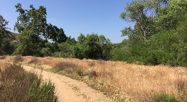
Although there are many side trails, the interpretive loop follows the fence along the riparian area as the river flows southwest. There is signage along the trail describing many of the rare and endangered plant and animal species found in this refuge, including least Bell’s vireo, California gnatcatcher, Quino checkerspot butterfly, and San Diego ambrosia. The willow, sycamore, cottonwood, and oak woodland provide nesting sites and habitat for many resident and migrating birds making this a favorite area for bird-watching.
At 0.64 mile, the trail continues straight, or makes a sharp turn back along the flank of the hillside, traveling through coastal sage scrub and offering a panoramic view of the watershed. Living along this section of the trail are coast horned lizards, red diamond rattlesnakes, roadrunners, and California and spotted towhees. The trail wraps back around to the north, eventually bringing you to the creek bed crossing and steel bridge.
An alternative loop can be made by going straight along the river corridor at the 0.64 mile mark. In about another 0.2 mile, there is a wooden bridge that crosses the riverbed to the north side. The trail eventually connects to a service road. Although not as scenic, a turn to the right makes this a nice 2-mile loop back to the Singer Lane parking area. Or, if looking for a longer challenge (5.6 miles one way), head south on the trail at the bridge and eventually connect to the Sweetwater River Trail on San Diego County land before returning. Access to this trail from the south can be found at Sweetwater Regional Park.
There is also a trail in the San Diego Wildlife Refuge on the north side of SR-94 along the Sweetwater River flood plain. This 1.4-mile section is best reached by parking at the trailhead at the end of Par 4 Drive, accessed from Steele Canyon Road off SR-94. There is no parking lot in this residential neighborhood, so please be respectful of driveways and access.
Distance from downtown San Diego: 15 miles. Allow 25 minutes driving time (Rancho San Diego). From SR-94 E/Campo Road, exit west (right) onto Singer Lane, then take an immediate left into the parking area. Limited parking can be found on Singer Lane. The trailhead is at the south end of the historic Sweetwater steel bridge.
Hiking length: 1.5-mile loop with longer options available.
Difficulty: Easy. Elevation gain/loss less than 200 feet. Equestrians, bicycles, and dogs (on leashes) allowed. No facilities or water.