Sponsored
Sponsored
This trail is part of the 55-mile San Dieguito River Park course that will extend one day from Volcan Mountain near Julian to the shore at Del Mar. It is also part of the Coast to Crest Trail that links Anza-Borrego Desert State Park to the ocean. Both the Del Dios Gorge Trail and the Santa Fe Valley Trail begin from the same parking area, and both follow the San Dieguito River with the Del Dios Gorge Trail going to the northeast and the Santa Fe Valley Trail going to the southwest.
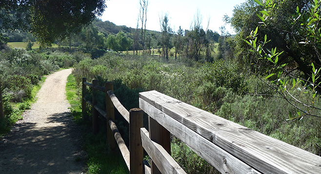
The beginning of the Santa Fe Valley trail is generally flat with a well-groomed pathway, which crosses over seven wooden bridges. The left side of the entire trail going out abuts the property line of one of Rancho Santa Fe’s golf courses. On the right side of the trail is the San Dieguito River. Water along the river can only be seen in the guise of three ponds along the route. There is a bit of a surrealistic feeling as one hikes and gazes right and communes with nature and then gazes left to observe golfers traversing the golf course in their golf carts.
Along the right side of the trail going out are common chaparral plants such as lemonade berry, California sagebrush, bush mallow, white sage, and California poppies. Beyond the chaparral vegetation is evidence of riparian flora such as willow, Mexican palm, (a nonnative species), and various species of grass (also nonnative). Unfortunately, the area was burned in the Witch Creek fire of 2007 and still shows evidence of distress.
Hiking the first 1.25 miles is easy, but the remaining 0.75 mile has a series of switchbacks bounded by railings as one climbs about 200 feet in altitude, eventually to the base of a power line. The plan is to continue the trail farther west at a later date. Presently, the end of the trail gives views of the golf course, a pond created by the San Dieguito River, and the path back toward the trailhead. Given the variety of flora along this route, the hike would be impressive in the spring when plants are flowering.
If one has limited time and can only hike one of the two trails from the trailhead, the Del Dios Gorge hike is recommended. The Santa Fe Valley Trail is best for an overview of the surrounding area.
Distance from downtown San Diego: 30 miles. Allow 50 minutes driving time. From CA-163N, take I-805N to I-5N and exit east on Via de la Valle after 20.5 miles. Drive east on Via de la Valle, which is SR-6. SR-6 has several name changes heading east, beginning with Via de la Valle, then Paseo Delicias, and finally Del Dios Hwy. It is 13 miles from I-5 on SR-6 to Calle Ambiente. After passing Calle Ambiente, turn in at the “Lemon Twist” fruit stand on the right. There is a road marked with an “SDRP” (San Diego River Park) sign that leads to the parking area.
Hiking length: 4 miles out and back.
Difficulty: Easy except for switchbacks at the end of the trail. Elevation gain/loss 200 feet. The gravel parking lot at the start of the trail provides parking for about a dozen vehicles. Be prepared to share the trail with runners, dogs, mountain bikers, and maybe equestrians. No facilities or water.