Sponsored
Sponsored
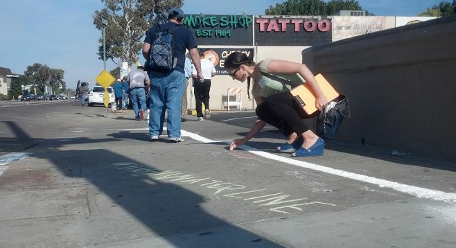
Climate change activists from San Diego 350 gathered in Mission Beach on Monday morning, January 19, to give holiday beachgoers a look at what's in store for the neighborhood if sea levels continue to rise as projected in a 2013 study commissioned by the San Diego Foundation.
"According to the scientists at Scripps Institution of Oceanography, we're expecting sea level rise of 12 to 18 inches over the next 35 years," San Diego 350 member Jeanne Peterson explained while others armed themselves with colorful chalk sticks and loaded a hopper with powdered chalk usually used in marking sports fields.
That rise would put the new high-tide line somewhere around the middle of Mission Boulevard, the main route through a neighborhood that attracts a significant portion of San Diego's out-of-town visitors each summer.
To illustrate their point, activists walked north from Belmont Park, leaving a thick chalk line emblazoned with the tags #HighWaterLine and #ChalkSD. They handed out maps and explained to passers-by the implications of a Mission Beach that would spend a significant portion of its time underwater. The group also carried a petition they hope to present to the city council, urging the adoption of a "strong and enforceable climate plan" for San Diego.
"We support Mayor Faulconer's plan," says Peterson, "but it doesn't have any teeth — there are no penalties or incentives for meeting or missing the targets, they're just suggestions...it just needs to be stronger in terms of enforcement."