Sponsored
Sponsored
The Famosa Slough State Marine Conservation Area is a 25-acre wetland that connects to the San Diego River Estuary via a 12-acre natural channel. The slough includes fresh water, brackish, and salt-marsh habitats. It is a “go to” spot for birders, neighbors, and those interested in what is the remnant of the San Diego river delta at the south end of False Bay or Mission Bay wetlands.
“Puerto Falso” (False Bay) was the name given by early Spanish explorers in 1542 to Mission Bay by some of Juan Cabrillo’s men who went ashore to search for fresh water. When they came to Mission Bay and did not see the ship, they thought at first that Cabrillo had sailed away without them. They named it False Bay to distinguish it from the larger San Diego Bay to the south. It continued to be called False Bay until officially changed to Mission Bay in 1915 by the U.S. Geographic Board.
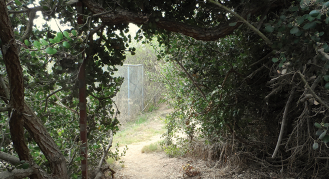
To start the Famosa Slough portion of the walk, park in the dirt then walk north through the yellow posts. To the right there is a short distance along a fence where the trail circles around one of the three sediment depressions. These have plants growing near and between concrete jacks and interlocking blocks to slow down runoff from the surrounding area. Water will collect and enter into black catchment basins with rocks at the base to help diffuse the water so that it soaks into the soil, or if there is a high volume of water, it will divert the surface water to the slough. '
Circle the sediment depressions and then turn south for a short distance until crossing the concrete walkway to the end of Montalvo St. Just beyond the fence, turn north and cross the end of Mentone St. Follow the trail along the west side of the slough. Make a short detour to the right that is closer to the water to look for birds such as egrets, herons, ducks, and coots. Return to the main trail where it then rises up along Famosa Blvd., turning again to the right when the path leads close to the water. Return to the main trail and continue to the corner of Famosa Blvd. and W. Point Loma Blvd. Turn right, going east on W. Point Loma Blvd. for a short distance and turn south on a wide gravel/dirt path where there is an excellent place to use binoculars to see how many different species of birds you can recognize. Follow the wide path where there are a number of native plants along the way until it turns up to W. Point Loma Blvd. Turn right, and after a short distance, there is a crosswalk to reach the other side. Turn west until you reach a Famosa Slough sign. Turn right just past Orleans Way, where the remnants of a trestle is visible. Follow the trail until there is a wide area before retracing your steps back to the parking lot.
The Friends of Famosa Slough, the City of San Diego, and other agencies and volunteers have worked to restore the slough and to promote public awareness of the importance of wetlands.
Distance from downtown San Diego: 6 miles. Allow 10 minutes driving time (Point Loma). From I-5N, merge onto I-8W, then take W. Mission Bay Dr./Sports Arena Blvd. Go west on W. Point Loma Blvd. for just over 0.5 mile, then south on Famosa Blvd. and continue following the road to where it becomes Camulos St. At the bend, turn southeast (left) onto Valeta St. and then left into a parking lot where Famosa Blvd. starts again. There are also entrances on the north side of W. Point Loma Blvd. and along Famosa Blvd. Any parking spot necessitates walking across W. Point Loma Blvd. to experience both sides of the slough.
Hiking length: 2 miles out-and-back.
Difficulty: Easy, with less than 50 feet elevation loss/gain. No facilities. Bring binoculars.