Sponsored
Sponsored
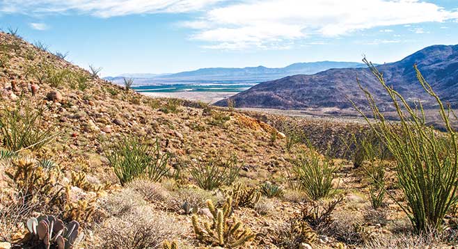
Here is your chance to walk on trails the Cahuilla used to travel between their old Santa Rosa village in Rockhouse Canyon and villages in Coyote Canyon. Although the trail is a little hard to follow in spots, it is still visible. The trail also provides stunning views of the Santa Rosa Mountains to the east and the San Ysidro Mountains in the west.
From your parked vehicle, cross the creek and follow the road east a short distance until it begins to curve southeast. At this point, find the trail, marked with ducks, going northwest into Box Canyon. As you progress up the trail, the canyon quickly narrows and some scrambling over or around boulders is necessary. Continue up the main canyon for about 1.25 miles, noting the tributary canyons coming into the main canyon on your right. Go about a quarter of a mile up the second tributary canyon. Keep to the right as this canyon branches, aiming for the low ridge ahead. The hike utilizes the old Cahuilla trail, segments of which you will find on top of that ridge. Although these segments are not continuous due to growth of cholla and other vegetation over the more than a 100 years since it was heavily used, basically you just follow the ridge and watch for ducks that periodically mark the trail. As you hike, note the abundance of different cactus species, including beavertail cactus, hedgehog cactus, California barrel cactus, Engelmann prickly pear, fishhook cactus, snake cholla, teddy bear cholla, and silver cholla. Desert agave is abundant in places as is ocotillo.
The goal is the Box Canyon playa that lies 3.75 miles from the trailhead. A playa is the flat-floored bottom of an undrained desert basin that at times can be a shallow lake; this playa is a dry lake in miniature. Rains erode sand and silt from the surrounding hills, which flow into and accumulate in the shallow depression. It is ringed with creosote bushes, but very few plants grow in playa soil, possibly due to salt that the runoff must also deposit here. Once you achieve this goal, you could continue on to Jackass Flat, Hidden Spring, or Rockhouse Canyon, but these are beyond the scope of a day-hike for most people. Return to your vehicle the way you came.
Vehicle access to this area is prohibited from June 1 through September 30 to protect water resources for bighorn sheep during the summer months. They can sometimes be seen along the road or up on the slopes, so bring your binoculars!