Sponsored
Sponsored
You are unlikely to encounter any horses, wild or tame, on this trail, but it offers a chance to hike through beautiful oak and sycamore-shaded canyons and lush chaparral that can be ablaze with color from late winter to spring and even into early summer in a wet year.
The trailhead is at the south end of the campground, 0.5 mile from the day-use parking area, but is well marked and easily found by walking south through the linear campground. Start hiking on the Dripping Springs Trail. Almost immediately you will cross the Arroyo Seco streambed. It is dry much of the year, as its name would suggest, but it can be a roaring river after a rainstorm; if so, cross it with care. Soon you will enter the Agua Tibia Wilderness and shortly thereafter you come to a signed trail junction. The Dripping Springs Trail continues straight ahead, while the Wild Horse Trail takes off to the left. Go left.
Wild Horse Trail rises steeply for about a half mile, then levels off, gaining elevation more slowly as it undulates a couple of hundred feet above the Arroyo Seco streambed and passes in and out of its tributaries. When in chaparral, the vegetation includes chamise and its tall, colorful relative, red shank; as well as whitethorn and warty-stem ceanothus, big berry and rainbow manzanita, buckwheat, sugar bush, bush monkey flower, felt leaf yerba santa, and scrub oak. On more moist and shady sites, the chaparral arches thickly over the trail, often reaching a height of 20 feet or more. Dense oak woodlands and riparian vegetation clothe some of the tributary canyons, especially the unnamed canyon at 1.75 miles from your car, where a seasonal stream may be bubbling over rocks, flanked by mossy banks lined with ferns, under tall canyon oaks and California sycamores.
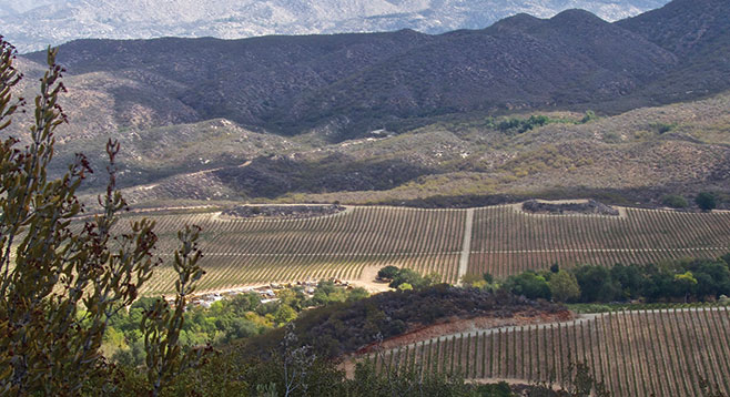
As the trail gradually climbs, the Arroyo Seco streambed grows more distant and views open up to the north and east that include the San Jacinto and San Bernardino Mountains. At about mile 4 the trail crosses a ridge and turns south. At this point there is a surprising view to the east where there is a large vineyard nestled in the now-broad Arroyo Seco valley named Devils Hole. If you are there in the fall, you may hear periodic explosions as the farmers set off carbide cannons to scare birds away from the ripening grapes. This may be a good place to turn around and head back because the Wild Horse Trail actually extends 10 miles from the campground to the Crosley Saddle, which overlooks the Pauma Valley and out to the Pacific. However, this is a 20-mile round trip that is probably too much for most day-hikers.