Sponsored
Sponsored
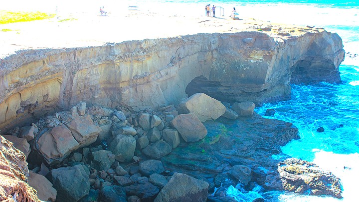
Right before Christmas Eve, 619newsmedia shared a video taken at Sunset Cliffs of a cliff that had just split. The footage was terrifying for some of its 62,000 viewers, as the person filming approached the edge of the sheared cliff, with a POV of their sneakers in the shot, overlooking the rocks, sand, and waves crashing about 40-50 feet below.
The recent sighting was the third sheared cliff reported in the county in 2023.
The OB Rag reported in a 2019 article that on the same cliffs, there was a yearly average of five deaths or severe injuries from 2005-2019. One fatality listed in the report happened in January 2014 when a 25-year-old woman visiting from Chicago was said to be taking sunset photos before falling from the cliffs. Then, on Christmas day of 2015, a 33-year-old Indiana man was said to have been “distracted by an electronic device,” causing him to fall “60 feet to his death at the cliffs.”
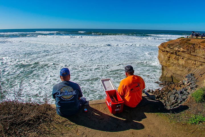
"There have been a series of sections of cliffs collapsing the past year," said Jim Grant in a recent interview with me. "Causes of collapsing cliffs: entropy, natural decay, and rain." Grant is a local beach and surf photographer who just snapped photos of the city posting signs last week that read "Danger: unstable cliffs; stay back; no public access."
Grant continued, "I realize people love to go to the ocean and watch the awesome sunsets; I am one of them. People go to the cliffs in droves, literally hundreds of cars a night .... and people trample down very dangerous sensitive bluffs."

Rozzee_ob added underneath the sheared cliff footage in December, "From the results of the last rain storm, cliffs will start to fall," — which made sense to the IGers. Just days before, San Diego experienced heavy rain and a storm.
Last February, NBC San Diego reported on a collapsed cliff at Black's Beach in La Jolla. Images depicted massive amounts of debris on the beach. Just a couple of weeks before the La Jolla incident, another cliff, estimated to be 25 feet tall and 250 feet wide, reportedly collapsed hundreds of feet south of the Torrey Pines Glider Port.
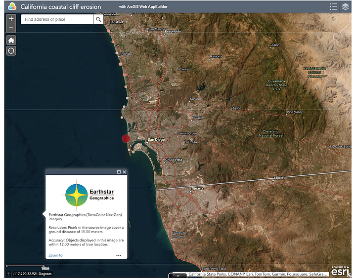
In August 2022, UCSD released a high-resolution study on California coastal erosion, including the above-mentioned areas and other areas along San Diego County’s coastline. "It’s probably the largest high-resolution cliff erosion study ever conducted, and provides the first detailed erosion rates for several parts of the state,” said Adam Young of Scripps Institution of Oceanography at UC San Diego in a statement.
Young, a coastal geomorphologist surveying San Diego County cliffs for several years, uses Light Detection and Ranging, a system that scans, via laser, the cliffs, creating high-resolution 3D spatial maps of the San Diego County coastline up to northern California. The research aims to understand coastal change, such as "the multiple interwoven cliff erosion processes that create cliff instability and trigger gravity-driven failures." Young explained, “Each [laser] survey provides a snapshot in time that we compare to previous surveys to measure and track erosion over time. We use these surveys and other sensors to quantify the erosion processes, identify erosion patterns, and examine stability conditions.”