Sponsored
Sponsored
The Tijuana River drains 1750 square miles from the mountains of San Diego’s East County and Tecate (Mexico) crossing the international border to empty into the Pacific Ocean just south of Imperial Beach. The estuary is unique in California because no road crosses the river’s mouth, creating an exceptional environment for wildlife.
Spooner’s Mesa, which sits above the drainage and estuary, was named for Olive and Christopher Spooner who once made their home on the mesa top. All that remains of the homestead are some non-native plants, including tamarisk planted as a wind break, and a concrete cistern with the couple’s names etched in the basin’s side. The uplift of the mesa reveals an ancient shoreline laid down roughly a million years ago. Native American Kumeyaay occupied the Tijuana River Valley for centuries as part of their fishing grounds. As a result, there are valuable archaeological sites in the area.
Start your hike from the steep dirt road that rises from the river valley. The hike up the hill takes you past coastal sage scrub plants such as coyote brush, wild buckwheat, laurel sumac, and jimson weed (Datura wrightii). The exotic large white and lavender-tinted, trumpet-shaped blooms of the datura feeds moths, butterflies, long-tongued bees, and hummingbirds; but all parts of the plant are poisonous to man.
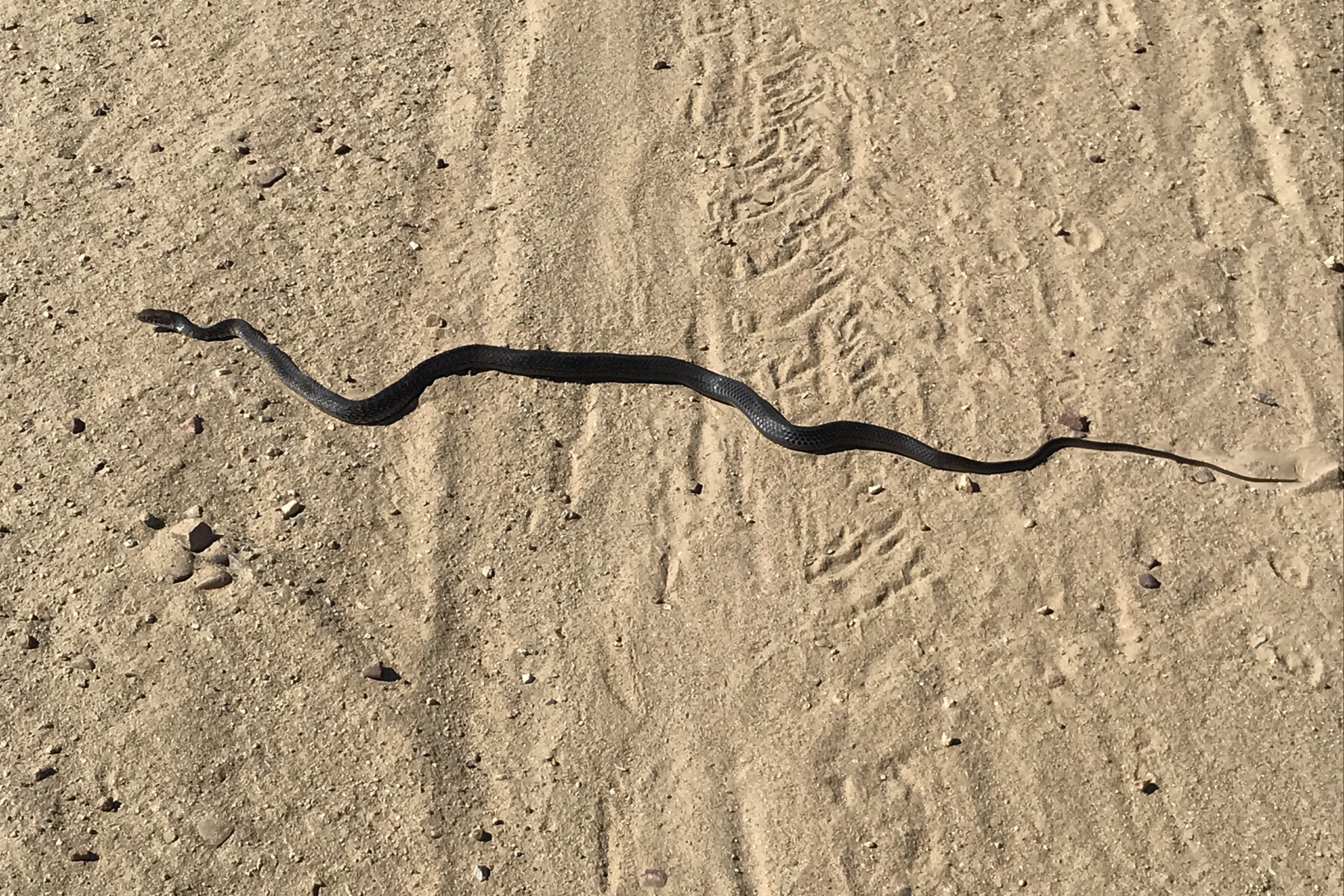
There is a great overlook part way up the mesa that allows sweeping views of the river valley and estuary, looking north to downtown San Diego. As you continue up the mesa, look to the south, beyond the border fence, to the suburbs of Vista del Pacifico (due south), Playas de Tijuana (to the west), and Mexico’s Highway 1. The International Border bisects the mesa and has created a barrier leaving the habitat divided, and the mesa bisected by access roads and trails. There are areas of habitat enhancement, allowing spiders to spin their webs or leave old webs behind. Unfortunately, the border barrier also prevents the cross migration of larger mammal species, and some birds, such as the greater roadrunner, which are unlikely to fly over the barrier. Also be on the lookout for snakes, like the coachwhip (Masticophis fuliginosus), which like to sun themselves on the access roads and trails.
At the top of the climb, the trail loops around the edge of the mesa, cutting through the middle as the south side of the mesa extends into Mexico. As you hike to the west edge of the mesa, it offers distant views of downtown San Diego, the harbor, Point Loma, and the Coronado Islands. After crossing through coastal sage and maritime scrub, look for the fishhook cactus (Mammillaria sp.) and chollas among the California buckwheat and lemonadeberry in the center of the mesa. The rare San Diego evergreen currant (Ribes viburnifolium ‘Spooner’s Mesa’) grows here. This beautiful currant variety has larger leaves giving the plant a fuller and denser appearance. The eastern edge of the mesa offers views of Chula Vista, Mount Miguel, and the Tijuana River Valley. The mesa also creates a great vantage point for bird watching as bushtits move through the chaparral, American kestrel, and turkey vultures soar above, northern harriers fly low over the saltmarsh, while least terns and plovers build nests near the shore.
After exploring the mesa’s many trails, return the way you came, down the steep trail to the parking area. If time permits, walk out Montezuma Road, past the deserted Border Field State Park entrance, across the sandy beach and dip your toes in the cool waters of the Pacific Ocean.