Sponsored
Sponsored
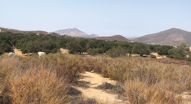
From the Spanish word for “pasturing place,” Potrero Regional Park is an oak and chaparral open space covering 115 acres in the far southeast part of San Diego County west of Campo. Nearby is a small town, also called Potrero, that has a general store, café, a post office, and a library. Best known simply as Potrero County Park, it is far from urban centers and major freeways, but offers some of the resources — playgrounds, ballfields, picnic areas, and even a dance pavilion — that are found in more centrally located parks. It is also a camping park with a campground that can accommodate RVs, tent campers, group camping, and those wanting to reserve one of the two wilderness cabins for overnight stays. It has hot showers and electrical hookups. Coast live oaks, some well over 100 years old, are found in the park area, along with grasslands that are part of a broad valley surrounded by rocky hillsides. This quiet, peaceful setting creates a very inviting park that also has hiking trails and a few surprises.
What sets Potrero County Park apart from many of San Diego’s other county parks is the outdoor exercise equipment that allows visitors to escape the urban gym and complete their fitness routine surrounded by natural sights and sounds. It also has an interesting history. The area was settled in 1868 by Charlie McAlmond, who had been a ship captain. He established a cattle ranch and farm. Soon thereafter, others moved into the area and also established ranches or became wood cutters. Oak trees were cut down and cordwood was hauled on horse-drawn wagons to San Diego where the wood could be sold. Happily, there are still plenty of oak trees that provide shaded areas in the park.
Because the area was in private hands for a long time, this is a part of the County that has seen little disturbance. It is much like the land originally settled by Captain McAlmond. Wildlife abounds: a visit may include rare glimpses of such animals as bobcats. Some of the more common animals that may be seen include deer, coyotes, eagles, hawks, scrub jays, rabbits, raccoons, skunks, and woodpeckers. Also look for fence lizards and gopher snakes, and watch out for the occasional rattlesnakes that should not be disturbed. The best times to see and hear wildlife are in the mornings and evenings. Whether you choose to use the equipment to do a rotation, or take some time to sit at a picnic table near the central parking lot, turn off your technology and listen for the dawn chorus as birds greet the day, or to the evening call of the Pacific tree frog.
When you are ready to get on the trail, the nature loop is in the northeast part of the park. Just follow the signs that say, “Wellness ahead: Nature Trail.” On the trail, as a rule of thumb, take the left path when the trail forks. The nature trail loops clockwise around a small hill identifiable by the stone pillars that shade a bench on the top. The nature trail leads through the chaparral, characterized by scrub oak, chamise, and wild buckwheat. The trail provides some insights into fire ecology, as three acres were burned near the park back in 2011 and some of the chaparral still shows fire damage. As you take the trail, note the interpretive signs that share some of the history of the Kumeyaay who once lived here. Look for grinding rocks that are not far from the acorn-producing oak trees. As you complete the loop and start heading back to the main park area, you will pass a grassy area and be reminded that you and your family are not the only ones who have enjoyed this space. An interpretive sign mentions places where water once flowed. The Kumeyaay built small dams here to create swimming holes.
The nature trail returns to the main part of the park at the group campground. Since this is a short hike, if you have time and your passport with you, it is a short distance to Tecate, Mexico, where you can enjoy a local restaurant and/or visit the Tecate Community Museum with its excellent displays about the culture and traditions of the Kumeyaay (Kumiai) people.
POTRERO COUNTY PARK
Find an outdoor gym in a natural setting in this park.
Driving directions: (Potrero) From 94 East, which becomes a two-line highway just past Rancho San Diego, turn left at Potrero Valley Road, then turn right into the park on Potrero Park Dr. Hiking length: Approximately 1 mile round-trip. Difficulty: Easy, less than 100 feet elevation change.