Sponsored
Sponsored
If you are looking for a loop hike in the Cuyamacas with a mix of sun and shade, old road and narrow trail, a variety of wildflowers, and a shady creekside spot to rest, then this trip might fit the bill. An abundance of wildflowers may be present in spring and summer, depending on the amount of rainfall received. The best time to visit this area is from October through May, as the summer months can be quite warm and thunderstorms are not uncommon by midday.
Begin the hike by backtracking south from the parking area about 200 feet and carefully cross the highway to the trailhead at the gated South Boundary Fire Road. An early-morning start is recommended in summer, as this segment of the route is quite exposed and the low bushes provide only small amounts of shade.
Follow the South Boundary Fire Road as it makes a fairly level traverse of low hills, at first heading south with views of Oakzanita Peak to the east, then curving northwest to parallel the upper Descanso Creek valley until it hits the Blue Ribbon Trail at 1.3 miles. White sage is frequently seen, as well as flattop buckwheat and chaparral whitethorn.
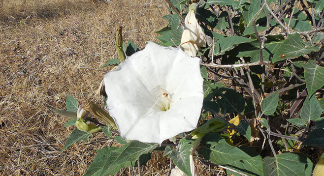
Turn left (south) on the Blue Ribbon Trail onto a narrow path that at times is lined with head-high bushes consisting of chamise, manzanita, basket bush, and a few patches of holly-leaf cherry. The trail makes a gradual descent of about 400 feet and at approximately 2.4 miles from the start reaches a spur trail that comes in from the left. Keep right, passing by clumps of jimson weed and enter an area with coast live oaks interspersed between shrubs. In summer, scarlet monkeyflower, canchalagua, and cryptantha may also be seen in bloom.
At just under 2.9 miles, veer to the right (west) at the junction with the Merrigan/Japacha Fire Road as the left fork goes a short distance to a gate with CA-79 just beyond. The signpost here is short and may be obstructed by long grass. Continue on the fire road in a northwesterly direction. The terrain opens up into mixed oak woodland and chaparral as the road gently climbs to a saddle, with a peek-a-boo view north to Cuyamaca Peak in the distance. If wandering off-trail, take care to avoid poison oak, as it is present in this area. The road then descends to meet the four-way junction with the Sweetwater Trail at 4 miles.
On the left is the continuation of Merrigan Fire Road, straight ahead is the Saddleback Trail, and to the right is the Sweetwater Trail. Turn right here to follow the Sweetwater Trail as it skirts the east side of the creek through lush riparian vegetation. Pause for a moment at the stands of tule (a common reed of still, shallow water) found here while you look for critters in the stream. At around 4.9 miles is a large rock on the right side of the trail that makes for a nice shady spot upon which to sit for a lunch or snack break while listening to the flow of the river.
About a quarter mile later, at 5.25 miles, the Sweetwater Trail meets the South Boundary Fire Road. Instead of turning left to cross the river, turn right uphill and leave the canopy of trees into drier, sunnier terrain. In half a mile, continue past the Blue Ribbon Trail on the right, now closing the loop of the hike. The remaining 1.3 miles on the South Boundary Fire Road should be familiar, though keep an eye out for any interesting flora or fauna missed on the way in. Reach the gate at the trailhead and jog left at the highway to reach your car on the other side.
Distance from downtown San Diego: 44 miles (Cuyamaca Rancho State Park). Allow 50 minutes driving time. From I-8E, take exit 40 for CA-79/Descanso. Drive north on CA-79 for 2.7 miles, then turn left to continue on CA-79 for another 3.7 miles to reach the signed East Mesa Parking area on the right shoulder. No facilities.
Hike Length: 7-mile loop.
Difficulty: Moderate with elevation gain/loss of 500 feet. Trail junctions are generally well-marked with brown signposts; however, some portions of the Blue Ribbon Trail may be a little overgrown.