Sponsored
Sponsored
The 346 square miles San Dieguito River watershed starts from runoff on the southern slope of Volcan Mountain, with tributaries of Santa Ysabel, Santa Maria, and Temescal creeks through the Ramona Grasslands to the ocean via the San Dieguito Lagoon in Del Mar. The watershed includes five reservoirs that include lakes Sutherland, Poway, and Hodges. Lake Hodges, with its maximum depth of 115 feet and 27 miles of shoreline, is contained within the San Dieguito River Park.
This hike starts either at the Del Dios Community Park on a 1.2-mile-long dirt path that parallels Lake Drive or at the parking lot across from Hernandez Hideaway to continue 1.9 miles to the Rattlesnake viewpoint just below the Lake Hodges Dam and back to your starting point.
Once on the second section, follow the dirt path past an SDG&E switchyard, the Olivenhain Pipeline pump house directly opposite the buoys surrounding the water inlet/outlet, plowed area, and inlet. Keep to the right past a short hairpin turn, then at the intersection of a paved road, turn left to continue on Lake Dr. After a short distance, the pavement ends, becoming a fire road that veers to the right. Close to where the fire road again becomes a dirt path that parallels Del Dios Highway, a rusting car looks to have missed a turn. Continue on the path to the end of the parking area, where there is a break in the fence. The trail turns left and down to the Rattlesnake overlook.
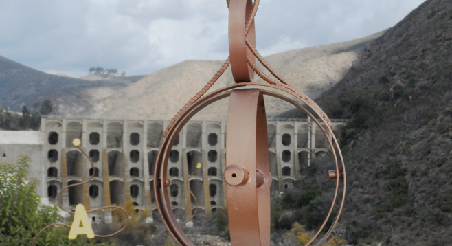
Take a break before returning by looking through the pipe scope to points A and B at the 1918 Hodges multiple-arch dam funded by the Santa Fe Railroad. The reservoir was then purchased by the City of San Diego in 1925; the main customers are the Santa Fe Irrigation and San Dieguito Water districts. Point C is the San Dieguito River continuing its journey to the Pacific Ocean.
Bring your binoculars to enjoy the birding in California’s first site formally recognized in 1999 as a Globally Important Bird Area. This was mainly due to the California gnatcatchers found in the equally endangered coastal sage scrub habitat that is found around the lake. Also of interest are the Western and Clark’s grebes, hawks, osprey, and ducks.
Plants along the trails include California sagebrush, cactus, laurel sumac, and lemonade berry. Some people are sensitive to the last two, as they are members of the sumac (or cashew) family — the same family as poison oak.
Distance from downtown San Diego: 33 miles. Allow 45 minutes driving time. From I-15, take exit 27 for Via Rancho Pkwy and turn left (west) onto E Via Rancho Pkwy for 3.2 miles, then left (south) again on Lake Dr. for 0.8 mile, just past Ash Lane if starting at Del Dios Community Park for the longer walk or another 1.2 miles to the parking lot across from Hernandez Hideaway, near the junction of Lake and Rancho drives.
Hiking length: approximately 6 miles from Del Dios Community Park or 4 miles from the Rancho/Lake Dr. parking lot to dam and back. Please keep a “passing lane” available for the multipurpose use of hikers, runners, and bicyclists. There is shore fishing, and private boats are allowed as the water level allows. Dogs on a leash permitted.
Difficulty: Easy, with little elevation gain/loss on both dirt and paved surface of the perimeter road.