Sponsored
Sponsored
The City of Escondido owns and manages the more than 3,000 acres of the Daley Ranch preserve that provides over 25 miles of hiking and dirt-biking roads and trails. Most visitors enter the ranch via La Honda Drive, off El Norte Parkway. The Engelmann Oak Trail is in a more secluded part of the ranch that can be reached via Cougar Pass Road. It offers a degree of solitude not found on the trails near the La Honda entrance. Also, Engelmann oaks are a somewhat rare live oak tree, usually with upright trunks and flat, gray-green leaves.
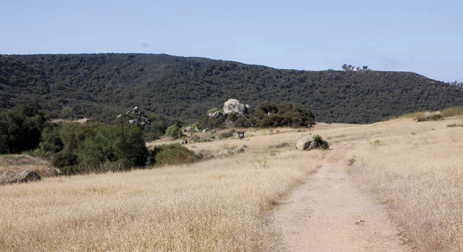
There are several different ways to hike the Engelmann Oak Loop, but the route described here is recommended for those who seek more solitude. After passing through the gate, follow the Cougar Ridge Trail as it passes near and then through a shady Engelmann and coast live oak woodland. As is the case with most Daley Ranch trails, this trail is an old dirt road originally used to move cattle or for fire protection. Although motorized vehicles will not be encountered, all ranch trails are popular with mountain bikers and equestrians.
After hiking 0.75 mile, the Engelmann Oak Trail branches off to the left. Take it and begin climbing this rather steep trail. Although initially difficult, after less than half a mile the hiking becomes easier as a grassy, gently rolling ridge is approached, studded with well-spaced Engelmann oaks and patches of chaparral.
From February through early May, the hills are cloaked with a carpet of green grasses. Although the annual grasses turn brown by late May, blooming annuals, perennials and shrubs continue to add color to the trail well into July. Depending on the month, blooming plants might include mariposa lily, wine cup clarkia, bush monkey flower, honeysuckle, canchalagua, wild heliotrope, phacelia, Nuttall’s snapdragon, and various kinds of penstemons, as well as the common chaparral shrubs, including holly leaf red berry, laurel sumac, manzanita, yerba santa, California lilacs, and chamise.
After 1.7 miles, the Bobcat Trail goes off to the right, down through a shady canyon of coast live oaks. It eventually joins the Cougar Ridge Trail and would be a way to shorten your hike if you are so inclined. However, to complete the Engelmann Oak Loop, stay to the left on the Engelmann Oaks Trail. There will be another possible detour 2.2 miles into the hike when the Burnt Mountain Trail takes off to the right. (Note: this trail does not lead up to the top of Burnt Mountain, but just bypasses part of the Engelmann Oak Trail.)
The Hidden Springs Trail joins the Engelmann Oak Trail from the left at 2.75 miles. It leads down to Jack Creek and is a connection to the rest of the network of Daley Ranch trails. Continue following the Engelmann Oak Trail and pass through an oak woodland, containing numerous beautiful, huge coast live oaks, as well as a meadow that can become a small pond in a rainy winter. A little further on, the Engelmann Oak Trail ends as it joins the Cougar Ridge Trail (at 3.35 miles). Go to the right, down the initially rather steep slope, and the Cougar Ridge Trail will follow along a stream and through an oak woodland, back to the trailhead and your car.
Canyoneers are San Diego Natural History Museum volunteers trained to lead interpretive nature walks that teach appreciation for the great outdoors. For a schedule of free public hikes:
http://www.sdnhm.org/education/naturalists-of-all-ages/canyoneer-hikes/
Distance from downtown San Diego: Approximately 45 miles. Allow one hour driving time. Go north on I-15 to Escondido. Exit at El Norte Parkway and take it east, about 1 mile to Broadway. Turn left on Broadway and follow it north 4.4 miles to Cougar Pass Road, on your right. Drive 1.4 miles up Cougar Pass Road and park in the lot on your left. The journey begins across the road where the Daley Ranch is entered via the Cougar Ridge Trail.
Hiking length: Almost 5 miles. Difficulty: This is mostly an easy, pleasant hike from October through June, but it might be arduous on hot days. Elevation gain is about 800 feet. No facilities and no drinking water.