Sponsored
Sponsored
These trails take you to view-points overlooking one of the most historic landscapes in San Diego’s North County, as well as areas of rapid suburban development. You will also have close contact with remnants of coastal sage scrub and willow riparian habitats that are thriving due to their protected status. Consider yourself lucky if you see any animal behavior, but always keep your distance.
Start hiking down the Hidden Valley Trail. It is only 0.2-mile long, but it is one of the few trails near here that will take you through a remnant of the native coastal sage scrub habitat that once cloaked these hills. The most common native plants here include coyote bush, California sagebrush, lemonadeberry, California sunflower, coast prickly pear, and black sage. Many other species are less easily noticed until they seem to suddenly appear when in flower. There are also a number of non-natives here, including invasive star thistles and black mustard, as well as planted ornamentals, especially acacia and eucalyptus.
Very shortly, you arrive at the well-manicured, completely non-native Hidden Valley Park, a jarring contrast to the habitat you’ve just passed through. There are picnic and toilet facilities here, as well as an array of children’s play structures.
Take the eastern exit from the park through the parking lot, then turn right on Vancouver Street. On the north side of Vancouver Street, find a break in the trees giving you a view to the north, overlooking Marron Valley. Buena Vista Creek flows through Marron Valley, providing a nearly year-round source of water for the green area you see stretching through the valley. Most of this valley, which is not currently under development, is part of the Buena Vista Ecological Reserve, a refuge established by the California Department of Fish and Wildlife to protect endangered species such as the California gnatcatcher and least Bell’s vireo, as well as the coastal sage scrub and willow riparian habitats that line the banks of the creek. Unfortunately for humans, the ecological reserve is not open to the public. Its purpose is to protect native fauna and flora from their greatest threat — namely, us.
The historic Marron Adobe can be seen just north of the reserve. It was built in 1843 by Juan Maria Romouldo Marron, a Mexican pioneer, who once owned virtually all the land you see here. Members of his family lived in this historic adobe until recent times.
Continue walking up Vancouver. In one block, turn right onto Concord Street. Follow Concord for 2 blocks until you reach the signal on Carlsbad Village Drive. Turn left and continue up the sidewalk on the west side of Carlsbad Village Drive for about 0.2-mile. When you reach a blue USPS drop box, look for a dirt trail leading off to the left and take it. This is the beginning of the Village H North Trail.
This trail leads up to the top of a knoll, from which you have an unobstructed view of the housing development that has replaced the rock quarry which occupied the eastern end of the Marron Valley until recently. Buena Vista Creek still flows through the development, though in a much-restricted channel. Its waters also still tumble over the El Salto Falls, a site important to the Luiseño people who had a village near here, as noted in the records of the 1769 Portola Expedition. Today, there is no longer any physical trace of the village, and public access to the falls is forbidden. However, you can find many photos of the falls on the internet.
From the knoll, follow the unpaved but well-trod Village H North Trail as it takes you southeast. The disadvantage of the trail is that, although it is separated from Carlsbad Village Drive, the road is only a few feet away on your right. The plus of the Village H North trail is that it provides a great view on your left, down into a small canyon containing the Carlsbad Village-Robertson Ranch Habitat Conservation Area.
Parts of this area are undergoing restoration and remain somewhat barren, but as you progress down the trail, you begin to find vigorously growing toyon and lemonadeberry bushes. You also can see lush growths of willows, broom baccharis, and mule fat lining the bottom of the canyon below. At about three-fourths of the way to the eucalyptus forest, there is a spring, or ciénega, near the fence; there, you will find a thicket of cattails and rushes growing among large laurel sumac and lemonadeberry shrubs.
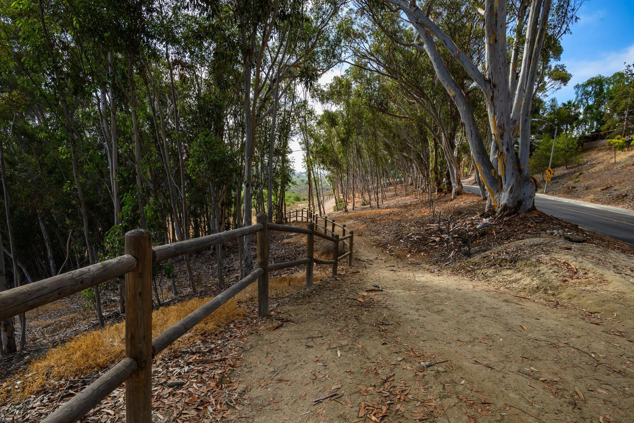
When you reach the eucalyptus grove, you will have traveled 1.1 miles. In another 225 steps, you will reach a break in the fence on the left side of the trail and a branch trail leading steeply down through the trees to your left. This short trail soon leaves the eucalyptus forest and enters a mixture of grassland, coastal sage scrub, and willow-riparian habitats. In addition to the usual coastal sage scrub species, you can find several less commonly observed species, including fuchsia-flowered gooseberry, chaparral bushmallow, San Diego goldenbush, and sawtooth goldenbush, all beautiful when in flower.
Once the trail flattens out, you may not realize it, but you are crossing on top of a small check dam. Urban runoff collects behind the dam, creating a marsh that not only contains a dense thicket of arroyo and Gooding’s black willows, but also rushes. The trail continues east for a short distance, then re-enters a eucalyptus grove and ends at Tamarack Avenue.
Go back the way you came and rejoin the Village H North Trail. Go left and continue for about 0.2-mile to the signed Carlsbad Village Drive crossing at the Victoria Street intersection. In another 0.1-mile you will reach the Village H South Trailhead. It is signed as a 0.5-mile loop trail through another eucalyptus grove. The trail only recently became Carlsbad City property. It was completely refurbished and re-opened to the public in August of this year. The area is very popular with dog walkers.
When you are finished exploring this area, go back to your vehicle the way you got here.