Sponsored
Sponsored
Santa Rosa Plateau Ecological Reserve, near Murrieta in Riverside County, consists of 9000 acres and many hiking trails. The one described here has good hiking with lots of beautiful vistas; wildlife such as birds, coyotes, rattlesnakes, and newts; rolling, grass-covered hills; sprawling oaks; and wildflowers. At certain times of the year, you can spot the snow-covered mountains of San Gorgonio and San Jacinto. Look also for coyotes walking through the landscape, or for their ropey scat on the trail. Listen for the beautiful song of the meadowlark.
Starting at the Vernal Pool Trailhead, walk 0.1 mile to the Los Santos Trail, go left (north), and continue for 1.2 miles. The trail is strewn with volcanic rocks, mariposa lilies, poppies, and prickly pear cacti. (Flowers are more likely in the spring.)The trail leads to oaks, bringing some shade. Watch for shade-loving poison oak as well. It is best to stay on the trail, and rest on benches that are available along the way. While sitting or walking, watch the tall grasses waving in the wind, and take in the California live oaks and Englemann oaks perched on the hillsides.
This is a great area to learn the differences between the California or coast live oak (Quercus agrifolia) and the Englemann oak (Quercus engelmannii). The live oak is a densely branched evergreen tree with prickly-edged, cupped leaves that are shiny, dark green above, and drab green and hairy below. The Englemann oak tree is less dense; the branches are artistically angular. Its leaves are flat blue-green ovals, with smooth edges. It is drought deciduous, meaning that in extended dry and hot conditions it drops leaves. The Reserve has one of the largest stands of these trees in its native southern California range. They grow best above the dry coastal plain and below 4,300 feet elevation.
After 1.0 mile, there is a steep rise covered with chamise (Adenostoma fasciculatum). This shrub, also called greasewood, is a keystone plant of the dense, woody chaparral ecosystem. As a keystone species, it has a disproportionately large effect on its environment; the chaparral ecosystem being dramatically changed when the species is removed. Its small bundled leaves and deep roots allow it to survive long periods of drought. It responds to fire by both resprouting from a burl and germinating seeds stimulated by chemicals in charred wood and smoke.
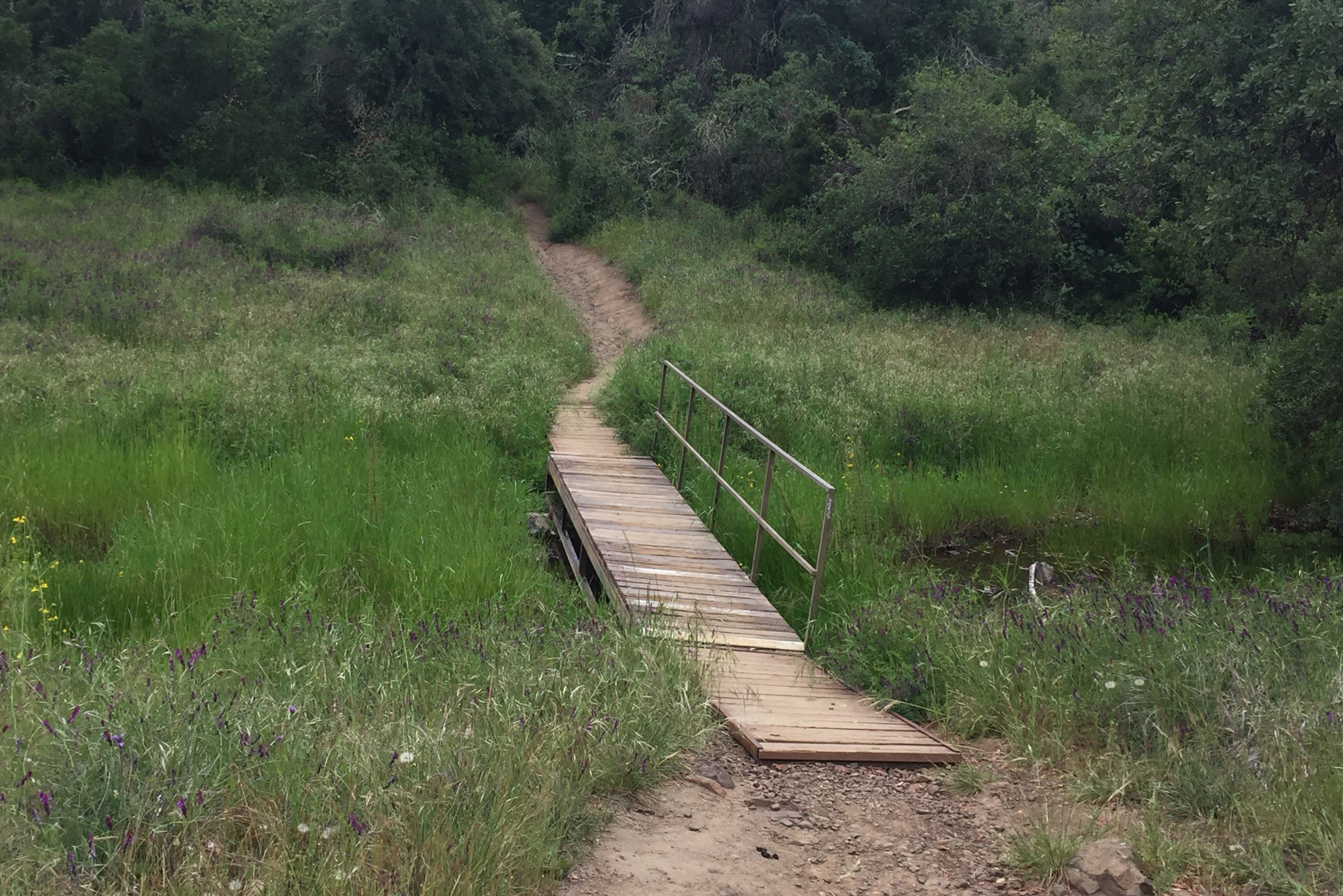
At mile 1.3, turn right (east) at the cutoff to Hidden Valley Road for 0.2 mile. Then turn left (north) onto Hidden Valley Road, walking for 0.7 mile. There you will see a sign for Coyote Trail (east), a beautiful trail with lots of oaks, sycamores, and a stream with a bridge crossing. It’s a good place to look for frogs and newts. In the spring, you will see lots of globe lilies, checkerblooms, purple vetch, popcorn flowers, and scrub oaks. This trail is only 0.5 mile long. When you come to a sign for Trans Preserve Trail, turn right. You will be passing a rise called Poppy Hill on the right. In spring, you will see plenty of poppies and large stands of lupine here.
After 0.9 mile on the Trans Preserve Trail, you will cross Ranch Road and continue on the trail up the hill (south) for 0.8 mile, toward more stands of oak trees. Take time to sit on the bench and enjoy more vistas of the area while listening for the ratcheting call of the acorn woodpecker, the trill of a spotted towhee. You might spot a soaring red-tailed hawk or hear the territorial call of a red-shouldered hawk. Next, there is a trail junction with Vernal Pool Trail. Turn right (west). The parking area where you started, which is just 0.5 mile away, will complete the loop.