Sponsored
Sponsored
According to Jerry Schad, in his book Afoot and Afield in San Diego County, Wooded Hill is the highest peak in San Diego County that is covered by trees. The other nearby higher peaks are all covered by brush. This trail is well named, as you will be in the shade of Kellogg, or California black oaks (Quercus kelloggii) and Jeffrey pines (Pinus jeffreyi) for the majority of the time. On warm days you may catch the scent — variously described as vanilla, butterscotch, or even pineapple — emanating from the Jeffrey pines. Another species of pine tree found in the vicinity is the ponderosa pine (Pinus ponderosa). While the Jeffrey and ponderosa pine trees look similar to the untrained eye, the quickest way to tell them apart is to pick up a pinecone. The Jeffrey cones have inward-pointing barbs, whereas ponderosa pine cones have outward-pointing barbs that feel prickly when touched. This leads to the mnemonic device of “gentle Jeffrey” and “prickly ponderosa.”
This is an excellent trail for the entire family, with a gradual climb to the high point. In the fall, the leaves of the Kellogg oaks will turn a brilliant yellow, ushering in the County’s fall colors. In the spring, the new leaves of this oak will come out in pink, heralding the start of a new year.
The route forms a figure-eight loop. As you leave the parking lot on the marked trail to the left, start up a gentle rise and very shortly come alongside the first oaks and pines. Soon you will come to the crossover point of the figure eight. Stay to the left at the intersection and follow the sign for the Long Loop. (The Short Loop is the trail you will be returning on, and taking it now would quickly bring you back to your car.) Along the trail, you will notice rocks with numbers painted on them. These indicate points of interest, and an interpretive pamphlet can be found at the start of the trail. If none are available at the trailhead, they can also be found at the visitor center a few miles up the highway in the community of Mt. Laguna.
A wide variety of wildflowers makes this a spectacular scene. Golden yarrow, pine paintbrush, yellow pincushion, scarlet monardella, and beaked penstemon provide a colorful display in spring and early summer. Little (or yellow) monardella and wild flax also lend some color.
In addition to the colorful flower display, the scenery is quite stunning. From various promontories along the trail, you can see southeast to Laguna Mountain, south into Mexico, and west to the ocean on a clear day.
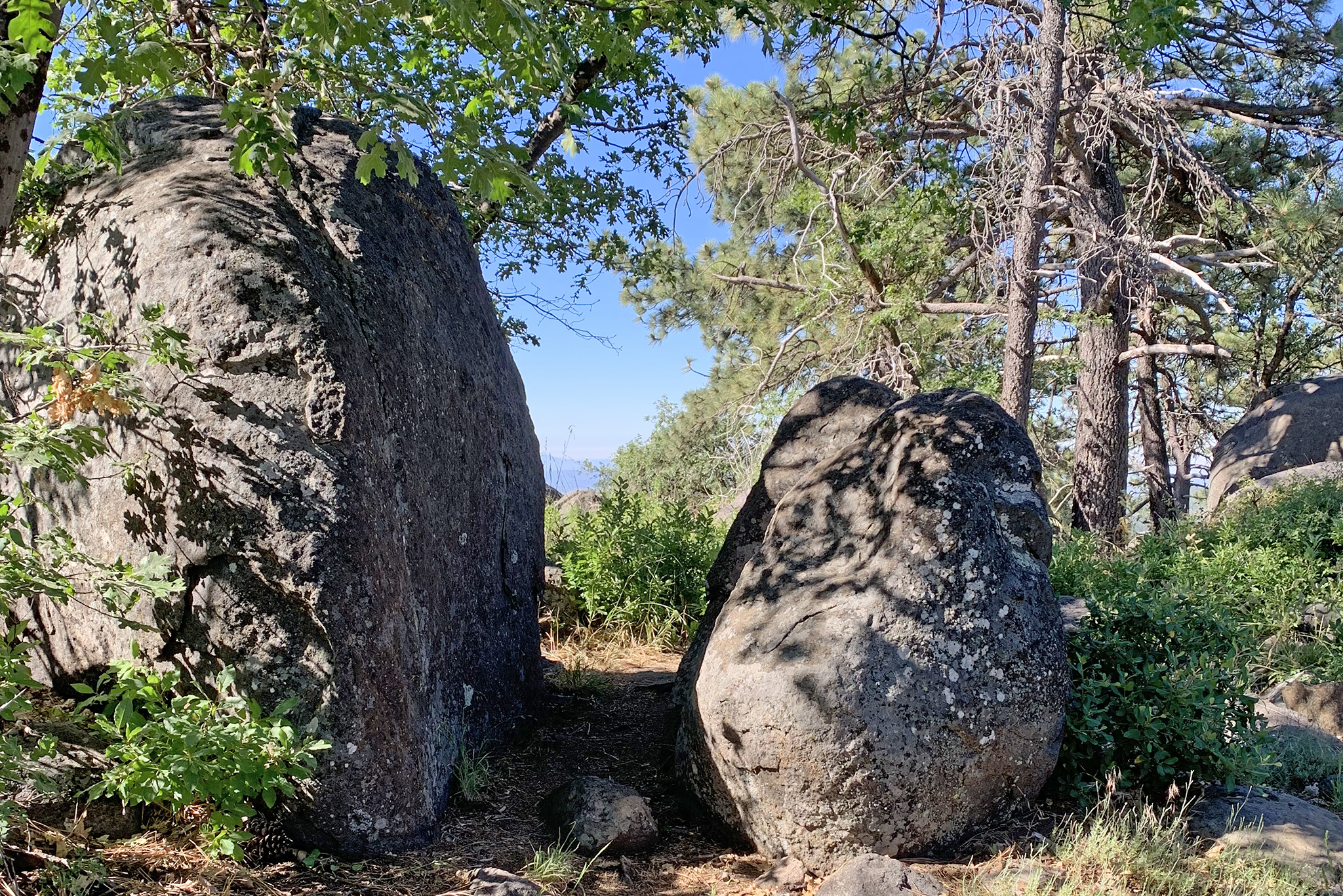
After reaching the high point of the trail (at 6,223 feet elevation), stop and take in the view before passing between two large granodiorite boulders to begin the trip back down to the parking area.
Soon you will see an old water tower off to the left, apparently no longer in use. You will also see a trail come in from the left (Los Rasalies Ravine Trail) that follows along the Sunrise Highway to the north and west. Stay to the right at the trail junction to get back to the parking area.
The remainder of the trail is under the canopy of pines and oaks, with an understory of more wildflowers. As the season progresses, the Utah service-berry and choke cherry will produce fruit, and the mountain mahogany will drop its flowers and give way to long, silvery, feather-like seed structures.
When you reach the figure-8 crossover again, stay to the left and the parking lot will come into view. If you wanted to extend the hike for another mile, take the trail south from the trailhead, which is the Los Rasalies Ravine Trail. This can be followed to the water tower described above. Either return on the Los Rasalies Rivine Trail or follow the original trail back to the parking area.
WOODED HILL (Laguna Mountains)
This hike is short but packed with great scenery, lots of shade, and an abundance of late-blooming native plants.
Driving Directions: From I-8 E, take the Sunrise Highway (S1) exit. Follow Sunrise Highway north for about 8 miles and turn left at the Wooded Hills Campground marker. Go about 0.3 mile to a small parking lot on the left, for users of the Wooded Hill Nature Trail. A National Forest Adventure Pass (can be purchased at the visitor center or Laguna Mountain Lodge general store) is required to park. An enclosed pit toilet is available about 0.3 mile farther down the road at the trailhead for the Agua Dulce loop. Hiking length: About 1.5 miles round trip with an added 1-mile out-and-back or loop extension possible. Difficulty: Easy. Elevation gain/loss 280 feet. Bikes are not allowed. Dogs on leash are allowed.