Sponsored
Sponsored
“Paper charts need no batteries.”
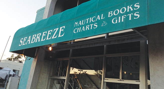
Ann Kinner, Captain, US Coast Guard, has put the little sign strategically among all the rolls of charts in her Seabreeze Book and Chart Store in Point Loma. It’s the kind of display that likely hasn’t changed in seaports for 200 years. You’re surrounded by rolled paper charts peeking out of long cubby holes, dozens of them, along with maps, and books with titles such as Rounding the Horn. Sailing ships and yacht models sit between dangling globes, but make space for this wall given over to the rolls. We’re talking navigational charts from San Diego Bay to Pago Pago, American Samoa.
But do we really need them today?
“People rely too much on electronics,” Kinner says. “And the thing is, electrics and salt water don’t go well together, and batteries can get wet, give out. You have to have a Plan B. These charts are Plan B.”
People who come in here are about to head out of the bay and point their little boats toward South America, Polynesia, or maybe a circumnavigation of the world. Yes, they use their iPads and electronic navigation aids, but they also rely on Kinner and her usually more-detailed charts to get them there. The place is also stacked with spiral-bound reference books such as the Yachtsman Mexico-to-Panama Chart.
“People heading for Puerto Vallarta need that one,” she says.
She’s petite, youthful, serious, competent. And she wants you to know how to get there the old-fashioned way, using paper charts that you roll out on your captain’s table, measuring distances with needle-pointed dividers. Just as Columbus or Captain Bligh did it, combining sextant readings of the heavens with tide and current guesstimates to figure out where da heck you are.
“That’s the thing,” she says. “The danger to many of today’s sailors is they believe electronics will do all the work for them. But, like everything, electronics depend on the quality of the information inputted into them. They sometimes base their calculations on outdated charts. Some have chart information derived from the Captain Cook era.”
Yes, printed charts can be inaccurate too, but she says printing on demand can incorporate changes.
“It’s important. Just look at the shifting shoals in San Diego Bay, or Oceanside Harbor. Or Hawaii’s Big Island. With Kilauea always erupting, their shoreline is constantly expanding. And they have a new island about to be born.”
Also, she says, GPS signals can be febrile and inaccurate by as much as five miles. And GPS can be hacked.
Does she have horror stories? She has horror stories. “The captain of a 40-foot catamaran was in the other day. He had become notorious for sailing the Pacific, five aboard, and trying to cross a reef into an atoll, without charts, at night. They hit the reef, sank. They are lucky they all survived. Now he wants to sail back out to the Marquesas. Hasn’t changed. There are too many idiots out there.”
But actually, she says fewer people are tackling the blue-water voyages. “Twenty years ago, the cruising fleet was more typically younger couples with their kids, sailing around the world. Now, not so much. Sailing, yachts, it’s all become too expensive. Now we have older couples coming in, and they have power boats, and they don’t want to venture as far.”