Sponsored
Sponsored
Tecate Peak is a 3885-foot border sentinel, visible from both Baja California, Mexico, and from Southern California. The actual summit is less than a mile north of the border in California, with a service road that winds to expansive vistas of both countries and the Pacific Ocean.
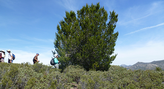
Known as Kuuchamaa to the Kumeyaay, it has been a sacred site for Native Americans of northern Baja California and Southern California for hundreds of years. The summit and much of the northern flanks are on Bureau of Land Management (BLM) property. There is no official trail to the summit. From the gate, you hike up the service road, which can have restricted vehicle access because of road conditions or to protect the environment. Constructed in 1958, the road is a long series of switchbacks, with a steep 15 percent grade. Without the road, the hike would be difficult, given the rocky substrate and mixed chaparral and coastal sage scrub habitat.
The vegetation reflects the metavolcanic nature of the peninsular ranges, with alkaline clay soils derived from gabbro, a dark-colored plutonic rock rich in iron and magnesium. Huge boulders hug the side of the road; many still bear the red stains of fire retardant dropped during the 2007 Harris Fire, which burned most of the Tecate cypress stands on the mountain. This environment also supports the rare coastal California gnatcatcher and endangered Quino checkerspot butterfly.
At the summit is an unsightly array of towers, chain-link fences, and concrete foundations. A fire lookout station was once located here; now there are TV relay towers, but the views make up for the intrusion. On a clear day, you will get a good view of the divide between the U.S. and Mexico, the town of Tecate, mountains in Baja California, the Pacific Ocean, and the sparsely populated landscape of southeast San Diego County. Return the same way.
To learn more about the Kumeyaay, an optional side trip can be taken with the needed current documentation requirements to exit and re-enter the U.S. A parking lot on the U.S. side is available for a small fee, followed by a 15-minute walk from the border into Tecate, Mexico, to El Museo Comunitaria Kumiai (Kumeyaay Community Museum), in a charming structure designed and built by James Hubbell. Hours open: 10 a.m.–5 p.m., Wednesday through Saturday; small fee.
Distance from downtown San Diego: 40 miles. Allow 1 hour driving time (Tecate). Take SR-94 E to SR-188, the turnoff to Tecate, California, and the border crossing for Tecate, Baja California, Mexico. Drive south about 1.6 miles on SR-188 toward the border until there is a sign that reads, “International Border 15,000 feet.” Take a right (west) onto the dirt road just before this sign. It is also easy to get onto the wrong track, due to a maze of roads in the area. The road goes along the corrugated-metal border fence before turning northwest and beginning the climb up Tecate Peak. In about 2.8 miles you should arrive at a gate, which is usually open. There is parking along the road shoulder above or below the gate, but parking above runs the risk of returning to a locked gate. You are bound to run into the Border Patrol, and they are most often helpful and informative. 4WD vehicles are advisable because the road is either rough and rocky or loose and bumpy. If raining or just after, the dirt road can become impassible.
Hiking Length: Depending on where you park, 9–10 miles round trip (it is 4.6 miles from the gate to the summit).
Difficulty: Moderate. Elevation gain/loss 1500 feet. The gate is at 2350 feet. No facilities, water, or shade. Pack a windbreaker, as it is usually blowing at the top with trekking poles recommended due to the steep grade.