Sponsored
Sponsored
The Doane Valley Nature Trail provides a sampling of the many plants and shrubs that can be found at Palomar Mountain State Park. Taking a hike on this trail is a great way to learn about those plants. If you enjoy nature trails with interpretive stations, you will be delighted with this trail. There are 30 unique stations giving a brief description of the plant, shrub, tree, or item featured. Be sure and pick up a trail guide at the trailhead. There is a small fee charged for the guide, and it is worth it as the rangers of Palomar Mountain State Park have done a wonderful job putting it together.
The nature trail runs alongside Doane Creek, and the brochure highlights many of the plants and shrubs that the Luiseño tribe of Native Americans used for food, housing, and/or clothing. A Luiseño band has lived on or near Palomar Mountain since pre-Hispanic times — before 1769. Luiseños are related to the Cupeño, who once lived at Warner Springs, and the Cahuilla who live today at Agua Caliente and further north in the Santa Rosa Mountains and Palm Springs area and east in the Coachella Valley. They speak an Uto-Aztecan Shoshoni language while the Kumeyaay, who live to the south and in northern Baja California, speak a Yuman language. They also have different customs, but their use of plants is similar.
The first station is a stinging nettle (Urtica holosericea) with the recommendation to look but not touch as this plant has chemicals that cause the painful “sting” that the trichomes (hairs) inject! The plant was one of the greens that the Luiseño gathered and ate. Wild rose (Rosa californica) is at the second station. The rose hip is high in Vitamin C. In addition to being a food, it had many uses, both medicinal and religious. Landscape features are also pointed out along the trail. For instance, station 8 highlights where a landslide took place during the winter of 1992–’93 when approximately 80 inches of rain fell on the mountain. You will also learn about mountain wildflowers, such as the thimbleberry (Rubus parviflorus) that grows in abundance alongside the creek.
After following the stream for about a quarter mile, the trail climbs a little into an open meadow where grassland shrubs and flowers can be seen. The trail continues to rise into a wooded hillside, where there is alder, cedar, fir, pine, and black oak (Quercus kelloggii), the oak favored by the local Indian tribes as a staple in their diets as it has less tannic acid to process.
The trail ends on the access road to the Doane Valley Campground, where you can decide whether to turn around and go back down the same trail to see the things missed on the way up or traverse the campground and return to Doane Pond via the road.
Be sure to check at the entrance station to find out if the rangers have any guided nature walks or campfire programs scheduled while there.
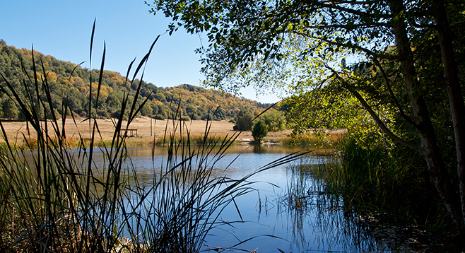
Distance from downtown San Diego: 74 miles. Allow two hours driving time (Palomar Mountain). Take I-15 north and exit at SR-76 E. Drive east 20.7 miles and take the left fork, S-6/South Grade Rd. Drive up the mountain for 6.8 miles to the stop sign. Turn left (west) on State Park Rd./SR-7 and follow the signs to the park entrance. State Parks Pass required or pay day-use fee. Follow the road to School Camp and Doane Pond to the parking lot.
Hiking length: 1 mile.
Difficulty: Easy. Elevation gain/loss about 300 feet. There are two stream crossings and a few steep areas. Facilities at the NE end of the parking lot; nature trail begins just off the parking area before the restrooms. Dogs and mountain bikes not allowed on trails.