Sponsored
Sponsored
The Fry Creek Trail is one of the few places to hike on public lands on Palomar Mountain, other than the trails of Palomar Mountain State Park. The Fry Creek trail climbs through a magnificent, dense mixed montane forest that is reminiscent of forests much further north. Since it receives an average of 48 inches of rain each year, it has a lush growth of conifers and oaks, as well as an understory of manzanita, California lilacs, coffeeberry, and other shrubs.
The name “Palomar” means pigeon roost or pigeon home in Spanish and Palomar Mountain is home to the band-tailed pigeon, as well as the acorn woodpecker, Steller’s jay, golden eagle, and mountain quail. This is a good place to look for birds that may not be seen or rarely seen in the chaparral or desert environments.
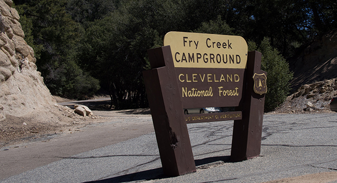
The trail begins near the information boards about 100 feet or so from the campground entrance. After climbing up a small hill, the trail turns to the east, passing near campsite #1, and continues above the entrance road.
Soon the trail makes a hairpin turn and proceeds up the south-facing Fry Creek slope, leaving the campground behind. From this point, the hike is through a dense forest of canyon oak, black oak, coast live oak, Jeffrey pine, Coulter pine, big cone Douglas fir, and white fir. Although there is evidence of recent fires, most of the trees survived with only blacked bark. After hiking about 0.77 mile, there will be a dirt road to cross with the trail continuing on the other side. This will go up to the high point of this trail, in a saddle at 5240 feet of elevation. The saddle is the divide between Fry Creek and an unnamed canyon leading down to Upper Doane Valley in the state park. There used to be a trail leading to the state park from near here, but now it is completely overgrown and is not recommended. An area of planted Coulter pines, known as Penny Pines, lies just off the trail.
After passing the high point, the trail begins its descent down the north-facing Fry Creek slope. Except for a brief period after passing the high point, the campsites will not be in sight. The north-facing slope is steeper than the south-facing slope, so the forest is somewhat less dense, allowing occasional views beyond the immediate trees, including outlooks to the white dome of the Palomar Observatory. Approaching the hike’s end, a few short switchbacks will head down to the campground, near site #9, not far from the campground entrance.
Distance from downtown San Diego: 62 miles. Allow 1.5 hours driving time (Palomar Mountain). From I-15 N, exit east onto Via Rancho Parkway on what will become first Bear Valley Parkway, then continue on S-6 (E Valley View Parkway then Valley Center Rd.). Turn east on SR-76 for 5 miles, then a slight left onto S-6 (South Grade Rd./Palomar Mtn. Rd.) for about 6.5 miles until the intersection. Turn north and continue on S-6 (Canfield Rd./South Grade Rd.) for 2.7 miles to the Fry Creek Campground on the left, just past Observatory Campground. The campground is closed from December 1 through March 31, but remains open to hikers. Park on the right side of the highway and enter the campground on foot. There is a $5 day-use fee.
Hiking length: 1.8-mile loop.
Difficulty: Moderate. Elevation gain/loss of 400 feet. The trail is well constructed, adequately signed, and easily followed most of the year, though it might be difficult to follow in winter if covered with snow. Leashed dogs are allowed. It can be enjoyed year round, but the best times to go are in the fall when the leaves of black oaks change color and again in the spring as their new leaves appear.