Sponsored
Sponsored
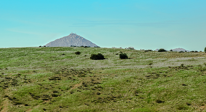
The Simon Open Space Preserve near Ramona is one of several San Diego County parks established in recent years to preserve land where native plants and animals can flourish and we can continue to enjoy them. Although small, this preserve provides over 6 miles of hiking trails through grasslands, chaparral, and riparian habitat with some outstanding views of the surrounding mountains. Many different routes are possible, as there is a web of looping trails covering the lower parts of the preserve, connecting to various suburban streets. However, the trail described here goes to the top of the ridge and to both Spangler and Ramona Peaks.
From Vista Ramona, near Calle Andrea, a well-groomed trail leads west, with houses to the north, but passing through chaparral consisting of California sagebrush, laurel sumac, buckwheat, white sage, and a few black sage. It is slightly above but near an intermittent stream lined with Engelmann oaks, coast live oaks, and the occasional tall black willow. The trail forks in 0.3 of a mile. The branch going off to the right is the one to take up the ridge and to Spangler and Ramona peaks. However, consider going another 0.1 mile on the trail to the left, as it will go to a stream, which bubbles over polished granite slabs if it is flowing. After looking at the stream, return to the fork and start heading up the trail to the top of the ridge.
The trail up to the ridge is roughly parallel to a power line that crosses the preserve. Several trails ascending from below intersect with this ridge access trail. Keep to the right in each case, unless the apparent trail goes to one of the power poles. Initially, the trail mainly passes through chaparral with sugar bush, wild cucumber, buckwheat, deer weed, white sage, and California sagebrush. You will hear, but may not see, the endangered California gnatcatcher flitting about in the sagebrush.
After hiking 1.3 miles and ascending about 500 feet, you will arrive at the ridge top in the middle of a grassy field. Large patches of grassland extend over much of the ridge and the land to the north. Here, wild oats and other nonnative grasses dominate, along with nonnative filaree, but it is not without interest. Meadowlarks can be seen or at least their melodious songs heard, while hawks soar above looking for an incautious field mouse. There are also some beautiful native herbaceous species, including violas, wild hyacinths and soap plants.
There is a three-way junction of trails at the top of the ridge. The trail straight ahead continues to follow the power line, while the trail on the left (west) goes to Spangler Peak. The trail to the right (east) goes to Ramona Peak. It is about 3.7 miles out and back to Spangler Peak while Ramona Peak is about 1.2 miles out and back from the trail junction.
The county recommends equestrians use the Mt. Gower OSP Staging Area as there is limited parking on Calle Andrea. The Rutherford trail leading west from the Mt. Gower Staging Area connects to the trail at the start of the Simon OSP near Calle Andrea. Although drinking water for humans and horses is available at the Mt. Gower Staging Area, as well as restroom facilities, this option adds about 4 miles to the hike. Once you have explored both peaks, return to your vehicle the way you came.
Distance from downtown San Diego: 42 miles. Allow 1 hour driving time. Take SR-67 to Ramona. SR-67 ends at the intersection with SR-78 in the middle of Ramona. Continue straight ahead on SR-78 through Ramona and turn right on Third St. Third St. soon becomes Old Julian Highway, which is followed for 2 miles to Vista Ramona Rd. Go right on Vista Ramona Rd. and drive 1.2 miles to the unmarked trailhead, just south of Calle Andrea, a short suburban street on the right. Park on Calle Andrea and walk back out to Vista Ramona Rd. and about 20 feet south to the trailhead.
Hiking length: 4.4 to 6.2 miles.
Difficulty: Moderate. Elevation gain/loss 1100 feet. The trails, though unsigned, are easily followed with no obstacles to overcome. Short stretches of the trail are steep. Open to hikers, mountain bikers, equestrians, and leashed dogs. No facilities or water.