Sponsored
Sponsored
Kitchen Creek Falls is found in a remote canyon off the south flank of the Laguna Mountains that is easily accessed by the well-maintained Pacific Crest Trail. During the wet season, water from higher elevations flows into Kitchen Creek over bedrock slabs and falls into a small pool. The creek continues to flow south down to Lake Morena. Along the trail are abundant wildflowers in spring and early summer.
From the Boulder Oaks parking area and campground, site of a defunct store, carefully make your way across Old Highway 80, following the signs for the Pacific Crest Trail (PCT) to begin your hike. Follow the trail to the left and down to cross beneath I-8. At this point you are in the riparian zone along Kitchen Creek. It is dominated by cottonwoods that provide abundant shade during the summer months. This is a good spot to see many birds and other wildlife, including mule deer.
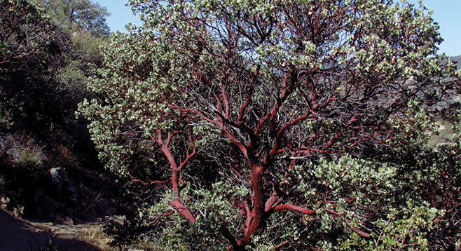
Once you pass under the twin I-8 bridges, the trail begins a sharp rise to the right through a series of switchbacks on a north-facing slope. Wildflowers are abundant along this section of trail in the spring and early summer. Once to the top of the switchbacks, pass through a spring-loaded gate (leave it closed behind you). The trail levels out a bit and will gradually rise through chaparral surrounded by manzanita, ceanothus, prickly pear, cholla, and other common chaparral species. After about a mile, there will be an expansive scenic view down onto this portion of the Kitchen Creek watershed. Even in a very dry year, the numerous cottonwoods along the creek make it appear to be a green oasis.
As the trail continues to climb, the overview of the riparian zone becomes even more stunning. At about 2.2 miles into the trip, the PCT takes a turn to the right and continues up the back side of the ridge. At this point, look for a poorly marked trail off to the left. There is a split granite rock formation pointing to the sky that the trail skirts around before it starts to descend. It is poorly maintained here as compared to the PCT, so be careful of loose rocks and spiny yuccas reaching out into the trail that may impale the unobservant hiker. This trail continues to get steeper and eventually the hiker finds himself scrambling to get down to the level of the top ledge of the falls. The bedrock sheets here provide good traction when dry, but when wet, they are extremely slippery since they are polished by the running water. Note that in dry years, the stream may dry up completely late in the season. So, the best time to visit would be in the spring or early summer when wildflowers are out and the sounds of the waterfall guides you to its location. Return to your car by the same trail.