Sponsored
Sponsored
The present Bow Willow Campground was the site of a large seasonal Kumeyaay village. Many trails radiate out from the campground area, making it a choice staging area for adventure. One trail heads into the Laguna Mountains while another leads to a historic rock house, a remnant of when cattlemen roamed these hills. Still another trail, the one described here, leads to the beautiful palm oases at Mountain Palm Springs. En route, there is an opportunity to visit the elephant tree ”forest” at Torote Bowl, with its dramatic views east to the Carrizo Badlands and marsh.
Start walking northwest from the campground, crossing the wide, sandy Bow Willow Creek wash. Look for weathered 4˝x4˝ posts with yellow tops that mark the trail. An unpainted sign identifies this as the Mountain Palm Springs Trail, and a sign about 0.3 mile from the campground marks the direction for the Southwest Grove and the Torote Bowl. While crossing the 0.7 mile-wide Bow Willow Creek wash, note the widely spaced desert willow, mesquite, smoke, and ironwood trees, which may be in bloom. If the rains have been favorable, there also may be a carpet of colorful annual wildflowers that could include purple mat, desert phacelia, Bigelow’s monkeyflower, chia, and bajada lupine. The trail proceeds up the hillside on the north side of the wash, opening up some grand vistas as you gain elevation. At a fork in the trail, take the left branch to proceed to Torote Bowl, about half a mile ahead.
The Torote Bowl is the upper end of an unnamed canyon and is home to at least 15 large (for an elephant tree) torote, as the elephant tree is known in Spanish. Although rare in the United States, the elephant tree (Bursera microphylla) is common in Baja California. This is one of the largest concentrated “herds” of elephant trees in the Anza-Borrego area and is well worth the hike to view this unusual plant that has a swollen truck reminiscent of its namesake.
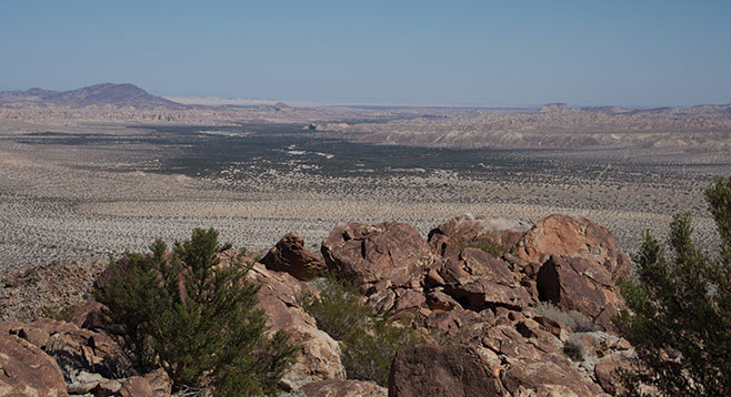
The view from Torote Bowl out to the Carrizo Badlands and marsh is not to be missed and is another reason to take this short side-trip. After examining the elephant trees and taking in the view, return to the trail junction and take the signed trail to the Southwest Grove of palms in Mountain Palm Springs, 1.9 miles from Bow Willow. This large well-watered palm grove offers shade and a cool respite from the desert sun.
At this point, there are two options. Either head back the same way for a slightly less than 4 miles out-and-back hike, or take the well-worn trail east from the Southwest Grove toward the Mountain Palm Springs primitive campground for more adventure. There are six major palm groves in the Mountain Palm Springs area plus many other scattered palms wherever water nears the surface, opening up many opportunities for further exploration. However, the route described here assumes further exploration will be left for another day.
To head back to Bow Willow Campground, find a well-used but unsigned trail leading south up a small gully shortly before arriving at the Mountain Palm Springs trailhead parking area. Following this trail requires close attention, but it is marked with frequent ducks, and it is easy walking through the Sonoran scrub. If the trail is lost, just keep walking west-southwest until Bow Willow Campground comes into view.