Sponsored
Sponsored
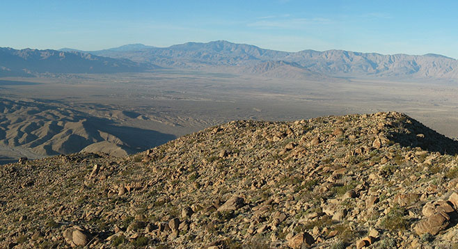
Sunset Mountain takes its name from the last rays of sunshine that enshroud the top with the setting sun. The 3657-foot peak is located south of SR-78 between Pinyon Wash and Harper Canyon. From the top, there are views to the Salton Sea beyond the Borrego Badlands, which make the hike worth the effort. Borrego Valley lies to the north, and the Pinyon Mountains and Whale Peak are to the southwest. The bulk of the Vallecito Mountains stretch out toward Fish Creek.
If hiking in the early part of the year, plan accordingly for short days of sunlight. Carry a light and a jacket if starting the climb any time after 12 noon. Take extra care hiking down, which can be more difficult than hiking up because of the steepness and loose rocks. Trekking poles are recommended. Sunset Mountain can be climbed from various sides, but the route from Pinyon Wash is the easiest.
From the parked vehicle, begin hiking to the east and climb up toward the low point of the broad ridge that lies to the west of the peak. There is no real trail, but one should not be concerned about getting lost. Heading for the saddle and then walking the ridge will avoid the many big boulders that would be encountered if you just went straight up. Keep the summit in view and look back at the trail often for landmarks for the return trip. The main challenge will be finding a way around large rocks, agave, and cacti. After the ridge is ascended, follow it to the summit, where there is a U.S. Geological Survey benchmark and a climbers’ log to record your name. Retrace your path for the return hike.
A variety of plants can be found on this hike from smoke trees, chuparosa, and desert lavender in the wash to jojoba and ephedra/Mormon tea at the higher elevations. A variety of cacti and agave are found at all elevations. Be particularly cautious of the agave staves and the catclaw acacia. Long pants and a long-sleeve shirt offer some protection.