Sponsored
Sponsored
It may be a surprise to many that there are areas of Anza-Borrego Desert State Park (ABDSP) that can be enjoyed during the summer months. The higher elevations are cooler with trails open to various recreationalists. However, because the trails have only recently opened, few take advantage of this great area.
In 2001, California State Parks and the Anza-Borrego Foundation acquired a portion of the Lucky 5 Ranch at the juncture of the Cuyamaca and Laguna mountains along the Sunrise Highway as an addition to Anza-Borrego Desert State Park. The 2126-acre northern portion of the ranch lands are adjacent to Cuyamaca Lake and connect Anza-Borrego to Cuyamaca Rancho State Park, providing a wildlife corridor between the mountains and the desert.
Two trails lead out from the Sunrise Trailhead staging area. The Lucky 5 Trail heads south toward Kwaymii Point, while the short La Cima trail connects to the recommended loop that heads west toward Upper Green Valley. The loop has good views and the trail is well maintained and signed, passing through oak woodlands, chaparral, and meadowlands.
The trail crosses the Cima Conservation Camp paved road and then parallels the road on the north side. At mile 1.37 there is a junction with the Upper Green Valley Trail. Turn left, and at mile 2.0 there will be a boundary sign indicating that you are leaving Anza-Borrego and entering Cuyamaca. The trail will become shaded from the large trees alongside the trail. At about mile 3.0 there will be a junction with the Soapstone Grade Fire Road. Turn right to leave the Upper Green Valley Trail and head up the fire road. At mile 3.7 there will be another junction and a sign pointing to the right for the California Riding and Hiking Trail, indicating that the Sunrise Highway is 2.4 miles ahead. Go right. At mile 4.53 a boundary sign will indicate that you are reentering Anza-Borrego.
As you swing around to the north and begin heading back to the trailhead, there will be sweeping views of the meadow below and a glimpse of Lake Cuyamaca. At about mile 6.2 there is a junction leading to Sunrise Highway and the Fages Monument. If you have not stopped to visit the monument before, take a few minutes to divert a few hundred yards to the monument to learn about Pedro Fages, who discovered the desert while chasing deserters east from the San Diego Mission Presidio in 1772. Then come back to the junction.
As you continue along the trail you will soon pass under large Kellogg black-oak trees. As you turn south a little further, the paved road leading to Cima Conservation Camp will be visible again. At mile 7.7 the large loop will be completed. Turn left and follow the trail back to the trailhead and the parked vehicles.
The trail has a variety of grasses, buckwheat, manzanita, mountain mahogany, scrub oak, ceanothus, chamise, white sage, nolina, willow, coast live oak and Kellogg black oak, milkweed, and even cedar. In late spring, a variety of flowering plants will also be visible.
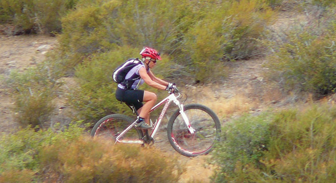
Equestrians, mountain bikers, and hikers can all enjoy the area. Camping is allowed near the trailhead, and there is no charge for camping. Equestrians will find water and several corrals for their horses. The water in the trough is not for human consumption. Ground fires are prohibited because of the surrounding grass and potential fire danger.
From the Sunrise Trailhead, equestrians can ride to Los Vaqueros Group Horse Camp in Cuyamaca Rancho State Park or they can ride on the California Riding and Hiking Trail. Mountain bikers will find a variety of good trails emanating from the trailhead.