Sponsored
Sponsored
San Diego is a hiker’s dream. Head east of I-15 and the suburban veneer begins to flake off the landscape as the hills reveal their rugged roots. Travel farther out and the hills swell into scrappy mountains. Many hikers claim that the best hikes lie out here, beyond East County, but my years on the trail have taught me that the best hike in town is only a stone’s throw from Cowles Mountain.
The Fortuna Mountain Trail lies in the heart of Mission Trails Regional Park. It’s not a secret trail, nor is it the most scenic, rugged, or challenging hike in the county — those titles belong to Granite Mountain in Anza Borrego. Instead, it offers something rare that most “serious hikers” tend to overlook: flexibility. Whether you’re just breaking in your first pair of boots or you’re tying the laces to your umpteenth pair of Keens, the trail can be tailored to any level of fitness. Moreover, it’s open year-round, provides a constant change of scenery, and is dotted with friendly hikers.
A moderately challenging hike, the Fortuna Mountain Trail asks its participants to climb two peaks: North and South Fortuna. The challenge takes about three hours, with several interconnected trails if you need to turn back or want to make it harder. The trail can be approached two ways: clockwise or counterclockwise. Clockwise is easier, especially if you start at the West Fortuna Staging Area in Tierrasanta. Here you’ll take the Rim Trail north to the backside of North Fortuna. From the top, you’ll have stellar views of the park, MCAS Miramar, Scripps Ranch, and East County. The trek is just over 6 miles with an elevation gain of around 1300 feet.
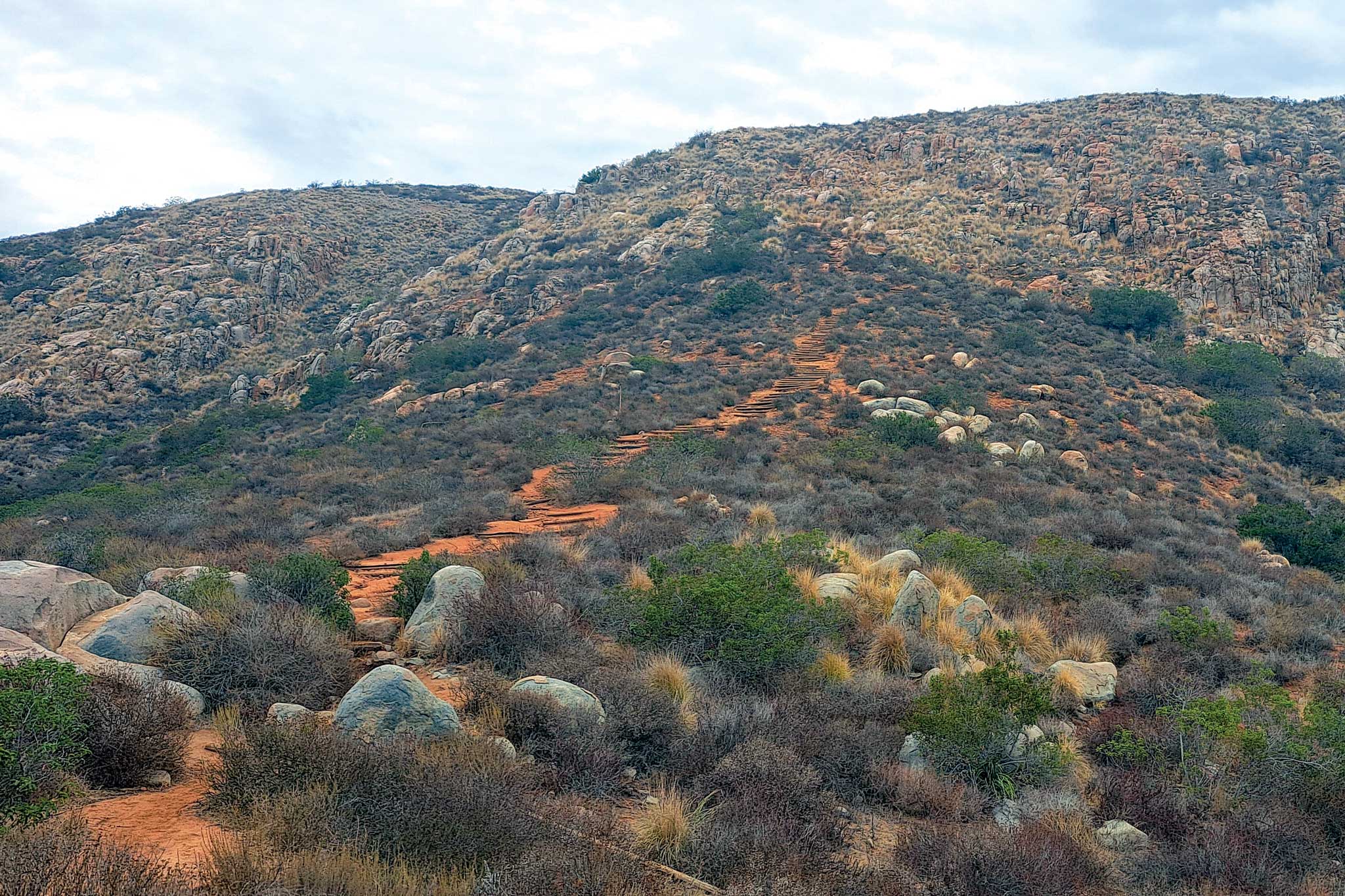
The harder approach is to head counterclockwise, especially if you start from the Jackson Staging Area when the San Diego River is low in the drier season. From here, the hike is just over 7 miles with a gain closer to 2,200 feet. The high point of the trail is a section dubbed “Stairway to Heaven,” where you climb more than a hundred wooden and stone steps up 300 feet over a tenth of a mile. While the climb can be brutal, you’ll top out to find a majestic view of the nearby peaks. The view from the top of South Fortuna is much less rewarding, so find a rock to rest on and keep an eye out for any rock climbers on the granite slopes across the way.
The Fortuna Mountain Trail gives hikers a dose of wilderness without having to travel far. In the drier months, the landscape is brown; in the spring, a lush green. If you traverse the entire loop, you’ll trod along wooden stairs, slippery boulders, rocky trails, gravel roads, and the occasional puddle of mud. A few sprawling, shady oak trees and massive power lines that hum like cicadas will keep you company, as will the occasional buzz of a single-engine plane as it echoes through the valley. It’s the perfect hike to drop by for a couple hours during the weekday to breathe in the wind, take in the sights, and then go back home to shower, eat, and binge HBO. Really, it doesn’t get any better than that.