Sponsored
Sponsored
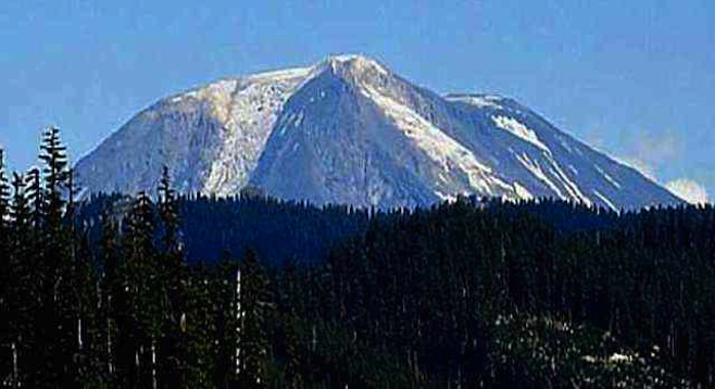
Mount St. Helens is an active stratovolcano located near Washington State's southern border – 96 miles south of Seattle and 50 miles northeast of Portland.
On May 18, 1980, the eruption changed more than 200 square miles of rich forest into a grey, lifeless landscape resembling a moonscape. Instead of erupting upward, Mount St. Helens blew sideways. A 650-mile-per-hour blast of gas, rock and ash swept over a 230-square-mile area, killing nearly everything in its path. The 600˚ F eruption vaporized the forest near the volcano and left other trees standing but scorched to death.
See the remains of the trees that were destroyed where they stood as the blast arrived. Some vegetation has returned to the slopes around the volcano, but it will be years before the forest itself returns.
The first (and least impressive) exhibit you'll approach is the Mount St. Helens Visitor Center at Seaquest/Silver Lake on mile marker 5 on State Route 504 off Interstate 5. It’s somewhat outdated; save it for a stop on the way back down if you have time.
The Mount St. Helens Forest Learning Center at mile marker 33 is free. This is undoubtedly the best of the three exhibits on the mountain. There’s a playground for children and a helicopter to climb into and pretend you're flying around the mountain. The eruption chamber is an experience you can't miss.
At mile marker 52, Johnston Ridge Observatory has an awesome view with great exhibits.
The Northwest Forest Pass is required to visit the sites around Mt. St. Helens. This is a vehicle pass for $5 a day/$30 per year and good in both Oregon and Washington National Forests.
Check the Mount St. Helens websites before planning a visit between October and February, as many times all roads are closed once snow begins in the winter months.