Sponsored
Sponsored
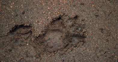
If you want to spot wildlife, the earlier you make the hike to Chiquito Basin, the better. One morning, in the soft wet ground along the way, I discovered fresh tracks of a deer and a mountain lion, both apparently moving along at a running gait. With an earlier start I might have witnessed a terrific chase.
It might bear mentioning that in this remote region of Orange County, mountain lions are occasionally spotted and attacks on hikers and mountain bikers have happened, though that has not occurred recently. To stay as safe as possible, travel in groups and don’t let kids stray.
To get to the starting point from San Diego, follow Interstate 5 into Orange County and make a right at Ortega Highway (Highway 74) in San Juan Capistrano. Drive more or less east on Ortega Highway for 21.7 miles, and then turn left (west) on Long Canyon Road. Proceed nearly three miles to Blue Jay Campground, on the left. An older, shorter route to Chiquito Basin (steep and slippery in places) departs from the far west end of that campground. The newer San Juan Trail, which starts near the campground entrance, is nearly two miles longer (round trip), and not as steep. Wherever you park your car, don’t forget to post a National Forest Adventure Pass.
The wide, rocky path of the old San Juan Trail leads southwest along the ridgeline past some walk-in campsites shaded by oaks and tall chaparral and then pitches downhill. At 0.6 mile and again at 0.8 mile, the new San Juan Trail, with its gentler but longer grade, crosses the old one. Keep straight, if you want, to save time. Between these two crossings, white sage uniformly carpets the slopes on both sides of the old trail; in springtime its dull, grayish foliage is upstaged by Indian paintbrush, a plant parasitic on the roots of the sage.
Continue downhill into the oak-rimmed meadow called Chiquito Basin. This is a great place for birdwatching, picnicking, or loafing. From the western corner of the meadow a faint trail leads to Chiquito Spring, named by early Cleveland Forest ranger Kenneth Munhall, who stopped there one warm afternoon in 1927 with his horse, Chiquito. The spring is bedecked with giant chain ferns and poison-oak vines and buzzes with insects. On the poison-oak-infested slope north of the spring (if you dare to go there), you can find at least half a dozen Indian grinding holes worn into the granitic bedrock.
Return to Blue Jay Campground the same way you came, or pick an alternate route for the way back.
This article contains information about a publicly owned recreation or wilderness area. Trails and pathways are not necessarily marked. Conditions can change rapidly. Hikers should be properly equipped and have safety and navigational skills. The Reader and Jerry Schad assume no responsibility for any adverse experience.
Chiquito Basin
Hike to a quiet hideaway in the Santa Ana Mountains of Orange County.
Distance from downtown San Diego: 94 miles
Hiking/biking length: 2.8 miles round trip (shortest route) • Difficulty: Moderate