Here's something you might be interested in.
Ask a Hipster — Advice you didn't know you needed
Big Screen — Movie commentary
Blurt — Music's inside track
Booze News — San Diego spirits
Classical Music — Immortal beauty
Classifieds — Free and easy
Cover Stories — Front-page features
Drinks All Around — Bartenders' drink recipes
Excerpts — Literary and spiritual excerpts
Feast! — Food & drink reviews
Feature Stories — Local news & stories
Fishing Report — What’s getting hooked from ship and shore
From the Archives — Spotlight on the past
Golden Dreams — Talk of the town
The Gonzo Report — Making the musical scene, or at least reporting from it
Letters — Our inbox
Movies@Home — Local movie buffs share favorites
Movie Reviews — Our critics' picks and pans
Musician Interviews — Up close with local artists
Neighborhood News from Stringers — Hyperlocal news
News Ticker — News & politics
Obermeyer — San Diego politics illustrated
Outdoors — Weekly changes in flora and fauna
Overheard in San Diego — Eavesdropping illustrated
Poetry — The old and the new
Reader Travel — Travel section built by travelers
Reading — The hunt for intellectuals
Roam-O-Rama — SoCal's best hiking/biking trails
San Diego Beer — Inside San Diego suds
SD on the QT — Almost factual news
Sheep and Goats — Places of worship
Special Issues — The best of
Street Style — San Diego streets have style
Surf Diego — Real stories from those braving the waves
Theater — On stage in San Diego this week
Tin Fork — Silver spoon alternative
Under the Radar — Matt Potter's undercover work
Unforgettable — Long-ago San Diego
Unreal Estate — San Diego's priciest pads
Your Week — Daily event picks
Mission Bay Park is all too, too tidy
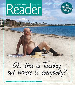
Ok, this is Tuesday, but where is everybody?
Let’s say you’re a redhead. Duck, that is. Or a scaup. Or a falcon looking for rabbits. Or a coot, ruddy duck, bufflehead, or — more likely over Mission Bay these days — a seagull or a crow. Whatever, you’re aloft over the park’s eastern shoreline. You might spot a lone rider below, dusting doggedly over reddy dirt that’s patchworked with cream-and-yellow-flowering groundcover. And you might hear him muttering to himself, because there’s no one else around, “Gimme a break. This ain’t no bay. This is an inland sea!”
That’s yours truly on the bike, juddering along happily enough, except that after maybe ten miles and a couple of arched-bridge crossings, the butt’s feeling battered and the calves are asking for a time-out. The idea was simple enough: just ride around Mission Bay, for a lark, because, really, who gives it a moment’s thought? You usually whisk right past on Interstate 5, maybe pause a moment to think, “Oh, those poor people in De Anza Cove. If I had a mobile home there, I’d fight too.” Then you’re looking at SeaWorld and crossing the river. That’s it: Most people’s experience of what’s been called (depending on who you talk to) the finest aquatic park in America, or the finest example of a major, man-made ecological tragedy.
Here though, on your big-tire bike, you’re not sweating the Big Stuff. You’re more worried about snakes, rabbits, weirdos jumping out of bushes, or getting a puncture. Because, out here, you are alone. You pedal past Perez Cove, South Pacific Passage, and Hidden Anchorage, seeing distant women slick by in their rowing eights, or dozens of grunting paddlers digging the choppy waters from a pair of dragon boats. But then, nothing. Just you, the bobbing bike, and a silent land that feels as unexploited right now as on that Thursday, September 28, 1542, when Juan Rodríguez Cabrillo spied it from his galleon, San Salvador. He was right off Point Loma, trying to decide which “harbor” to try, and he realized — just in time — that this was a tidal marsh, that the real bay was on the south side of Point Loma. He called these meandering sloughs “False Bay.”
False Bay, maybe, but, after the Big Intervention, in the 1940s–’50s, a true inland sea. From here, you look west and north to straits, bays, islands, distant patches of water. And you suddenly appreciate: this place is vast! What an incredible project for San Diego to take on, to create a play park on this colossal scale.
To quote the city’s Parks and Recreation Department website: “Mission Bay Park is the largest man-made aquatic park in the country, consisting of 4235 acres, approximately 46 percent land and 54 percent water. The park offers a wide range of recreational activities, including paths for walking and jogging, and playgrounds for children. It is one of San Diego’s most popular locations to fly a kite, picnic, or sail a model yacht. Fire rings make it possible to cook out and stay warm. Mission Bay Park also offers a variety of free opportunities to the public, such as professional volleyball and Over-the-Line sporting events. Annual attendance in the park is estimated at 15 million.”
How big a deal is that? Twenty-five million cubic yards of sand and silt were dredged to create the land forms of the park, now almost entirely man-made. The San Diego River no longer filters into the ocean through Mission Bay. It has been reduced, for its last mile, to the indignity of a levee-constricted flood-control channel beside the bay. And all to create a kind of giant Disneyland of sparkling white artificial beaches, artificial islands, vacation apartments, jet-ski rental shops, and jogging trails to everywhere except the government island in the middle of Fiesta Bay. (They call that the “Bowling Pin,” because of the shape of the navigation-aid tower sticking up from the middle of the island.)
That’s one Mission Bay. The other? The flyway stopover to millions of birds, the spawning ground for billions of fish? The city virtually said “scram” to that — to the creatures, great and small, who lived here before the decision was made to create a “world-class” attraction (a term that all smaller cities — and San Diego back then was small — attach to their bigger projects).
I’m making this calf-killing circumnavigation to see if there’s a “real” Mission Bay under the Club Med happy-happy façade. Whether, even with its man-made heart, it has developed a sustainable ecosystem it can truly call its own.
I unhitch my bike from the rack of the Number 9 bus next to Perez Cove and SeaWorld, but more interestingly, next to Hubbs SeaWorld Research Institute. First thing I notice is that all of Perez Cove, and the “South Pacific Passage” beyond, is neatly contained between rock revetments on all sides of the channel. This is a tidy bay. Maybe too tidy. Like some giant’s garden pond, nothing rough and ready, nothing left to chance and nature. The second thing that stands out is the noises coming from the treetops in the Institute’s garden. I look up, and there, high in the branches of three Torrey pines that lean out over the bay, sit dozens of giant stick-nests. An almost-grown bird looks down at me. It’s a great blue heron. A parent swoops out of a nearby nest and heads down over the waters. Score one for wildlife, beyond Shamu’s cage.
I’m not quite sure which direction to go, so I ride west under the Ingraham Street bridge to the Quivira yacht basin. One or two sea lions bark out from the bait barge moored in the middle of the basin, and I can hear the smack-smack of 100 halyards blowing against their aluminum masts. Fishing boats sit groaning against each other. The names appear in big block letters across their transoms: The Pacific Voyager, Legend, Cortez, New Seaforth. One is hauling in her hawsers at the bait barge, heading out toward the channel; it’s a large boat, with lots of people aboard. You have to wonder: Is she heading south for Cabo, San Nicolas Islands? The French island, Clipperton? Or just the kelp beds off La Jolla?
My voyage is of a more modest kind, but I still ask the first couple of people I come across which way to go. “Just start riding east,” says this middle-aged guy, Jim. “The path will take you up by Fiesta Island. That’s the least-civilized part of the bay. There’s land up there they haven’t decided what to do with yet.”
“But you have no idea how civilized Mission Bay has gotten,” says his buddy Ron. “We were both brought up here. When we were kids, our houses looked out over mud flats. A few fishing shacks. And ducks? This was called ‘Duckville.’ But you’ll be surprised how much space there still is here.”
Five minutes later, I’m still hanging around west of the Ingraham Street bridge when I meet another guy, Bill, who says, “You should go to Fiesta Island.” He’s a bright-eyed 63-year-old riding a lowrider bicycle that pulls a little trailer cart behind it. Looks as if he’s got his life packed aboard. “There’s a guy hands out free meals there tonight,” he says. “Mission Bay, they look after you. And if they don’t, there’s always O.B. But that’s across the water.”
By “water,” he means the San Diego River channel. How he puts it means a lot, separating “real” San Diego — and its bigger, more famous, more legitimate bay — from here. As if this were a different country, with its own denizens, its own partisan take on things.
Half an hour later, I’m up alongside Fiesta Island. It’s as Jim said. Empty. Couple of rabbits, wind whisking. Hard to differentiate from the distant rush of traffic. Could that be the 5? There’s an occasional hardscape leading down to a canopy that shelters seats at the water’s edge. Farther on, beside an impromptu parking lot, a bulldozer has scraped a stretch of land, 100 feet long and 10 feet wide, from the underbrush. It turns out this is a model-plane airport. A sign lays out the rules for launching, landing, and racing. Then a tarmac-sealed road branches down to the water. Fiesta Island Road. It runs across a causeway onto a whole huge chunk of land that stretches off to the north and south. It’s as desolate an island as you’d care to see, with a road bordered by tussocky underbrush, berms protecting sunken, inland plains of dirt and stress-growth underbrush. Not a tree in sight.
I keep pedaling against the flow on this one-way island-perimeter road, circling west along its south coast, just to see if Bill’s right about the free-meal handout. I can’t believe anybody would pick this location to do it in. I head on till I find myself skirting the north shore of the inlet called Hidden Anchorage. Only sign of life is a distant man and a dog. Then I spot a ski-jump platform out in the water. A couple of runners puff by, then two racing-bike riders. Apart from that, it’s me, a high-flying, sweet-voiced songbird, and the wind.
I search, but no handout, nowhere, so I turn around, and when I’m almost back to the causeway I come upon a group of twentysomething girls and boys who have started a fire in a fire ring. “Spruce,” says a guy, Chris, when I ask what kind of wood he’s using. He’s in construction, so he can get plenty of good-burning wood without nails (they’re not permitted). He comes out here because of his black Lab, Thomas. Chris says that this is the only large wild area he knows where you can really run a dog off-leash. “We’re here every night,” he says.
Back across the causeway, I head north, the undeveloped areas giving way to grassy, cozy waterside areas with specialized uses, such as a playground for disabled kids, and then the luxuriously maintained areas around a Hilton Hotel. From here on, it’s more predictable and mowed-lawn civilized, and, yes, cute. De Anza trailer park shines across De Anza Cove, which makes it look sadly romantic. Twenty minutes later, I pass through the village’s guard post. Inside, it’s break-your-heart charming. Like Pompeii before the eruption, this village’s clock is ticking. Difference is, people know the end is nigh. Even the residents’ lawyers concede that they don’t have a legal leg to stand on. There are no squatters’ rights here, no matter how entrenched and genteel the community they’ve created.
And genteel it is. Everything is neat, village-like, scaled down. The small yacht club, the mobile homes, the community garden, the streets with their flower names: Astor, Begonia, Camellia, Narcissus. You can see from some of the gardens that folks have retired here and created little worlds they’d always dreamed of. On De Anza Bay Drive, there’s a Japanese-style house, with a perfect Japanese garden. Everything is to scale, and there are views, uninterrupted, across the artificial inlet of De Anza Cove. One perfect yacht is anchored in the middle. No wonder the city and the developers want to get their hands on this for parkland, which would probably mean a big fat hotel and other taxable development.
Indeed, the sense that this is a doomed society is brought home at the glass-walled, smart-looking community center. I feel like a voyeur, cruising round on my bike. You can see right through the building to the pool area. There are five girls in a Jacuzzi but nobody using the pool, or the bar, or the dining room. That’s it, life at the end of a lease.
I’m starting to get tired. The civilized path helps along here, but I want to move on. The sloughs of the Kendall-Frost Reserve and the Northern Wildlife Preserve shine green in the afternoon light. And then the path swoops you ’round Crown Point, into Sail Bay. I bike past crystal-white sand beaches and the venerable, still-charming Catamaran Hotel. Even more charming is the tight, footpath-linked community of mostly prewar cottages that make up the Mission Beach peninsula community behind Santa Clara, San Juan, and Santa Barbara coves. It’s San Diego’s most densely developed residential community, with the smallest lots in the city. If they could make density look and feel so good in the ’30s, what’s our problem today?
I pass the Bahia Resort Hotel, with the Paradise Point Resort just a one-minute windsurf across the water on Vacation Isle. Then, a bridge across the Mission Bay Channel, around the Hyatt Islandia, back down to Quivira yacht basin, and it’s over. Whew. It’s taken most of the day, with coffee stops at places like the Olive Cafe on Santa Clara Place, and beach stops, and hotel stops. Butt-relaxing stops. I’ve just biked 14 miles of pathways around an area that encloses 27 miles of shoreline. Of this, 19 miles are sandy beaches, including eight official swimming areas.
That’s the thing, especially on this western side of the bay: it’s all so…soigné. Just a sand-spit away, the wild Pacific pounds on Mission Beach shores, but here, all is surrealistically calm, glassy. Fantasy Island. You expect Ricardo Montalbán momentarily. And, okay, this is Tuesday — but where is everybody? The white beaches, the sparkling waters, empty. Only the Mission Bay Aquatic Center, billed as the world’s largest, seems to have things going on. College kids use it big-time, for credit-approved water sports. Rowing, sailing, windsurfing, CPR training.
Not only that, but, apart from those great blue herons in the Torrey pines and a few ducks settled in the grass here and there, you don’t see a lot of wildlife. Half a century on, you have to wonder: if people and birds don’t seem to want to use Mission Bay, how viable is this great man-made fun park?
“It’s true, it’s changed here. People aren’t coming like they used to,” says Jimmy, who owns Jake’s Tiki Bar (Jake was his dog) on Quivira Way, more or less where I started this odyssey. Jimmy is one of the characters of the bay. So is his palm-thatched tiki bar. Inside, he has photos of Clark Gable posing with a passel of fish (at Broadway Pier, not here). There’s a picture of the Mission Beach (later La Jolla)–downtown trolley in 1915, when it carried you downtown quicker than a bus does today, 94 years later. Outside, customers have put up wooden, paint-daubed direction signs on the posts holding up the palapa. “Paris, 5672 miles.” “Scottsdale, 350 miles.” “Dog Beach, 50 Butt Sniffs.” “Pago Pago, 4942 miles.” “Pacers, Just a Kiss Away.”
So why aren’t people using The Bay? Is it the economy? “No,” says Jimmy. “It’s a lot of things. They used to have the Summer Pops here. They took that away. I don’t know. It has become a weekend thing. A Sunday thing, a Fourth of July place. Because we do have the best place to watch fireworks. We see four [different displays] from here.”
I get my friend Rod, who’s a Mission Bay–based lifeguard, on the phone. His headquarters are just west of Jake’s. “The thing I don’t get about Mission Bay is nobody uses their boats,” he says. “They have five marinas here. I was in Australia last year, and everybody uses their boats, every weekend. Here, they just sit in port.” He says the $625 yearly mooring fees are too cheap — you don’t have to be a serious boater to get in. “They should make a mega-yacht marina in Mariner’s Basin. You’re out in the ocean in five minutes from here, whereas imagine how long it would take you to get to sea from, say, South Bay, Chula Vista.” Plus, he says, Mission Bay is too shallow. “The average depth is nine feet.”
Hmm. Nine feet? That means that “False Bay,” nearly five centuries and many millions of dollars later, would still be impossible for Juan Cabrillo to navigate. His 100-foot galleon, San Salvador, had a draft of 10 feet and needed at least 12 feet of water.
The only people who do use the bay on weekends, Rod says, are jet-skiers. “People drive them like they’re Zambonis. They just slam ahead. We get the most horrific accidents.”
Talk to Pete Cuthbert, and you might be convinced that Mission Bay Park is a marvelous example of a small town creating a huge attraction by sheer vision and guts.
“People don’t realize it today, but Mission Bay made San Diego,” he says. Cuthbert is a retired San Diego city planner who was much involved in the development of recreational facilities for the area. “It gave us something other than the military to rely on. To take on a project of this size was unbelievable. We couldn’t and wouldn’t do it today. But with the hotels and SeaWorld, it’s self-supporting; in fact, it creates an awful lot of wealth and tax revenue. And it has turned mud flats into something of real beauty.”
Cuthbert says that Mission Bay’s islands are made up of little bits of everything. “Six inches of the islands’ topsoil is manure from sewage. The solids were filtered out. Then the dredgings from the bay, and also a little bit of El Cajon — when they were digging through El Cajon’s ten feet of thick loam to build Parkway Plaza, and for Sears’ basement, all that soil was transported to Mission Bay, to help build the islands. They were very creative.”
Indeed, when you look at the history, this inland sea is a truly miraculous creation. And it was largely the work of one man, Glenn Rick, planning director of the City of San Diego from 1928–1955. He was called the “Father of Mission Bay Park,” starting back in 1926.
Actually, the possibility of engineering “False Bay” to a more useful life began in, if you can believe it, 1602, when, 60 years after Cabrillo, Spanish Captain Geronimo Palacio prepared the first engineering map of Mission Bay. The real drive started during WWII. The mayor of the day, Harley Knox, feared a postwar return of the Great Depression. Knox, and councilmen such as Jerry Crary, believed Mission Bay could be key to the city’s transition from wartime to peace, with a move away from economic dependence on the military. In July 1944, the city council designated Rick to “supervise the work of converting Mission Bay State Park into a top-notch municipal playground.” Remember, this was a town of 362,000 souls in 1945, with a six-man planning department.
For his day, Glenn Rick was unusually sensitive to the environment. His son William says his dad “pushed hard for the environmental point of view but lost out to more active interests. [He] pushed for 19 ‘natural’ wildlife areas but achieved only 5. In the end, the contribution of the Kendall-Frost lands east of Rose Creek provided the principal natural area.”
The other losers were the Kumeyaay people, who had been using the sloughs for 10,000–12,000 years. Nothing was done, or probably even thought about, to accommodate a traditional way of life that depended on healthy marshland for its fish, shellfish, and birdlife.
“We used to have several year-round coastal villages,” says Michael Connolly Miskwish, an elder with the Campo band of Kumeyaay Indians and a former NASA engineer. “During the winter, our populations would swell as families came down from the mountains. It was a time of reunion. Dozens of clans would come. They would use the marsh plants to build boats with. They would use the clumps of tar that would float down from, say, L.A’.s tar pits, to waterproof them. But when the Spanish settled, our only [contribution] was as labor to build a berm to stop the river from switching and pouring into San Diego Bay, which it had done regularly, silting it up. They needed deep water for their ships. But we have never been consulted, by them, or the Americans, when it comes to Mission Bay.”
Jim Pugh was a budding environmentalist when the bulk of Mission Bay was dredged, but, as a student, he was too young for them to think of consulting him. He wishes they had.
“Is Mission Bay a tragedy? Oh yes,” he says. Pugh is renowned for his work in saving nearby Famosa Slough, called by some the last ecologically viable remnant of Mission Bay. “If you’re a duck or a fish, Mission Bay has been ruined. Your marsh has been taken away. Before, this used to be called ‘Duckville,’ because there were so many migrating ducks that would come and rest up here on their flyway between Alaska and points south.”
He says it would be very hard to mitigate now. “It was a huge deal when they took this estuary away. It’s the equivalent of dredging the San Elijo Lagoon. Almost as big as taking away the Tijuana River estuary. When they started serious dredging, in the 1950s, their target depth was 15–17 feet. They piled all that sludge to create Vacation Island, and Ski Island, and above all, Fiesta Island.” The result is that the bay is about half as big as it was before, and more or less lifeless.
“I kayak,” he says, “and Mission Bay is pretty boring. The shorelines are all rock revetment. There’s no life there. If they had preserved [the natural shorelines of] tidal channels, there would be far more. There’s only one little place where natural marsh occurs, the Kendall-Frost marsh [16 acres up near the Rose Creek inlet]. And you’re not allowed in there. So you can’t paddle among wildlife. There’s no place where you can really see wildlife.”
What did the website say — 4235 acres for man? Subtract 16 acres for the entirety of the rest of nature, and we win big, 4219 to 16.
Pugh says the city hasn’t seen the error of its ways. “They’re gearing up for another dredging program. That is only good for ski-boat users. The waters of Mission Bay don’t flush well. With deep water, when the tide comes in, and then goes out, up and down from 2–10 feet, say, only a small percentage of the water gets replaced. Remember, there’s only one entrance. To make the flushing better, you need to make Mission Bay shallower, not deeper. Then it would flush far more.”
He says people haven’t grasped the role of marshes and intertidal wetlands.
“Tidal wetlands are where life is spawned, where fish come to have babies. They need creeks, inlets with shallow waters. Only in shallow waters does plenty of sunlight penetrate to grow aquatic plants to provide food and oxygen for the fish, and concealment for the baby fish hiding from bigger fish, and from birds. So fewer plants means fewer fish means less food for all, including shore birds.”
Pugh maintains a special disgust for the city’s program of cleaning the sand for those crystal-clear beaches. “By getting rid of the seaweed, we kill all naturally occurring life, especially insects. For instance, the leaf hopper — which feeds exclusively on seaweed — he’s rich pickings for shore birds. Instead, we pay for the removal of the seaweed, we dredge the natural shallow waters, and we end up, at great expense, with sparkling white sand that looks great but is actually dead, a sterile shore environment that starves birds looking for food. All except for gulls and crows. They eat our picnic remains.”
The result? A dead zone in the Pacific Flyway, says Pugh. Millions of birds that give and get life from these marshes have had to find somewhere else to go, or starve.
“I tell you, if Mission Bay were healthy, at some times of the year the birds, the migrating ducks, would blot out the sun. They would be so many, if this place was welcoming.”
Of course, some still come, in relatively tiny numbers, to the San Diego River flood-control channel, and especially to that last remnant of the original Mission Bay marshlands, the Famosa slough. But what birds are we missing? Take a big breath — the list includes coot, ruddy duck, bufflehead, northern pintail, green-winged teal, scaup, redhead, loons, more ducks such as mallards, pintails, cinnamon teals, shovelers, the great blue herons, egrets, green-backed herons, and black-crowned night herons (all dependent on California killifish and mosquito fish that should be so abundant in shallow waters), plus Belding’s savannah sparrow and various shorebirds, including avocets, black-necked stilts, and killdeer, which forage and nest in sheltered areas of the wetland. Then add a whole raft of endangered birds (not surprising, given the fact that 90 percent of all California wetlands have been dug up and sealed over), such as California least terns and the light-footed clapper rail, which nests in the tall cord grass of the Famosa, and also in Kendall-Frost Reserve, and you begin to understand why San Diego County wetlands are the most threatened resource on the California coast.
So is it too late to do something to turn back the clock in Mission Bay?
“Let the bay restore itself,” says Jim Pugh. “Stop the dredging, or at least cut it down. The bay will do the rest. Let it become shallow again. Then the tides could flush it more effectively, more plant life would grow, more fish would spawn, more birds would return to eat them, diversity would return. If we really cared about balance with nature, we’d allow much more marsh to come back. Back in the ’50s, they originally only planned to dredge half of the bay and to leave the rest as a wildlife refuge. But once they started dredging, they somehow couldn’t stop themselves.”
But, he says, one light in the dark is that the Mission Bay Master Plan does talk of returning Campland, the commercial campsite at the northern end of Mission Bay Park, to marsh. “Then this would become a more interesting place. People long to watch wildlife, to have it around them. They could look at the life from boardwalks built over the grasses. Back in the early ’60s, I took a rowboat up one of the little creeks into Kendall-Frost, before it was put off limits. I lay down in the bottom boards, out of sight, and just watched the birds. It was incredible. Beautiful. They were all around me.”
He says that at Mission Bay’s Cudahy Creek, which used to run with animal blood and guts from a meat-packing plant, the marsh is already trying to come back. Unfortunately, sometimes circumstances are just too much. “Kendall-Frost Reserve is shrinking, because of waves caused by boats and by winds on the deep water. It’s retreating about a meter a year.”
And what of the biggest single area in the bay still largely undeveloped, 485-acre Fiesta Island? Let’s not overdevelop it, says Pugh. “From the start, it was envisaged as a ‘natural place for tranquility,’ an ‘aquatic Mission Trails.’ There again, the northern part was to be graded to return to marsh habitat. Now they’re talking of roads and shore development. That shouldn’t happen.”
Carolyn Chase, one of San Diego’s best-known voices for the environment and founder of San Diego’s Earth Day, thinks Fiesta Island should be allowed to go to the dogs. “Mission Bay has miles of underutilized white sandy beaches for people, but at Fiesta Island, people and their dogs are there every day. Dogs can run unleashed all around the 95 acres of the island that is fenced. Over the years, this fenced area has turned into the major recreation area for folks who walk, run, bike, or exercise with their dogs off-leash.”
She fears that the city, to accommodate needs such as dragon-boat activities, and to make more “nice” areas for “corporate picnics,” will create yet another beach, and a road to access it that would cost “millions.”
“The fact is,” she says, “a group of dog-lovers who use and love Fiesta Island have formed an organization [FIDO — Fiesta Island Dog Owners] which already has 3600 members. That makes them the largest user-group of Fiesta Island. And, unlike others, they use it every day.” She says people are passionate about keeping that section of the island wild and loose. Even the Dog Whisperer, César Milan, used this area to help rehabilitate a dog suffering from post-traumatic stress disorder, Chase wrote in her magazine, San Diego Earth Times, last year. “He said it was the only place in Southern California where he could take him.”
But odds are the pressures to “gentrify” Fiesta Island will continue apace. Ever since big-hearted George Marston — a civic booster with boundless optimism but a very conventional, conservative view of civic planning — the pressure has been to tame, bring order, and follow the “acceptable” aesthetic diktats of his — and our — day. Copying English garden design was cool. Tipping the hat to Spanish architecture was cool. Learning from the Kumeyaays’ 10,000 years of accumulated knowledge on how to guide and plan the region was not cool. Looking to strictly Mexican ideas, like planning our aesthetics around the basic desert nature of the land, was not either. Not unless they were themselves copying European traditions. Or — as Jennifer Luksic and Nik Kendziorski of the San Diego Historical Society write in the Journal of San Diego History: “Mediterranean and Iberian fantasy worlds became the focus of much of the architecture and land-use development in San Diego…Civic boosters and entrepreneurs romanticized Southern California with images of lush landscapes and environments that would appeal to the East Coast. George Marston helped to create the image that was being marketed. San Diego sold the climate and only had to create the landscape, a European landscape, to make the fantasy a reality. Historian Lucinda Eddy writes, ‘Although some visions changed over time, the image of San Diego’s ideal location, situated between mountains, desert, and ocean, and its near-perfect climate, remained intact. In addition, the conscious effort to transform the landscape from semi-arid desert to tropical paradise had an enormous impact on the selling of San Diego…’ ”
Mission Bay Park, with its “islands” of palm trees and Pepsodent-white beaches and hotels with blue pools, fits that desired take. Wetlands, sloughs, and untidy Fiesta Island dog-runs do not. Nor does bird poop, already the number-one “vandalizer” of the park. Blame the human-dependent birds — gulls, crows, pigeons, and pelicans.
Meanwhile, let’s not hold our breath for the return of a billion migratory birds, or even the vision of happy, leash-free dogs dashing through rough undergrowth. We’re on a different trip in Mission Bay. Bring your doggie bag, please.
But…as I’m about to head for the Number 9 bus, southbound, I get a reminder not to be all eco-pure and doom-laden. I come across Wes Holland, here at Quivira Basin. He’s soaking wet. He just managed to capsize his sea kayak when he was coming alongside at the jetty. He’s laughing. “I had to do it at the last moment, so everybody could see,” he says. He’s coming in to Aqua Adventures kayak center. It turns out he’s a Navy officer who’s spent the last five years with the Navy SEALs, much of that time in Iraq. “This place is so good,” he says. “I’m here every day. Just to go out and watch the reflections on the water on a still morning. I was at a lake in Iraq. No way you could do this there. Not just the situation, but the pollution. Believe me, you guys have made a paradise here.”
Here's something you might be interested in.
Mission Bay Park is all too, too tidy
Ok, this is Tuesday, but where is everybody?
Mission Bay Park is all too, too tidy
Ok, this is Tuesday, but where is everybody?
Let’s say you’re a redhead. Duck, that is. Or a scaup. Or a falcon looking for rabbits. Or a coot, ruddy duck, bufflehead, or — more likely over Mission Bay these days — a seagull or a crow. Whatever, you’re aloft over the park’s eastern shoreline. You might spot a lone rider below, dusting doggedly over reddy dirt that’s patchworked with cream-and-yellow-flowering groundcover. And you might hear him muttering to himself, because there’s no one else around, “Gimme a break. This ain’t no bay. This is an inland sea!”
That’s yours truly on the bike, juddering along happily enough, except that after maybe ten miles and a couple of arched-bridge crossings, the butt’s feeling battered and the calves are asking for a time-out. The idea was simple enough: just ride around Mission Bay, for a lark, because, really, who gives it a moment’s thought? You usually whisk right past on Interstate 5, maybe pause a moment to think, “Oh, those poor people in De Anza Cove. If I had a mobile home there, I’d fight too.” Then you’re looking at SeaWorld and crossing the river. That’s it: Most people’s experience of what’s been called (depending on who you talk to) the finest aquatic park in America, or the finest example of a major, man-made ecological tragedy.
Here though, on your big-tire bike, you’re not sweating the Big Stuff. You’re more worried about snakes, rabbits, weirdos jumping out of bushes, or getting a puncture. Because, out here, you are alone. You pedal past Perez Cove, South Pacific Passage, and Hidden Anchorage, seeing distant women slick by in their rowing eights, or dozens of grunting paddlers digging the choppy waters from a pair of dragon boats. But then, nothing. Just you, the bobbing bike, and a silent land that feels as unexploited right now as on that Thursday, September 28, 1542, when Juan Rodríguez Cabrillo spied it from his galleon, San Salvador. He was right off Point Loma, trying to decide which “harbor” to try, and he realized — just in time — that this was a tidal marsh, that the real bay was on the south side of Point Loma. He called these meandering sloughs “False Bay.”
False Bay, maybe, but, after the Big Intervention, in the 1940s–’50s, a true inland sea. From here, you look west and north to straits, bays, islands, distant patches of water. And you suddenly appreciate: this place is vast! What an incredible project for San Diego to take on, to create a play park on this colossal scale.
To quote the city’s Parks and Recreation Department website: “Mission Bay Park is the largest man-made aquatic park in the country, consisting of 4235 acres, approximately 46 percent land and 54 percent water. The park offers a wide range of recreational activities, including paths for walking and jogging, and playgrounds for children. It is one of San Diego’s most popular locations to fly a kite, picnic, or sail a model yacht. Fire rings make it possible to cook out and stay warm. Mission Bay Park also offers a variety of free opportunities to the public, such as professional volleyball and Over-the-Line sporting events. Annual attendance in the park is estimated at 15 million.”
How big a deal is that? Twenty-five million cubic yards of sand and silt were dredged to create the land forms of the park, now almost entirely man-made. The San Diego River no longer filters into the ocean through Mission Bay. It has been reduced, for its last mile, to the indignity of a levee-constricted flood-control channel beside the bay. And all to create a kind of giant Disneyland of sparkling white artificial beaches, artificial islands, vacation apartments, jet-ski rental shops, and jogging trails to everywhere except the government island in the middle of Fiesta Bay. (They call that the “Bowling Pin,” because of the shape of the navigation-aid tower sticking up from the middle of the island.)
That’s one Mission Bay. The other? The flyway stopover to millions of birds, the spawning ground for billions of fish? The city virtually said “scram” to that — to the creatures, great and small, who lived here before the decision was made to create a “world-class” attraction (a term that all smaller cities — and San Diego back then was small — attach to their bigger projects).
I’m making this calf-killing circumnavigation to see if there’s a “real” Mission Bay under the Club Med happy-happy façade. Whether, even with its man-made heart, it has developed a sustainable ecosystem it can truly call its own.
I unhitch my bike from the rack of the Number 9 bus next to Perez Cove and SeaWorld, but more interestingly, next to Hubbs SeaWorld Research Institute. First thing I notice is that all of Perez Cove, and the “South Pacific Passage” beyond, is neatly contained between rock revetments on all sides of the channel. This is a tidy bay. Maybe too tidy. Like some giant’s garden pond, nothing rough and ready, nothing left to chance and nature. The second thing that stands out is the noises coming from the treetops in the Institute’s garden. I look up, and there, high in the branches of three Torrey pines that lean out over the bay, sit dozens of giant stick-nests. An almost-grown bird looks down at me. It’s a great blue heron. A parent swoops out of a nearby nest and heads down over the waters. Score one for wildlife, beyond Shamu’s cage.
I’m not quite sure which direction to go, so I ride west under the Ingraham Street bridge to the Quivira yacht basin. One or two sea lions bark out from the bait barge moored in the middle of the basin, and I can hear the smack-smack of 100 halyards blowing against their aluminum masts. Fishing boats sit groaning against each other. The names appear in big block letters across their transoms: The Pacific Voyager, Legend, Cortez, New Seaforth. One is hauling in her hawsers at the bait barge, heading out toward the channel; it’s a large boat, with lots of people aboard. You have to wonder: Is she heading south for Cabo, San Nicolas Islands? The French island, Clipperton? Or just the kelp beds off La Jolla?
My voyage is of a more modest kind, but I still ask the first couple of people I come across which way to go. “Just start riding east,” says this middle-aged guy, Jim. “The path will take you up by Fiesta Island. That’s the least-civilized part of the bay. There’s land up there they haven’t decided what to do with yet.”
“But you have no idea how civilized Mission Bay has gotten,” says his buddy Ron. “We were both brought up here. When we were kids, our houses looked out over mud flats. A few fishing shacks. And ducks? This was called ‘Duckville.’ But you’ll be surprised how much space there still is here.”
Five minutes later, I’m still hanging around west of the Ingraham Street bridge when I meet another guy, Bill, who says, “You should go to Fiesta Island.” He’s a bright-eyed 63-year-old riding a lowrider bicycle that pulls a little trailer cart behind it. Looks as if he’s got his life packed aboard. “There’s a guy hands out free meals there tonight,” he says. “Mission Bay, they look after you. And if they don’t, there’s always O.B. But that’s across the water.”
By “water,” he means the San Diego River channel. How he puts it means a lot, separating “real” San Diego — and its bigger, more famous, more legitimate bay — from here. As if this were a different country, with its own denizens, its own partisan take on things.
Half an hour later, I’m up alongside Fiesta Island. It’s as Jim said. Empty. Couple of rabbits, wind whisking. Hard to differentiate from the distant rush of traffic. Could that be the 5? There’s an occasional hardscape leading down to a canopy that shelters seats at the water’s edge. Farther on, beside an impromptu parking lot, a bulldozer has scraped a stretch of land, 100 feet long and 10 feet wide, from the underbrush. It turns out this is a model-plane airport. A sign lays out the rules for launching, landing, and racing. Then a tarmac-sealed road branches down to the water. Fiesta Island Road. It runs across a causeway onto a whole huge chunk of land that stretches off to the north and south. It’s as desolate an island as you’d care to see, with a road bordered by tussocky underbrush, berms protecting sunken, inland plains of dirt and stress-growth underbrush. Not a tree in sight.
I keep pedaling against the flow on this one-way island-perimeter road, circling west along its south coast, just to see if Bill’s right about the free-meal handout. I can’t believe anybody would pick this location to do it in. I head on till I find myself skirting the north shore of the inlet called Hidden Anchorage. Only sign of life is a distant man and a dog. Then I spot a ski-jump platform out in the water. A couple of runners puff by, then two racing-bike riders. Apart from that, it’s me, a high-flying, sweet-voiced songbird, and the wind.
I search, but no handout, nowhere, so I turn around, and when I’m almost back to the causeway I come upon a group of twentysomething girls and boys who have started a fire in a fire ring. “Spruce,” says a guy, Chris, when I ask what kind of wood he’s using. He’s in construction, so he can get plenty of good-burning wood without nails (they’re not permitted). He comes out here because of his black Lab, Thomas. Chris says that this is the only large wild area he knows where you can really run a dog off-leash. “We’re here every night,” he says.
Back across the causeway, I head north, the undeveloped areas giving way to grassy, cozy waterside areas with specialized uses, such as a playground for disabled kids, and then the luxuriously maintained areas around a Hilton Hotel. From here on, it’s more predictable and mowed-lawn civilized, and, yes, cute. De Anza trailer park shines across De Anza Cove, which makes it look sadly romantic. Twenty minutes later, I pass through the village’s guard post. Inside, it’s break-your-heart charming. Like Pompeii before the eruption, this village’s clock is ticking. Difference is, people know the end is nigh. Even the residents’ lawyers concede that they don’t have a legal leg to stand on. There are no squatters’ rights here, no matter how entrenched and genteel the community they’ve created.
And genteel it is. Everything is neat, village-like, scaled down. The small yacht club, the mobile homes, the community garden, the streets with their flower names: Astor, Begonia, Camellia, Narcissus. You can see from some of the gardens that folks have retired here and created little worlds they’d always dreamed of. On De Anza Bay Drive, there’s a Japanese-style house, with a perfect Japanese garden. Everything is to scale, and there are views, uninterrupted, across the artificial inlet of De Anza Cove. One perfect yacht is anchored in the middle. No wonder the city and the developers want to get their hands on this for parkland, which would probably mean a big fat hotel and other taxable development.
Indeed, the sense that this is a doomed society is brought home at the glass-walled, smart-looking community center. I feel like a voyeur, cruising round on my bike. You can see right through the building to the pool area. There are five girls in a Jacuzzi but nobody using the pool, or the bar, or the dining room. That’s it, life at the end of a lease.
I’m starting to get tired. The civilized path helps along here, but I want to move on. The sloughs of the Kendall-Frost Reserve and the Northern Wildlife Preserve shine green in the afternoon light. And then the path swoops you ’round Crown Point, into Sail Bay. I bike past crystal-white sand beaches and the venerable, still-charming Catamaran Hotel. Even more charming is the tight, footpath-linked community of mostly prewar cottages that make up the Mission Beach peninsula community behind Santa Clara, San Juan, and Santa Barbara coves. It’s San Diego’s most densely developed residential community, with the smallest lots in the city. If they could make density look and feel so good in the ’30s, what’s our problem today?
I pass the Bahia Resort Hotel, with the Paradise Point Resort just a one-minute windsurf across the water on Vacation Isle. Then, a bridge across the Mission Bay Channel, around the Hyatt Islandia, back down to Quivira yacht basin, and it’s over. Whew. It’s taken most of the day, with coffee stops at places like the Olive Cafe on Santa Clara Place, and beach stops, and hotel stops. Butt-relaxing stops. I’ve just biked 14 miles of pathways around an area that encloses 27 miles of shoreline. Of this, 19 miles are sandy beaches, including eight official swimming areas.
That’s the thing, especially on this western side of the bay: it’s all so…soigné. Just a sand-spit away, the wild Pacific pounds on Mission Beach shores, but here, all is surrealistically calm, glassy. Fantasy Island. You expect Ricardo Montalbán momentarily. And, okay, this is Tuesday — but where is everybody? The white beaches, the sparkling waters, empty. Only the Mission Bay Aquatic Center, billed as the world’s largest, seems to have things going on. College kids use it big-time, for credit-approved water sports. Rowing, sailing, windsurfing, CPR training.
Not only that, but, apart from those great blue herons in the Torrey pines and a few ducks settled in the grass here and there, you don’t see a lot of wildlife. Half a century on, you have to wonder: if people and birds don’t seem to want to use Mission Bay, how viable is this great man-made fun park?
“It’s true, it’s changed here. People aren’t coming like they used to,” says Jimmy, who owns Jake’s Tiki Bar (Jake was his dog) on Quivira Way, more or less where I started this odyssey. Jimmy is one of the characters of the bay. So is his palm-thatched tiki bar. Inside, he has photos of Clark Gable posing with a passel of fish (at Broadway Pier, not here). There’s a picture of the Mission Beach (later La Jolla)–downtown trolley in 1915, when it carried you downtown quicker than a bus does today, 94 years later. Outside, customers have put up wooden, paint-daubed direction signs on the posts holding up the palapa. “Paris, 5672 miles.” “Scottsdale, 350 miles.” “Dog Beach, 50 Butt Sniffs.” “Pago Pago, 4942 miles.” “Pacers, Just a Kiss Away.”
So why aren’t people using The Bay? Is it the economy? “No,” says Jimmy. “It’s a lot of things. They used to have the Summer Pops here. They took that away. I don’t know. It has become a weekend thing. A Sunday thing, a Fourth of July place. Because we do have the best place to watch fireworks. We see four [different displays] from here.”
I get my friend Rod, who’s a Mission Bay–based lifeguard, on the phone. His headquarters are just west of Jake’s. “The thing I don’t get about Mission Bay is nobody uses their boats,” he says. “They have five marinas here. I was in Australia last year, and everybody uses their boats, every weekend. Here, they just sit in port.” He says the $625 yearly mooring fees are too cheap — you don’t have to be a serious boater to get in. “They should make a mega-yacht marina in Mariner’s Basin. You’re out in the ocean in five minutes from here, whereas imagine how long it would take you to get to sea from, say, South Bay, Chula Vista.” Plus, he says, Mission Bay is too shallow. “The average depth is nine feet.”
Hmm. Nine feet? That means that “False Bay,” nearly five centuries and many millions of dollars later, would still be impossible for Juan Cabrillo to navigate. His 100-foot galleon, San Salvador, had a draft of 10 feet and needed at least 12 feet of water.
The only people who do use the bay on weekends, Rod says, are jet-skiers. “People drive them like they’re Zambonis. They just slam ahead. We get the most horrific accidents.”
Talk to Pete Cuthbert, and you might be convinced that Mission Bay Park is a marvelous example of a small town creating a huge attraction by sheer vision and guts.
“People don’t realize it today, but Mission Bay made San Diego,” he says. Cuthbert is a retired San Diego city planner who was much involved in the development of recreational facilities for the area. “It gave us something other than the military to rely on. To take on a project of this size was unbelievable. We couldn’t and wouldn’t do it today. But with the hotels and SeaWorld, it’s self-supporting; in fact, it creates an awful lot of wealth and tax revenue. And it has turned mud flats into something of real beauty.”
Cuthbert says that Mission Bay’s islands are made up of little bits of everything. “Six inches of the islands’ topsoil is manure from sewage. The solids were filtered out. Then the dredgings from the bay, and also a little bit of El Cajon — when they were digging through El Cajon’s ten feet of thick loam to build Parkway Plaza, and for Sears’ basement, all that soil was transported to Mission Bay, to help build the islands. They were very creative.”
Indeed, when you look at the history, this inland sea is a truly miraculous creation. And it was largely the work of one man, Glenn Rick, planning director of the City of San Diego from 1928–1955. He was called the “Father of Mission Bay Park,” starting back in 1926.
Actually, the possibility of engineering “False Bay” to a more useful life began in, if you can believe it, 1602, when, 60 years after Cabrillo, Spanish Captain Geronimo Palacio prepared the first engineering map of Mission Bay. The real drive started during WWII. The mayor of the day, Harley Knox, feared a postwar return of the Great Depression. Knox, and councilmen such as Jerry Crary, believed Mission Bay could be key to the city’s transition from wartime to peace, with a move away from economic dependence on the military. In July 1944, the city council designated Rick to “supervise the work of converting Mission Bay State Park into a top-notch municipal playground.” Remember, this was a town of 362,000 souls in 1945, with a six-man planning department.
For his day, Glenn Rick was unusually sensitive to the environment. His son William says his dad “pushed hard for the environmental point of view but lost out to more active interests. [He] pushed for 19 ‘natural’ wildlife areas but achieved only 5. In the end, the contribution of the Kendall-Frost lands east of Rose Creek provided the principal natural area.”
The other losers were the Kumeyaay people, who had been using the sloughs for 10,000–12,000 years. Nothing was done, or probably even thought about, to accommodate a traditional way of life that depended on healthy marshland for its fish, shellfish, and birdlife.
“We used to have several year-round coastal villages,” says Michael Connolly Miskwish, an elder with the Campo band of Kumeyaay Indians and a former NASA engineer. “During the winter, our populations would swell as families came down from the mountains. It was a time of reunion. Dozens of clans would come. They would use the marsh plants to build boats with. They would use the clumps of tar that would float down from, say, L.A’.s tar pits, to waterproof them. But when the Spanish settled, our only [contribution] was as labor to build a berm to stop the river from switching and pouring into San Diego Bay, which it had done regularly, silting it up. They needed deep water for their ships. But we have never been consulted, by them, or the Americans, when it comes to Mission Bay.”
Jim Pugh was a budding environmentalist when the bulk of Mission Bay was dredged, but, as a student, he was too young for them to think of consulting him. He wishes they had.
“Is Mission Bay a tragedy? Oh yes,” he says. Pugh is renowned for his work in saving nearby Famosa Slough, called by some the last ecologically viable remnant of Mission Bay. “If you’re a duck or a fish, Mission Bay has been ruined. Your marsh has been taken away. Before, this used to be called ‘Duckville,’ because there were so many migrating ducks that would come and rest up here on their flyway between Alaska and points south.”
He says it would be very hard to mitigate now. “It was a huge deal when they took this estuary away. It’s the equivalent of dredging the San Elijo Lagoon. Almost as big as taking away the Tijuana River estuary. When they started serious dredging, in the 1950s, their target depth was 15–17 feet. They piled all that sludge to create Vacation Island, and Ski Island, and above all, Fiesta Island.” The result is that the bay is about half as big as it was before, and more or less lifeless.
“I kayak,” he says, “and Mission Bay is pretty boring. The shorelines are all rock revetment. There’s no life there. If they had preserved [the natural shorelines of] tidal channels, there would be far more. There’s only one little place where natural marsh occurs, the Kendall-Frost marsh [16 acres up near the Rose Creek inlet]. And you’re not allowed in there. So you can’t paddle among wildlife. There’s no place where you can really see wildlife.”
What did the website say — 4235 acres for man? Subtract 16 acres for the entirety of the rest of nature, and we win big, 4219 to 16.
Pugh says the city hasn’t seen the error of its ways. “They’re gearing up for another dredging program. That is only good for ski-boat users. The waters of Mission Bay don’t flush well. With deep water, when the tide comes in, and then goes out, up and down from 2–10 feet, say, only a small percentage of the water gets replaced. Remember, there’s only one entrance. To make the flushing better, you need to make Mission Bay shallower, not deeper. Then it would flush far more.”
He says people haven’t grasped the role of marshes and intertidal wetlands.
“Tidal wetlands are where life is spawned, where fish come to have babies. They need creeks, inlets with shallow waters. Only in shallow waters does plenty of sunlight penetrate to grow aquatic plants to provide food and oxygen for the fish, and concealment for the baby fish hiding from bigger fish, and from birds. So fewer plants means fewer fish means less food for all, including shore birds.”
Pugh maintains a special disgust for the city’s program of cleaning the sand for those crystal-clear beaches. “By getting rid of the seaweed, we kill all naturally occurring life, especially insects. For instance, the leaf hopper — which feeds exclusively on seaweed — he’s rich pickings for shore birds. Instead, we pay for the removal of the seaweed, we dredge the natural shallow waters, and we end up, at great expense, with sparkling white sand that looks great but is actually dead, a sterile shore environment that starves birds looking for food. All except for gulls and crows. They eat our picnic remains.”
The result? A dead zone in the Pacific Flyway, says Pugh. Millions of birds that give and get life from these marshes have had to find somewhere else to go, or starve.
“I tell you, if Mission Bay were healthy, at some times of the year the birds, the migrating ducks, would blot out the sun. They would be so many, if this place was welcoming.”
Of course, some still come, in relatively tiny numbers, to the San Diego River flood-control channel, and especially to that last remnant of the original Mission Bay marshlands, the Famosa slough. But what birds are we missing? Take a big breath — the list includes coot, ruddy duck, bufflehead, northern pintail, green-winged teal, scaup, redhead, loons, more ducks such as mallards, pintails, cinnamon teals, shovelers, the great blue herons, egrets, green-backed herons, and black-crowned night herons (all dependent on California killifish and mosquito fish that should be so abundant in shallow waters), plus Belding’s savannah sparrow and various shorebirds, including avocets, black-necked stilts, and killdeer, which forage and nest in sheltered areas of the wetland. Then add a whole raft of endangered birds (not surprising, given the fact that 90 percent of all California wetlands have been dug up and sealed over), such as California least terns and the light-footed clapper rail, which nests in the tall cord grass of the Famosa, and also in Kendall-Frost Reserve, and you begin to understand why San Diego County wetlands are the most threatened resource on the California coast.
So is it too late to do something to turn back the clock in Mission Bay?
“Let the bay restore itself,” says Jim Pugh. “Stop the dredging, or at least cut it down. The bay will do the rest. Let it become shallow again. Then the tides could flush it more effectively, more plant life would grow, more fish would spawn, more birds would return to eat them, diversity would return. If we really cared about balance with nature, we’d allow much more marsh to come back. Back in the ’50s, they originally only planned to dredge half of the bay and to leave the rest as a wildlife refuge. But once they started dredging, they somehow couldn’t stop themselves.”
But, he says, one light in the dark is that the Mission Bay Master Plan does talk of returning Campland, the commercial campsite at the northern end of Mission Bay Park, to marsh. “Then this would become a more interesting place. People long to watch wildlife, to have it around them. They could look at the life from boardwalks built over the grasses. Back in the early ’60s, I took a rowboat up one of the little creeks into Kendall-Frost, before it was put off limits. I lay down in the bottom boards, out of sight, and just watched the birds. It was incredible. Beautiful. They were all around me.”
He says that at Mission Bay’s Cudahy Creek, which used to run with animal blood and guts from a meat-packing plant, the marsh is already trying to come back. Unfortunately, sometimes circumstances are just too much. “Kendall-Frost Reserve is shrinking, because of waves caused by boats and by winds on the deep water. It’s retreating about a meter a year.”
And what of the biggest single area in the bay still largely undeveloped, 485-acre Fiesta Island? Let’s not overdevelop it, says Pugh. “From the start, it was envisaged as a ‘natural place for tranquility,’ an ‘aquatic Mission Trails.’ There again, the northern part was to be graded to return to marsh habitat. Now they’re talking of roads and shore development. That shouldn’t happen.”
Carolyn Chase, one of San Diego’s best-known voices for the environment and founder of San Diego’s Earth Day, thinks Fiesta Island should be allowed to go to the dogs. “Mission Bay has miles of underutilized white sandy beaches for people, but at Fiesta Island, people and their dogs are there every day. Dogs can run unleashed all around the 95 acres of the island that is fenced. Over the years, this fenced area has turned into the major recreation area for folks who walk, run, bike, or exercise with their dogs off-leash.”
She fears that the city, to accommodate needs such as dragon-boat activities, and to make more “nice” areas for “corporate picnics,” will create yet another beach, and a road to access it that would cost “millions.”
“The fact is,” she says, “a group of dog-lovers who use and love Fiesta Island have formed an organization [FIDO — Fiesta Island Dog Owners] which already has 3600 members. That makes them the largest user-group of Fiesta Island. And, unlike others, they use it every day.” She says people are passionate about keeping that section of the island wild and loose. Even the Dog Whisperer, César Milan, used this area to help rehabilitate a dog suffering from post-traumatic stress disorder, Chase wrote in her magazine, San Diego Earth Times, last year. “He said it was the only place in Southern California where he could take him.”
But odds are the pressures to “gentrify” Fiesta Island will continue apace. Ever since big-hearted George Marston — a civic booster with boundless optimism but a very conventional, conservative view of civic planning — the pressure has been to tame, bring order, and follow the “acceptable” aesthetic diktats of his — and our — day. Copying English garden design was cool. Tipping the hat to Spanish architecture was cool. Learning from the Kumeyaays’ 10,000 years of accumulated knowledge on how to guide and plan the region was not cool. Looking to strictly Mexican ideas, like planning our aesthetics around the basic desert nature of the land, was not either. Not unless they were themselves copying European traditions. Or — as Jennifer Luksic and Nik Kendziorski of the San Diego Historical Society write in the Journal of San Diego History: “Mediterranean and Iberian fantasy worlds became the focus of much of the architecture and land-use development in San Diego…Civic boosters and entrepreneurs romanticized Southern California with images of lush landscapes and environments that would appeal to the East Coast. George Marston helped to create the image that was being marketed. San Diego sold the climate and only had to create the landscape, a European landscape, to make the fantasy a reality. Historian Lucinda Eddy writes, ‘Although some visions changed over time, the image of San Diego’s ideal location, situated between mountains, desert, and ocean, and its near-perfect climate, remained intact. In addition, the conscious effort to transform the landscape from semi-arid desert to tropical paradise had an enormous impact on the selling of San Diego…’ ”
Mission Bay Park, with its “islands” of palm trees and Pepsodent-white beaches and hotels with blue pools, fits that desired take. Wetlands, sloughs, and untidy Fiesta Island dog-runs do not. Nor does bird poop, already the number-one “vandalizer” of the park. Blame the human-dependent birds — gulls, crows, pigeons, and pelicans.
Meanwhile, let’s not hold our breath for the return of a billion migratory birds, or even the vision of happy, leash-free dogs dashing through rough undergrowth. We’re on a different trip in Mission Bay. Bring your doggie bag, please.
But…as I’m about to head for the Number 9 bus, southbound, I get a reminder not to be all eco-pure and doom-laden. I come across Wes Holland, here at Quivira Basin. He’s soaking wet. He just managed to capsize his sea kayak when he was coming alongside at the jetty. He’s laughing. “I had to do it at the last moment, so everybody could see,” he says. He’s coming in to Aqua Adventures kayak center. It turns out he’s a Navy officer who’s spent the last five years with the Navy SEALs, much of that time in Iraq. “This place is so good,” he says. “I’m here every day. Just to go out and watch the reflections on the water on a still morning. I was at a lake in Iraq. No way you could do this there. Not just the situation, but the pollution. Believe me, you guys have made a paradise here.”
Comments